
Agerpoint: Pioneering Spatial Intelligence for a Sustainable Agricultural Future
Unveiling the breakthrough technologies transforming how we understand and manage our natural world.
Agerpoint, Inc., headquartered in Research Triangle Park, North Carolina, stands at the forefront of agricultural technology, pioneering a sophisticated spatial intelligence platform. This company is dedicated to revolutionizing agriculture and environmental management through the innovative application of artificial intelligence (AI), advanced data analytics, and the creation of "digital twins" for crops, trees, and entire ecosystems. Their technology empowers stakeholders across various sectors—from agrochemical research and food production to conservation and carbon markets—with unprecedented insights and data-driven decision-making capabilities.
Key Insights into Agerpoint's Innovations
- Advanced Digital Twin Technology: Agerpoint specializes in creating highly accurate 3D digital replicas of individual plants and vast natural landscapes using accessible mobile technology, offering granular insights into plant health, growth, and biomass.
- AI-Powered Data Synthesis: The platform leverages AI, machine learning, and computer vision to analyze complex data from multiple sources (mobile devices, drones, satellites), providing actionable intelligence for precision agriculture and environmental monitoring.
- Driving Sustainability and Climate Solutions: Agerpoint's "Know Your Carbon™" initiative provides robust digital Measurement, Reporting, and Verification (MRV) for carbon credits, enhancing transparency and credibility in nature-based climate solutions and biodiversity conservation.
The Technological Bedrock of Agerpoint
Agerpoint's core strength lies in its ability to transform raw field data into actionable intelligence. This is achieved through a synergistic combination of cutting-edge hardware and software solutions, underpinned by a robust scientific methodology and a significant patent portfolio covering over 100 crop and forest types.
Field Data Capture and Digital Twin Creation
The Agerpoint Capture App: Democratizing Data Collection
The process often begins with the Agerpoint Capture app, which allows users to collect detailed 3D plant data using LiDAR and cameras found on modern smartphones and tablets. This mobile-first approach makes sophisticated data acquisition accessible and scalable, enabling the creation of precise ground-truth datasets. These datasets form the foundation for generating "digital twins"—dynamic, interactive 3D models of individual plants, orchards, or forests.
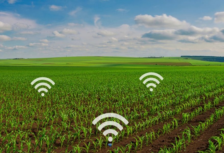
Precision agriculture relies on various sensors to gather detailed environmental and crop data, similar to how Agerpoint utilizes mobile and other sensor inputs.
Agerpoint Cloud: The Engine of Analysis
Once captured, data is uploaded to the Agerpoint Cloud platform. Here, proprietary AI and machine learning algorithms, coupled with high-performance computing and advanced computer vision techniques, process and analyze the information. This platform extracts a wealth of quantifiable metrics, including:
- Plant structural parameters: height, diameter, canopy volume, biomass.
- Health indicators: stress levels, disease presence, pest damage.
- Growth stage and yield predictions.
- Spatial positioning and density.
Multi-Source Data Fusion and Comprehensive Insights
Agerpoint's platform excels in fusing data from various sources. Ground-level data captured via mobile devices or terrestrial vehicles is integrated with information from drones and satellites, along with other geospatial layers and human observations. This multi-modal approach provides a holistic and multi-scale understanding of agricultural landscapes and natural ecosystems. This fusion allows for enhanced remote sensing capabilities, validated by on-the-ground accuracy, enabling more robust and reliable analytics.
Transformative Applications Across Sectors
The insights generated by Agerpoint's technology have far-reaching applications, driving efficiency, sustainability, and innovation across multiple domains.
Precision Agriculture and Sustainable Food Production
Agerpoint provides growers of tree, vine, and bush-based crops with tools for:
- Optimized Crop Management: Real-time monitoring of plant health and growth facilitates timely interventions, optimizing resource use (water, fertilizers, pesticides) and improving crop quality.
- Accurate Yield Forecasting: Predictive analytics help in estimating yields, enabling better harvest planning and market strategies.
- Early Disease and Pest Detection: AI algorithms can identify early signs of stress or infestation, allowing for targeted treatments and minimizing losses.
This focus on precision particularly benefits permanent crops, a sector historically underserved by technology at a commercial scale. Clients like Bayer and The Wonderful Company have utilized Agerpoint's tools to enhance their operations.
Environmental Stewardship: Carbon Markets and Biodiversity
Know Your Carbon™: Enhancing Carbon Credit Integrity
Agerpoint's "Know Your Carbon™" initiative is a significant contribution to climate action. By creating accurate 3D plant models and extracting precise physical measurements, this system provides a transparent and verifiable digital MRV (Measurement, Reporting, and Verification) framework for nature-based carbon sequestration projects. This technology, recognized as a winner of the World Economic Forum's Carbon Market Challenge at COP26, brings credibility to carbon credits derived from forestry and agricultural practices.
Biodiversity Monitoring and Conservation
The platform's capabilities extend to inventorying plant species, assessing ecosystem health, and monitoring biodiversity. This is crucial for conservation efforts, tracking invasive species, managing wildfire risk, and supporting habitat restoration projects. Governmental and conservation organizations leverage these tools for informed land use planning and environmental protection.
Supporting Research, Development, and Risk Management
Agerpoint's detailed data supports agrochemical and food & beverage R&D by enabling precise phenotyping and performance assessment of new products or practices. Furthermore, in the crop insurance sector, the technology can provide accurate assessments of damage following natural disasters, streamlining claims processes.
Technological Capabilities Radar
The radar chart below illustrates Agerpoint's strengths across several key technological and impact dimensions, comparing its advanced platform capabilities against traditional agricultural monitoring methods. This visualization highlights the significant advancements Agerpoint brings to the field, particularly in areas like data accuracy, innovation, and the ability to scale solutions for environmental impact.
Agerpoint's Ecosystem of Innovation
The following mindmap illustrates the interconnected components of Agerpoint's technological ecosystem, from its core technologies to its diverse applications and the significant impact it generates in agriculture and environmental science. It showcases how foundational elements like AI and digital twins enable a wide array of solutions for pressing global challenges.
for Agriculture & Environment"] id1["Core Technologies"] id1a["AI & Machine Learning"] id1b["Computer Vision"] id1c["Data Fusion
(Mobile, Drone, Satellite)"] id1d["Digital Twins
(3D Plant Models)"] id1e["Agerpoint Capture App"] id1f["Agerpoint Cloud Platform"] id1g["Patent Portfolio
(>100 crop types)"] id2["Key Applications"] id2a["Precision Agriculture"] id2aa["Crop Monitoring & Health"] id2ab["Yield Prediction"] id2ac["Disease & Pest Detection"] id2ad["Resource Optimization"] id2b["Environmental Solutions"] id2ba["Digital MRV (Know Your Carbon™)"] id2bb["Biodiversity Assessment"] id2bc["Forestry Management"] id2bd["Wildfire Risk Assessment"] id2be["Land Use Planning"] id2c["Research & Development Support"] id2ca["Agrochemical Trials"] id2cb["Food & Beverage Innovation"] id2cc["Automated Phenotyping"] id2d["Risk Management"] id2da["Crop Insurance Assessment"] id3["Impact & Outcomes"] id3a["Enhanced Sustainability"] id3b["Improved Efficiency & Productivity"] id3c["Data-Driven Decision Making"] id3d["Climate Change Mitigation"] id3e["Conservation Support"] id4["Industry Recognition"] id4a["World Economic Forum
Technology Pioneer (2022)"] id4b["WEF Carbon Market
Challenge Winner"] id4c["AIM for Climate Participant"]
Agerpoint in Action: Measuring and Analyzing the Natural World
To further understand Agerpoint's mission and technological capabilities, the following video provides an overview of how the company approaches the measurement and analysis of the natural world. It features insights into their use of digital twin technology and its applications, offering a visual perspective on their innovative work.
This video, "Agerpoint: Measure & Analyze the Natural World," highlights how Agerpoint is leveraging advanced technology like digital twins for applications such as forestry management. It offers a glimpse into the practical application of their tools and the impact they are having on understanding and managing complex ecosystems, reinforcing their commitment to providing detailed insights for better environmental and agricultural outcomes.
Key Technological Features and Benefits Summary
Agerpoint's platform is built upon several key technological pillars that deliver distinct benefits to its users. The table below summarizes these core features and their corresponding advantages, showcasing the comprehensive nature of Agerpoint's solutions.
| Feature | Description | Benefit |
|---|---|---|
| Mobile Data Capture (Agerpoint Capture app) | Smartphone/tablet-based application using LiDAR and cameras for 3D plant data collection in the field. | Accessible, scalable, and cost-effective field data acquisition; provides essential ground-truth data. |
| AI-Powered Analytics (Agerpoint Cloud) | Proprietary machine learning, computer vision, and high-performance computing algorithms analyze data on a cloud platform. | Automated phenotyping, predictive insights for growth and yield, early disease detection, reduced human bias, and enhanced decision-making. |
| Digital Twin Creation | Generation of highly precise, quantifiable, and interactive 3D virtual models of individual plants, crops, and entire forests. | Detailed visualization, accurate measurement of structural parameters (height, diameter, biomass), precise monitoring over time. |
| Multi-Source Data Fusion | Integration of ground-level sensor data (mobile, terrestrial vehicles) with aerial data (drones, satellites) and other geospatial layers. | Comprehensive landscape view, validation of remote sensing with ground truth, improved accuracy across multiple scales. |
| Digital MRV (Know Your Carbon™) | A system for Measurement, Reporting, and Verification of carbon sequestration and other environmental metrics. | Provides transparent, credible, and verifiable data for carbon credit projects and nature-based solutions; supports climate initiatives. |
| Broad Patent Portfolio | Extensive intellectual property covering innovative methods for capturing, analyzing, and managing precise crop data across over 100 crop and forest types, including 3D data fusion and agricultural asset management. | Demonstrates strong scientific rigor and technological leadership; supports diverse applications and continuous innovation. |
Frequently Asked Questions (FAQ)
Recommended Further Exploration
- How does Agerpoint's digital MRV system contribute to the integrity of carbon markets?
- What specific AI and machine learning techniques does Agerpoint employ for plant phenotyping?
- Explore case studies of Agerpoint's technology in different crop types and geographical regions.
- What is the role of Agerpoint's patent portfolio in its competitive strategy and technological development?
References
Last updated May 11, 2025