
Spatial Mapping of Alphonso Mango Orchards in Devgad and Their Suitability Analysis
A Comprehensive Study on Optimizing Alphonso Mango Cultivation in Devgad
Key Takeaways
- Optimal Location Factors: Devgad's unique soil and climate conditions make it highly suitable for Alphonso mango cultivation.
- Advanced Mapping Techniques: Utilization of GIS, remote sensing, and machine learning enhances the accuracy of orchard distribution and suitability analysis.
- Sustainable Agricultural Practices: Traditional and organic farming methods contribute to the high quality and global reputation of Devgad Alphonso mangoes.
Introduction
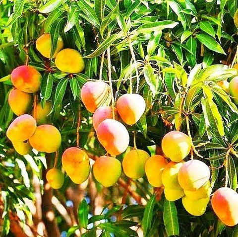
The Alphonso mango, often hailed as the "King of Mangoes," is renowned for its rich flavor, vibrant color, and smooth texture. Devgad, situated in the Sindhudurg district of Maharashtra, India, stands as a premier region for the cultivation of this prized fruit. This comprehensive study delves into the spatial mapping of Alphonso mango orchards in Devgad and conducts a thorough suitability analysis to optimize cultivation practices and enhance productivity.
Geographic Characteristics of Devgad
Location and Climatic Advantages
Devgad is strategically located in the coastal Konkan region, offering a unique combination of soil fertility and climatic conditions ideal for Alphonso mango cultivation. The proximity to the Arabian Sea results in a moderated climate with saline sea breezes, contributing to the distinctive flavor profile of the mangoes.
Cultivation Area and Production
The total cultivation area dedicated to Alphonso mangoes in Devgad spans approximately 45,000 acres. Annually, these orchards yield around 50,000 tons of Alphonso mangoes, underscoring the region's significant contribution to both national and international mango markets.
Data Collection and Preprocessing
Remote Sensing and GIS Data
Effective spatial mapping of Alphonso mango orchards in Devgad relies heavily on advanced remote sensing technologies and Geographical Information Systems (GIS). High-resolution multispectral satellite imagery from sources such as Sentinel-2 and Landsat 8 provides detailed land cover maps essential for identifying orchard locations.
Aerial and Drone-based Imagery
In addition to satellite data, aerial photography and Unmanned Aerial Vehicle (UAV) data offer finer resolution images that enhance the accuracy of orchard boundary mapping. These high-resolution datasets are crucial for distinguishing between different land uses and verifying the spatial extent of mango orchards.
Ancillary Data Collection
Supplementary data such as soil maps, climatic records, and land use patterns are integrated into the GIS framework to support the suitability analysis. Soil maps provide insights into soil types, drainage conditions, and fertility levels, while climatic data encompass temperature variations, precipitation patterns, and humidity levels essential for mango growth.
Field Data Collection
Ground truthing through field data collection is indispensable for validating remote sensing outputs. GPS coordinates of known Alphonso mango orchards are recorded to ensure spatial accuracy. Additionally, agronomic measurements, including soil pH, organic matter content, and irrigation practices, are documented to calibrate suitability models accurately.
Spatial Mapping Methodology
Image Preprocessing
The initial step in spatial mapping involves preprocessing the acquired imagery to enhance data quality. Radiometric and atmospheric corrections are applied to mitigate noise and atmospheric distortions, ensuring the integrity of the spectral data. Geometric corrections align the images with high-accuracy ground control points (GCPs), guaranteeing spatial precision.
Classification Techniques
Supervised Classification
Supervised classification methods, such as Maximum Likelihood Classification, Random Forest, and Support Vector Machines, are employed to categorize land cover based on training samples derived from known orchard locations. These algorithms analyze spectral signatures to differentiate mango orchards from other vegetation and land uses.
Object-Based Image Analysis (OBIA)
OBIA segments imagery based on texture, color, and shape, facilitating the delineation of orchard boundaries with higher accuracy, especially in regions where mango orchards are interspersed with diverse vegetation. This approach enhances the precision of spatial mapping by considering spatial context alongside spectral data.
Accuracy Assessment
An essential component of spatial mapping is the validation of classification results. A confusion matrix is constructed by comparing the classified data against ground truth information, allowing the calculation of accuracy metrics such as overall accuracy and kappa statistics. This assessment ensures the reliability of the spatial mapping outcomes.
Suitability Analysis
Defining Suitability Criteria
Suitability analysis evaluates multiple environmental and geographical factors to determine the most appropriate areas for Alphonso mango cultivation. The primary criteria include:
Soil Characteristics
Key soil parameters such as pH levels, organic matter content, drainage capacity, and soil texture are assessed to ensure optimal conditions for mango tree growth. Devgad's rich, fertile coastal soils provide the necessary nutrients and support robust mango cultivation.
Climatic Conditions
Temperature extremes, rainfall patterns, humidity levels, and frost occurrences are analyzed to evaluate climate suitability. Devgad's coastal climate, characterized by moderate temperatures and adequate rainfall, is conducive to high-quality Alphonso mango production.
Topography
Terrain factors such as slope, aspect, and elevation are considered to prevent soil erosion and ensure proper water retention. Gentle slopes and optimal elevation levels contribute to effective orchard management and sustainability.
Proximity Factors
Accessibility to water sources, markets, and necessary infrastructure plays a vital role in orchard management and distribution efficiency. Proximity to these resources enhances the feasibility of maintaining and expanding mango orchards.
Multi-Criteria Decision Analysis (MCDA)
MCDA integrates the defined suitability criteria to produce a composite suitability index. This process involves:
Criteria Weighting
Experts engage in the Analytic Hierarchy Process (AHP) to assign relative weights to each criterion based on their importance in mango cultivation. This weighting ensures that more critical factors have a greater influence on the final suitability assessment.
GIS Overlay Analysis
Each criterion layer is standardized to a common scale, typically 1 to 5, and then overlaid using the assigned weights. The resulting composite index highlights areas of high, moderate, marginal, and unsuitable suitability for Alphonso mango cultivation.
Validation of Suitability Map
The suitability map undergoes validation by cross-referencing with actual orchard performance data, including yield rates and disease incidence. Sensitivity analysis and expert feedback are incorporated to refine the weights and criteria, enhancing the map's accuracy and reliability.
Results and Discussion
Orchard Distribution Map
The spatial mapping reveals a concentrated distribution of Alphonso mango orchards in regions with optimal soil and climatic conditions. Clustering patterns indicate areas with favorable environmental factors, while fragmented areas highlight potential for expansion or improvement.
Suitability Map
The suitability classification identifies approximately 25.78% of Devgad as highly suitable for Alphonso mango cultivation. Another 64.04% falls under moderately suitable categories, while 9.18% is deemed unsuitable. These classifications guide targeted agricultural practices and orchard expansion strategies.
Implications
The alignment between current orchard locations and high suitability zones underscores the effectiveness of existing cultivation practices. However, areas with high suitability yet low orchard density present opportunities for expansion. Conversely, regions classified as unsuitable require alternative land use or soil management interventions to enhance their suitability.
Orchard Characteristics and Management Practices
Traditional Farming Methods
Alphonso mango cultivation in Devgad predominantly employs traditional and organic farming practices. The use of cow dung manure, Panchagavya (a mixture of five cow products), vegetative waste, and shell calcium ensures the maintenance of soil fertility and the production of premium-quality mangoes.
Orchard Layout and Design
Vertical Row Planting
Square and rectangular planting systems are widely adopted for their simplicity and efficiency. This layout facilitates easy maintenance, pest control, and harvesting operations, contributing to higher productivity.
Alternate Row Planting
Hexagonal, quincunx, and triangular planting systems offer higher tree density, optimizing land use. Although these layouts require more complex management, they enhance canopy coverage and fruit yield per acre.
Geographical Indication (GI) Tag
Devgad Alphonso mangoes have been awarded a Geographical Indication (GI) tag, certifying their authenticity and linking them to specific geographical origins and quality standards. This recognition not only enhances market value but also preserves the traditional cultivation practices that contribute to the mangoes' unique characteristics.
Advanced Mapping and Analysis Techniques
GIS and Remote Sensing Integration
The integration of GIS and remote sensing technologies facilitates precise mapping of mango orchards. High-resolution satellite imagery combined with GIS layers enables detailed analysis of land cover, soil types, and climatic conditions, essential for accurate orchard mapping and suitability assessment.
Machine Learning Models
Advanced machine learning algorithms such as Support Vector Machines (SVM), Random Forest (RF), and k-Nearest Neighbors (kNN) are employed to enhance the classification and mapping accuracy of mango orchards. These models analyze large datasets to identify patterns and optimize the classification process, leading to more reliable spatial mapping results.
Suitability Analysis: Detailed Examination
Soil Conditions
Devgad's coastal soils are rich in essential nutrients and have excellent drainage properties, making them highly suitable for Alphonso mango cultivation. The soil pH typically ranges between 6.5 to 7.5, providing an optimal environment for mango tree root systems.
Climate Suitability
The region experiences a warm and humid climate with distinct wet and dry seasons. Average annual rainfall of around 3000 mm supports adequate water availability, while temperature ranges between 25°C to 35°C during the growing season are ideal for mango fruit development.
Topographical Factors
Gentle slopes and favorable elevation levels minimize the risk of soil erosion and enhance water retention in mango orchards. Flat to moderately sloped terrains are preferred, as they facilitate efficient irrigation and management practices.
Proximity to Resources
Proximity to the Arabian Sea not only influences the microclimate but also ensures easy access to water resources for irrigation. Additionally, the nearby infrastructure, including roads and transportation networks, supports efficient distribution of harvested mangoes to markets both domestically and internationally.
Orchard Management and Sustainability
Organic Farming Practices
The emphasis on organic farming practices in Devgad ensures that Alphonso mangoes are free from synthetic pesticides and fertilizers. This approach enhances soil health, promotes biodiversity, and results in mangoes with superior taste and nutritional value.
Sustainable Agricultural Techniques
Sustainable techniques such as mulching, intercropping, and integrated pest management are employed to maintain ecological balance and reduce environmental impact. These practices contribute to the long-term viability of mango orchards and support the livelihoods of local farmers.
Water Management
Efficient water management systems, including drip irrigation and rainwater harvesting, ensure optimal water usage while preventing waterlogging and soil salinization. These systems are crucial for maintaining the health of mango trees, especially during dry spells.
Challenges and Opportunities
Challenges
Despite the favorable conditions, Alphonso mango cultivation in Devgad faces challenges such as pest infestations, climatic variability, and limited access to advanced farming technologies. Addressing these issues requires continuous research, farmer education, and investment in agricultural infrastructure.
Opportunities
There are significant opportunities for expanding mango orchards into highly suitable areas identified through spatial mapping and suitability analysis. Additionally, adopting precision agriculture techniques and leveraging GIS data can enhance orchard management, increase yields, and maintain the high quality of Alphonso mangoes.
Conclusion
The spatial mapping and suitability analysis of Alphonso mango orchards in Devgad provide invaluable insights into optimizing mango cultivation practices. By leveraging advanced technologies such as GIS, remote sensing, and machine learning, and by adhering to sustainable agricultural practices, Devgad can continue to sustain and enhance its reputation as a premier region for Alphonso mango production. The integration of traditional farming methods with modern analytical techniques ensures that Devgad Alphonso mangoes remain synonymous with quality and excellence in the global market.
References
Last updated February 14, 2025