
Unlocking Geospatial Power: Integrating Locations and Maps in AppSheet
Seamlessly Uploading and Visualizing Geographic Data for Dynamic App Experiences
AppSheet, a powerful no-code development platform, empowers users to create sophisticated applications from various data sources without writing a single line of code. One of its most compelling features is the ability to integrate and visualize location data, transforming static spreadsheets into dynamic mapping tools. This capability is invaluable for a wide range of use cases, from tracking field assets and managing logistics to conducting site inspections and visualizing customer locations.
The process of uploading location data to AppSheet and subsequently displaying it on a map involves understanding data structures, leveraging specific column types, and configuring map views. AppSheet supports both traditional geographical coordinates (latitude and longitude) and custom XY coordinates for internal maps, offering immense flexibility. Furthermore, it provides robust functionalities for capturing current GPS locations, filtering data based on proximity, and even creating interactive dashboards with integrated maps.
Key Highlights of Location and Map Integration in AppSheet
- Flexible Data Sources: AppSheet integrates seamlessly with various cloud storage services and databases like Google Sheets, Microsoft Excel, and Cloud SQL, allowing you to store and manage your location data efficiently.
- Diverse Map View Options: You can display location data using standard road or aerial map views (leveraging Google Maps) or create custom maps based on uploaded images like floor plans or site layouts, providing tailored visual contexts.
- Dynamic Location Capture and Filtering: AppSheet enables the capture of real-time GPS locations from devices and offers powerful expressions like
HERE()andDISTANCE()to filter and display data based on a user's current proximity.
Understanding Location Data and Storage in AppSheet
The Foundation of Geospatial Applications
Before you can display a map in your AppSheet application, you need to have your location data properly structured and stored. AppSheet is highly flexible in its data source integration, allowing you to connect to various platforms where your location information resides.
Choosing Your Data Source for Location Information
AppSheet's strength lies in its ability to connect to diverse data sources. For location data, common choices include:
- Google Sheets: This is a very popular and easy-to-use option. You can simply have columns for latitude and longitude (or addresses) in your Google Sheet, and AppSheet will read them directly.
- Microsoft Excel: Similar to Google Sheets, Excel files can serve as a data source, with location data organized in specific columns.
- Cloud SQL and Other Databases: For more complex applications or larger datasets, AppSheet can connect to cloud databases, providing robust data management capabilities for your location information.
- AppSheet Databases: If you prefer a native AppSheet solution for data storage, AppSheet databases can also host your location data directly within Google Cloud.
When you create a new app, AppSheet typically sets up a dedicated folder in your Google Drive (under appsheet/data/[the app's name]/[the table name]) to store files associated with the app, including uploaded images or other media that might be linked to locations.
Structuring Location Columns: LatLong, Address, and XY
AppSheet recognizes specific column types for handling location data. Correctly defining these columns in your data source is crucial for proper map display and functionality:
- LatLong Column Type: This is used for precise GPS coordinates. Your data source should have a column (or two separate columns for Latitude and Longitude) that AppSheet can identify as a LatLong type. For example, a single column containing "46.34,-32.34" or two separate columns for "Latitude" and "Longitude".
- Address Column Type: If you have street addresses in your data, AppSheet can geocode them (convert them into GPS coordinates) to display on a map. A column header like "Address" helps AppSheet efficiently identify and process this data.
- XY Column Type for Custom Maps: This unique feature allows you to use coordinates on a custom image, like a floor plan or a schematic. Instead of global GPS coordinates, you define points within the image's coordinate system. This is particularly useful for internal layouts like warehouses or manufacturing floors.
Displaying Locations on a Map in AppSheet
Configuring Map Views for Visual Insights
Once your data is properly structured, configuring a map view in AppSheet is straightforward. AppSheet offers various options to visualize your location data, from standard geographic maps to custom image-based maps.
Creating a Standard Map View
The "Map" view type in AppSheet is designed to display locations using geographical coordinates. To create one:
- Navigate to the UX tab in the AppSheet editor.
- Click New View and select Map as the View type.
- In the view settings, you'll need to specify the column containing your location data (LatLong or Address). AppSheet will then automatically place pins on the map for each entry.
- You can customize the map display, including road or aerial views, and set the default zoom level. By default, the map will zoom to show all pins.
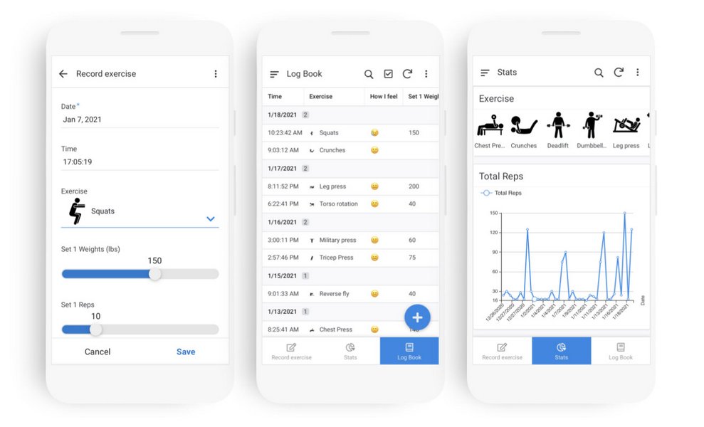
A sample AppSheet mobile application showcasing a map view with pinned locations.
Implementing Custom XY Maps for Internal Layouts
For scenarios requiring indoor mapping or specific site plans, AppSheet's XY map functionality is incredibly powerful. This allows you to upload an image (e.g., a floor plan, a warehouse layout) and use it as a background for your map.
To implement an XY map:
- Upload your image: The image needs to be accessible via a URL. You might store it in your cloud storage (e.g., Google Drive) and get a public URL for it.
- Create an XY column: In your data source, define a column of type 'XY'.
- Specify the image URL: In the definition of your XY column within AppSheet, you'll paste the URL of your custom map image.
- Add points to the map: You can then add new points to this custom map by specifying their XY coordinates relative to the image. This is ideal for visualizing inspection points, asset locations, or other data within a defined physical space.
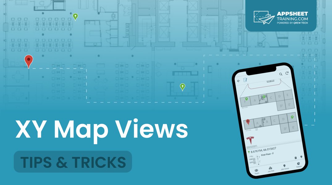
An illustration of how XY map views can be used for visualizing data on floor plans or custom images.
This capability is particularly useful for field workers in environments like warehouses or manufacturing floors, enabling them to pinpoint exact locations for tasks or inspections.
Enhancing Location-Based Functionality
Beyond Basic Map Display
AppSheet's location capabilities extend far beyond simply displaying pins on a map. You can integrate dynamic features that make your app truly intelligent and responsive to user needs.
Capturing Current GPS Location
AppSheet allows users to capture their device's current GPS location directly into a LatLong or ChangeLocation column. This is often done via a clickable icon within the input field for these column types. For the highest accuracy, AppSheet can attempt to obtain the most precise location for up to 30 seconds or until an estimated accuracy of 10 meters is reached. This is especially useful for field service, delivery tracking, or incident reporting where knowing the exact location is critical.
To automatically capture the user's current GPS coordinates, you can set the 'Initial Value' of a LatLong column to the expression HERE(). This ensures that when a new record is created, the location is pre-populated.
Filtering and Displaying Data by Proximity (Geofencing)
AppSheet can filter data based on the user's current location, effectively creating a geofencing capability. This involves:
- Having a LatLong column in your data for the locations you want to track.
- Creating a virtual column that calculates the distance between the tracked location and the user's current location using the
DISTANCE([LatLongColumn], HERE())expression. This returns the distance in kilometers. - Creating a "slice" of your data with a condition, for example,
[Distance in km] < 5000, to only show entries within a 5km radius.
This allows for views that show "nearby people," "nearby equipment," or activities within a specific operational area, enhancing the app's relevance to the user's immediate surroundings.
Interactive Map Dashboards
You can create interactive dashboards that combine map views with other data visualizations, such as calendars or lists. This allows users to visualize planned activities on a map alongside their schedule, or see details of a selected pin directly in the dashboard.
For example, you could have a dashboard with a calendar showing scheduled events and a map showing the locations of those events. When a user selects an event in the calendar, the map could dynamically highlight or zoom to the associated location.
Best Practices for Location Data Management
Ensuring Accuracy, Organization, and Performance
Effective management of location data is crucial for the optimal performance and accuracy of your AppSheet applications. Here are some best practices:
Organizing Files and Images Linked to Locations
When users upload images or files through AppSheet, these are typically saved in a designated folder within your Google Drive (appsheet/data/[app's name]/[table name]). It's good practice to organize these files logically. If you have images directly linked to specific locations, ensure their filenames are easily traceable to the corresponding data entries. AppSheet can also display images stored relative to the spreadsheet's location, making organization simpler.
AppSheet downscales most uploaded images to 600px wide for performance, while background images for apps are 1000px. This helps optimize app loading times.
Data Sync and Performance Considerations
If your location data source is frequently updated (e.g., live GPS tracking), consider the sync intervals. While AppSheet can automatically sync data, manually triggering updates or optimizing data structure can improve real-time performance. For large datasets, especially those with many addresses that need geocoding, there might be a delay before all points appear on the map as each address is processed.
Security and Accessibility of Location Data
AppSheet by default generates cryptic public URLs for images and files for security reasons. If you need more "friendly" URLs for external use, this security feature can be disabled, though it comes with a trade-off in terms of security. Always consider who needs access to your location data and configure sharing settings accordingly, especially for sensitive information.
Comparative Analysis of Location Features
To better understand the various facets of AppSheet's location and mapping capabilities, here's a radar chart comparing key features. This chart visualizes the strengths of different functionalities, providing a quick overview of how AppSheet excels in geospatial app development.
As illustrated in the radar chart, AppSheet demonstrates strong capabilities across the board for location-based applications. Its integration with various data sources and robust support for both standard and custom maps, combined with accurate GPS capture and geofencing features, makes it a highly effective tool for developing geospatial solutions without extensive coding.
Practical Applications and Use Cases
Transforming Operations with Location Intelligence
The ability to upload and display locations on a map in AppSheet opens up a myriad of practical applications across various industries:
- Field Service Management: Technicians can use apps to log their current location, update job statuses at specific sites, and navigate to the next service call.
- Asset Tracking: Businesses can track the last known location of equipment or vehicles, improving inventory management and preventing loss.
- Site Inspections: Inspectors can use custom XY maps of floor plans to mark inspection points, add notes, and attach photos directly to specific locations within a building or facility.
- Delivery and Logistics: Drivers can use apps to view their delivery routes, confirm deliveries with GPS stamps, and receive directions.
- Real Estate: Agents can showcase properties on a map, providing clients with a visual overview of available listings and their surroundings.
- Incident Reporting: Users can quickly report incidents with precise location data, aiding rapid response and accurate record-keeping.
These examples highlight how integrating location data and maps can streamline operations, enhance decision-making, and improve communication for teams working in the field or managing geographically dispersed assets.
Essential Map and Location Configurations
The table below summarizes key configurations and considerations when working with location and map features in AppSheet, providing a quick reference for common settings and their impact.
| Feature/Configuration | Description | Key AppSheet Setting/Column Type | Impact/Benefit |
|---|---|---|---|
| Standard Map Display | Displaying geographical locations with pins on Google Maps. | UX > Views > New View > Type: Map; Data Column: LatLong/Address | Visualizes global addresses/coordinates; provides directions. |
| Custom Map (XY) | Using an image (e.g., floor plan) as a map background with custom coordinates. | Data > Columns > Column Type: XY; XY column definition: Background Image URL | Ideal for indoor mapping, facility layouts, site-specific inspections. |
| GPS Location Capture | Automatically or manually capturing the device's current geographical position. | Column Type: LatLong or ChangeLocation; Initial Value: HERE() |
Accurate real-time location stamping for field work, reports. |
| Proximity Filtering (Geofencing) | Displaying data points within a specified distance from a user's current location. | Virtual Column with DISTANCE([LatLong], HERE()); Data Slice with filter condition (e.g., [Distance] < X) |
Focuses data relevance based on user's proximity, e.g., "nearby assets." |
| Image Storage for Maps | Where images linked to locations (e.g., custom maps, photos at a site) are stored. | Google Drive folder (appsheet/data/[app name]), linked via URL in data source. |
Ensures visual assets are accessible and linked to data records. |
| Interactive Dashboard | Combining map views with other views (e.g., calendar, detail) on a single screen. | UX > Views > New View > Type: Dashboard; Include relevant map and other views. | Provides a holistic view of data, enabling dynamic interaction between map and related information. |
Deep Dive: Leveraging Google Maps and AppSheet
A Synergistic Approach to Location Intelligence
The seamless integration between AppSheet and Google Maps is a cornerstone of its powerful location capabilities. When you use the LatLong or Address column types for your map views, AppSheet intelligently leverages Google Maps' robust geocoding and rendering services. This means your app automatically benefits from the rich mapping features that Google Maps provides.
This integration extends to functionalities such as displaying road or aerial views, zooming and panning, and even providing directions. For instance, if you have a list of delivery addresses, AppSheet can plot them on a map, and users can then tap on a pin to get directions using their device's native mapping application.
Here's a video that demonstrates how AppSheet can utilize Google Maps and geolocation to create powerful applications:
This video provides a comprehensive guide on integrating Google Maps and geolocation features into your AppSheet application. It covers essential steps to visualize location data and enhance app functionality.
The video showcases how straightforward it is to set up a map view, capture GPS coordinates, and even calculate distances between points. This synergy between AppSheet's no-code environment and Google Maps' geospatial prowess makes building location-aware apps highly efficient and accessible.
Frequently Asked Questions (FAQ)
Conclusion
AppSheet's robust capabilities for handling location data and displaying maps are a cornerstone for building powerful, intelligent applications without coding. By understanding how to structure your data with LatLong, Address, or XY column types, and by leveraging AppSheet's intuitive UX configurations, you can transform raw geographical information into actionable insights and engaging visual experiences. Whether it's for field operations, asset management, or customer engagement, the integration of location intelligence empowers users with context-aware information and streamlines workflows. The platform's flexibility in data sources, coupled with its advanced features like real-time GPS capture and geofencing, makes it an invaluable tool for any organization looking to harness the power of location in their mobile and web applications.
Recommended Searches
- How can I build a GPS tracking app with AppSheet step-by-step?
- Guide to creating custom maps with floor plans in AppSheet.
- What are the best practices for calculating distances between locations in AppSheet?
- Detailed steps for implementing geofencing and proximity filters in AppSheet.
Search Results
 appsheet.wordpress.com