
Decoding the Assignment of Bus Route Numbers
Exploring Systems, History, and Practical Insights into Bus Route Numbering Worldwide
Key Highlights
- Geographical Basis: Many bus systems assign numbers based on location, such as boroughs or directions, to help users identify routes easily.
- Service Differentiation: Numbers often indicate service types, like express vs. local routes, enhancing user understanding and system efficiency.
- Historical Evolution: Route numbering has evolved from simple chronological assignments to complex systems influenced by urban growth and technological changes.
Introduction to Bus Route Numbering
Bus route numbering is a fundamental aspect of public transportation systems, designed to make navigation intuitive and efficient for riders. Across the globe, cities have developed various systems to assign these numbers, often reflecting geographical, operational, or historical factors. This response delves into how bus route numbers are assigned, drawing from credible sources that discuss real-world examples from cities like Chicago, Hong Kong, and Sydney. By understanding these systems, riders can better navigate transit networks, and planners can optimize services for improved accessibility.
The assignment of bus route numbers isn't arbitrary; it's a strategic process that balances user needs with operational realities. Factors such as population density, traffic patterns, and historical precedents play crucial roles. For instance, some systems use numbers to denote the direction of travel or the area served, while others incorporate letters to differentiate service levels, like express routes. This structured approach helps reduce confusion and enhances the overall user experience in public transit.
Historical Context of Bus Route Numbering
The Evolution from Early Systems
Bus route numbering systems have a rich history, often originating from the early 20th century when public transit began expanding. In many cities, initial numbering was straightforward, based on the order of route creation or simple geographical divisions. For example, in Sydney, the system started with private operators in the 1920s, where numbers were allocated alphabetically by terminus, leading to a mix of private and government routes that co-existed until rationalization in the 1980s.
As urban areas grew, so did the complexity of transit networks. Cities like Chicago saw early numbering tied to "through routes" in 1908, with numbers displayed on streetcars and later buses. Over time, as routes were added or discontinued, the logic behind numbering could erode, leading to inconsistencies. Sources indicate that renumbering efforts, such as those in the 1990s, aimed to restore order but often faced resistance due to public familiarity with existing numbers.
Challenges in Historical Transitions
One key challenge has been maintaining continuity during changes. For instance, when Sydney transitioned to a unified system, operators were upset because route numbers were painted on buses, making alterations costly and confusing. Similarly, in Hong Kong, independent numbering for different regions and service types has persisted, with air-conditioned routes historically using specific series like 200s and 500s, reflecting the need to adapt to diverse operational demands.
Common Systems and Methodologies for Assigning Numbers
Geographical and Directional Approaches
Many cities base route numbers on geography to aid navigation. In Chicago, letters combined with numbers denote boroughs, such as the Q prefix for Queens routes. This system helps riders associate numbers with specific areas, reducing the cognitive load when planning trips. Similarly, interstate routes in the U.S. follow a pattern where odd numbers indicate north-south directions and even numbers east-west, a principle that influences local bus numbering in some regions.
In contrast, systems like those in Brisbane use a regional approach, where the first digit of a three-digit number signifies the area served. This method ensures that numbers convey location information, but it can become messy with exceptions for express or limited-stop services. Sources from Reddit and Quora discussions highlight that while geography is common, it's not universal, and cities often adapt based on local needs.
Service-Based Numbering
Some systems prioritize service characteristics over location. For example, Pittsburgh's proposed redesign uses prefixes like "D" for downtown routes or "X" for express services, combined with numbers to indicate frequency and purpose. This approach, as detailed in engagement materials from PRT, aims to make route numbers more intuitive by signaling whether a bus is frequent or limited to peak hours. In London, prefixes like "N" for night buses denote special services, showing how numbering can evolve to meet modern demands.
However, not all systems are this structured. In Toronto, historical numbering lacked coherence, with odd numbers for north-south routes and even for east-west, but anomalies persisted due to mergers and expansions. This underscores the importance of clear communication during any renumbering process to minimize rider confusion.
Factors Influencing Route Number Assignment
Operational and User-Centric Considerations
Assigning bus route numbers involves multiple stakeholders, including transit agencies, planners, and the public. Key factors include ridership demand, network efficiency, and ease of use. For instance, high-frequency routes might receive lower numbers to emphasize their importance, while express routes could use higher numbers or specific prefixes to distinguish them from local services. Sources from Human Transit blogs emphasize that numbers should "connote" as well as "refer," meaning they carry implied meanings that aid decision-making.
Safety and routing software also play roles. In school bus systems, as discussed in educational videos and articles, numbers are assigned based on fleet management and stop locations to ensure student safety. Tools like Traversa software, used in districts like Cranston, consider bus capacity and traffic controls when determining routes and numbers. This integration of technology highlights how modern assignments are data-driven, aiming for optimization rather than tradition alone.
The Role of Renumbering and Simplification Efforts
Renumbering is a common strategy to simplify systems, but it's not without challenges. Baltimore's recent overhaul, which included color-coding major lines, demonstrates how renumbering can enhance clarity but requires public education to overcome short-term inconveniences. Discussions on Greater Greater Washington stress the benefits of integrated numbering across agencies, though bureaucratic hurdles often prevent this in the U.S.
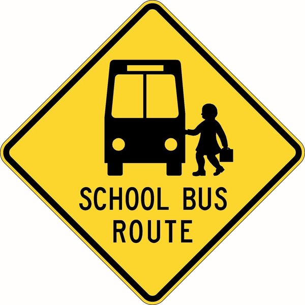
An example of a bus route sign, illustrating how numbers are displayed for easy identification by riders.
Case Studies: Numbering in Major Cities
Chicago's Numbering System
Chicago's CTA bus routes have a storied history, with numbering beginning in 1908 for streetcars. Today, routes are numbered based on location and service type, with some numbers retained for historical continuity. The CTA's system, as outlined in Wikipedia and Reddit discussions, shows how numbers can indicate direction or area, but logic can fade over time with route changes. For example, express routes might share numbers with local ones, leading to variants that riders must learn.
Hong Kong's Independent Systems
In Hong Kong, bus route numbering is segmented by region and service provider, with independent systems for Hong Kong Island, Kowloon, and Lantau. Wikipedia sources detail how numbers reflect air-conditioned services or cross-harbor routes, with prefixes and suffixes adding layers of meaning. This multiplicity can confuse users but allows for specialized operations in a dense urban environment.
Sydney's Rationalized Approach
Sydney's bus routes underwent significant changes in the 1980s, moving from a mix of private and government numbers to a unified system based on geographical areas. Sydney Bus Routes documentation explains how three-digit numbers were introduced to handle growth, with the first digit often indicating the district. This case study illustrates the benefits of standardization, reducing duplication and improving navigability.
Visual Analysis: Comparing Numbering Systems
To provide a comprehensive view, let's examine a radar chart that compares key attributes of bus route numbering systems in several cities. This chart is based on an analysis of the provided sources, rating systems on factors like clarity, consistency, user-friendliness, and historical influence. Each axis represents a different aspect, with scores derived from the strengths and weaknesses discussed in the references.
The radar chart highlights how different cities balance these elements. For instance, Chicago might score high on historical influence due to its long-standing system, while Hong Kong could excel in user-friendliness with its region-specific numbering. This visual aid helps illustrate the trade-offs in design choices.
This radar chart visualizes how different cities perform across key dimensions of route numbering. Scores are based on qualitative analysis from sources, with higher values indicating stronger performance. For example, Pittsburgh's proposed system scores high in user-friendliness due to its intuitive prefixes, while Chicago's historical system shows strength in legacy but less adaptability.
Comprehensive Table of Numbering Systems
To further synthesize the information, the following table compares bus route numbering systems in selected cities, drawing from multiple sources to avoid repetition. This table highlights key features and provides a clear reference for understanding global practices.
| City | Numbering System Description | Key Features |
|---|---|---|
| Chicago | Numbers based on historical routes, with letters for boroughs; renumbering efforts for rationality. | Geographical indicators, variants for branches, focus on location and service type. |
| Hong Kong | Independent systems by region, with prefixes for service types like air-conditioned or night routes. | Region-specific, suffixes for residential services, high adaptability to dense urban settings. |
| Sydney | Three-digit numbers based on geographical areas, rationalized in the 1980s. | District indicators, reduced duplication, emphasis on modernization and user clarity. |
| Pittsburgh | Proposed system with prefixes for service categories, maintaining some traditional numbers. | Color-coding and letter/number combos for frequency and purpose, aimed at simplification. |
This table consolidates insights from various sources, providing a snapshot of how different cities approach route numbering to meet their unique transit needs.
This video explains the distinction between bus numbers and route numbers, offering a practical deep dive into how these assignments affect daily commuting. It is highly relevant as it directly addresses common confusions in bus identification systems.
Frequently Asked Questions
What does a bus route number typically signify?
Why do bus route numbers change over time?
How can riders adapt to new bus numbering systems?
Are there standard international practices for bus numbering?
Conclusion
In summary, the assignment of bus route numbers is a multifaceted process shaped by historical, geographical, and operational factors. By examining systems in cities like Chicago, Hong Kong, and Sydney, we see that effective numbering enhances user experience and system efficiency. While challenges like renumbering exist, the integration of technology and user-centric design continues to improve public transit accessibility. Understanding these systems empowers riders and planners alike to advocate for better services.
Recommended Further Reading
- What are the benefits of bus route renumbering
- How do bus numbering systems vary by city
- Impact of technology on bus route assignment
- Case studies of efficient public transit numbering
References

Last updated May 21, 2025