
Islands: Earth's Scattered Jewels Explored
A deep dive into the diverse world of islands, their origins, types, and profound geographical significance.
Key Insights into Island Geography
- Diverse Origins: Islands are formed through a multitude of geological processes, including volcanic eruptions, tectonic plate movements, coral reef accumulation, and erosion, leading to a wide array of island types.
- Unique Ecosystems: Due to their isolation, islands often harbor unique flora and fauna, making them critical hotspots for biodiversity and endemism, though also rendering them vulnerable.
- Geopolitical & Human Impact: Islands range from uninhabited nature reserves to densely populated nations, playing significant roles in human migration, culture, and resource management, while facing specific challenges like climate change and limited resources.
Defining an Island: More Than Just Land in Water
An island is fundamentally defined as any area of land that is entirely surrounded by water and is smaller than a continent. This simple definition, however, belies a vast complexity. Islands can be found in all major bodies of water, including oceans, seas, lakes, and even rivers. There isn't a strict, universally agreed-upon size criterion that differentiates a large island from a small continent; rather, continents are typically defined as the largest landmasses on their respective tectonic plates. When islands are found in close proximity to one another, they form a group known as an archipelago.
The study of island geography is crucial as it provides insights into geological processes, evolutionary biology, climate patterns, and human adaptation. Each island tells a unique story of its creation, its ecological development, and its interaction with the surrounding environment and human populations.
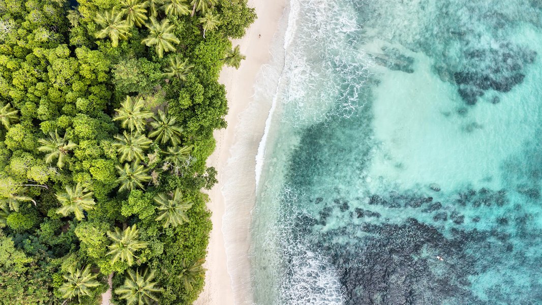
An aerial view showcasing the beauty of tropical islands, often characterized by vibrant coral reefs and clear waters.
The Genesis of Islands: A Look at Formation Processes
Islands are not static entities; they are born from dynamic geological forces and are continually shaped by environmental factors. Understanding these formation processes is key to appreciating their diversity.
Volcanic Activity
Submarine Eruptions Building Land
Many oceanic islands owe their existence to volcanic activity. Magma from the Earth's mantle rises through weaknesses in the oceanic crust, erupting on the seafloor. Over millennia, successive eruptions build up layers of lava and ash, eventually breaching the water's surface to form a volcanic island. The Hawaiian Islands are a classic example, formed as the Pacific Plate moved over a stationary hotspot, creating a chain of volcanic islands and seamounts. Iceland, too, is a product of extensive volcanic eruptions along the Mid-Atlantic Ridge, shaped further by glacial erosion.
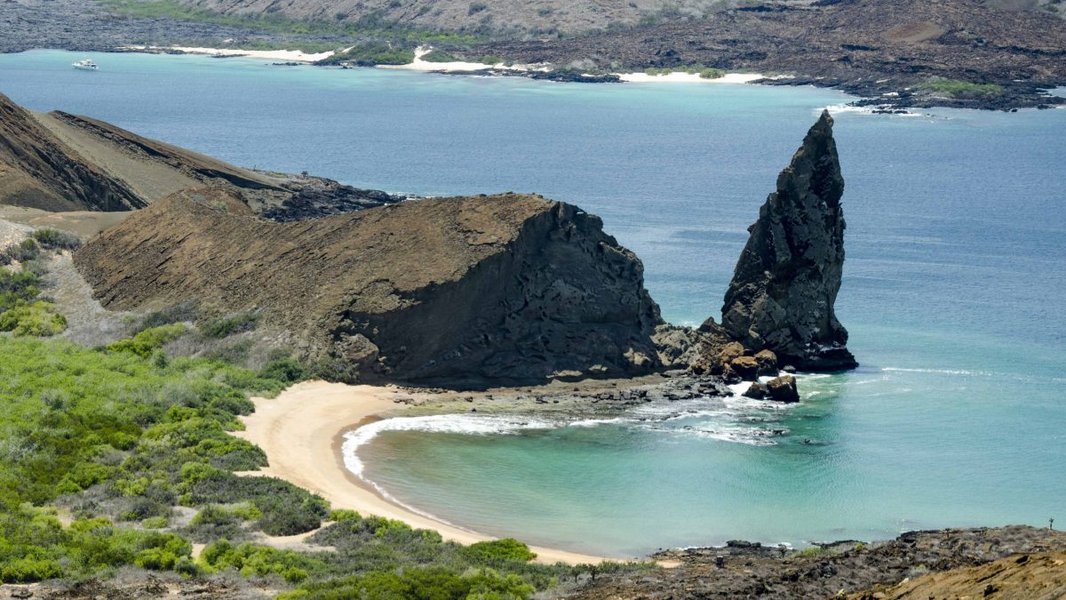
The stark volcanic landscape of Bartolome Island, Galapagos, showcases the raw power of island formation through volcanism.
Tectonic Plate Movements
Shifting Continents and Rising Seabeds
Plate tectonics play a critical role. Continental islands often form when portions of a continental landmass are separated due to tectonic rifting or when sea levels rise, inundating lower-lying areas and isolating higher elevations. The movement of tectonic plates at subduction zones, where one plate slides beneath another, can also lead to volcanic activity that forms island arcs, such as Japan or the Aleutian Islands.
Coral Reef Development
Living Structures Creating Land
In warm, shallow tropical waters, coral islands, particularly atolls, are formed by the growth of coral polyps. These tiny marine organisms secrete calcium carbonate skeletons, which accumulate over time to build vast reef structures. Atolls typically form around a subsiding volcanic island. As the volcano sinks, the coral reef continues to grow upwards, eventually forming a ring-shaped island or series of islets enclosing a central lagoon. This process is sometimes referred to as the "VC-SEA" process: Volcanic eruption, Coral growth, Subsidence, Erosion, and Atoll formation.
Erosion and Sedimentation
The Sculpting Power of Water and Wind
Erosion can separate land from a mainland, forming continental islands, especially when land bridges are weathered away. Sedimentation, the deposition of sand, silt, and other materials by rivers, ocean currents, or wind, can lead to the formation of barrier islands along coastlines or river delta islands. These islands are often dynamic, changing shape and size with storms and currents.
A Spectrum of Islands: Classification and Examples
Islands are broadly categorized based on their geological origins and location. Each type possesses distinct characteristics.
Continental Islands
Continental islands are structurally part of a continent and lie on the continental shelf. They were once connected to the mainland but became separated due to rising sea levels submerging connecting land, or through tectonic movements like rifting. Geologically, they resemble the adjacent continent.
- Examples: Greenland (largest island, on North America's continental shelf), Great Britain (Europe), New Guinea, Madagascar, Newfoundland, Borneo.
- Characteristics: Often large, with diverse geology and ecosystems, sometimes supporting significant mountain ranges and varied resources.
Oceanic Islands
Oceanic islands arise from the deep ocean floor and have never been connected to a continental landmass. They are typically volcanic in origin but can also be formed by other tectonic processes or uplift.
- Subtypes:
- Volcanic Islands: Formed by volcanic eruptions, often characterized by rugged terrain and high peaks (e.g., Hawaiian Islands, Iceland, Canary Islands, Japan).
- Coral Islands/Atolls: Built by coral polyps in tropical waters, often low-lying and ring-shaped (e.g., Maldives, Tuvalu, Marshall Islands).
- Characteristics: Often isolated, leading to high rates of endemism. Volcanic islands can be "high islands," while coral islands are typically "low islands."
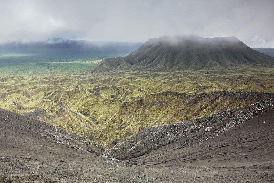
Ambrym Island in Vanuatu, an example of an active volcanic oceanic island.
Other Island Types
Specialized Formations
- Barrier Islands: Long, narrow islands typically running parallel to a coastline, formed by the accumulation of sand and sediment deposited by waves and currents. They protect the mainland from storm surges and erosion (e.g., Outer Banks of North Carolina, USA).
- Tidal Islands: Landmasses connected to the mainland by a natural or man-made causeway that is exposed at low tide and submerged at high tide (e.g., Mont Saint-Michel, France).
- River and Lake Islands: Formed within rivers or lakes due to sediment deposition (e.g., fluvial islands or aits), erosion carving out channels, or even volcanic activity within a lake (e.g., Bananal Island in Brazil, the world's largest fluvial island).
- Artificial Islands: Man-made islands constructed by humans for various purposes such as land reclamation for airports (e.g., Kansai International Airport, Japan), residential areas (e.g., Palm Jumeirah, Dubai), or industrial facilities.
Visualizing Island Characteristics
The following chart provides a comparative visualization of different island types based on several key geographical and ecological attributes. These are generalized characteristics and can vary significantly for individual islands.
This radar chart illustrates how different island types score on various characteristics. For instance, Continental Islands generally rank high in geological age and resource richness, while Coral Atolls are particularly vulnerable to sea-level rise but can host specialized biodiversity.
Exploring Island Formation and Types: A Mindmap
To better understand the relationships between island formation processes and their resulting types, the following mindmap provides a visual overview. It branches out from the central concept of "Islands" to major categories and specific examples or formation mechanisms.
Land surrounded by water,
smaller than a continent"] id2["Formation Processes"] id2a["Volcanic Activity"] id2aa["Hotspots (e.g., Hawaii)"] id2ab["Subduction Zones (e.g., Japan)"] id2ac["Mid-Ocean Ridges (e.g., Iceland)"] id2b["Tectonic Movements"] id2ba["Continental Rifting"] id2bb["Sea Level Changes separating land"] id2c["Coral Reef Growth"] id2ca["Fringing Reefs"] id2cb["Barrier Reefs"] id2cc["Atolls (around subsiding volcanoes)"] id2d["Erosion & Deposition"] id2da["Coastal Erosion"] id2db["Sediment Accumulation (Rivers, Currents)"] id3["Island Types"] id3a["Continental Islands"] id3aa["On continental shelf (e.g., Greenland, Great Britain)"] id3b["Oceanic Islands"] id3ba["Volcanic (e.g., Hawaii, Iceland)"] id3bb["Coral/Atolls (e.g., Maldives)"] id3c["Barrier Islands"] id3ca["Coastal sediment accumulation (e.g., Outer Banks)"] id3d["Tidal Islands"] id3da["Connected at low tide (e.g., Mont Saint-Michel)"] id3e["River/Lake Islands"] id3ea["Fluvial (e.g., Bananal Island)"] id3f["Artificial Islands"] id3fa["Man-made (e.g., Palm Jumeirah)"] id4["Significance"] id4a["Biodiversity & Endemism"] id4b["Human Habitation & Culture"] id4c["Vulnerability (Climate Change, Disasters)"] id4d["Geopolitical Importance"]
This mindmap illustrates the interconnectedness of island geography, from their fundamental definition and complex formation processes to the diverse types of islands we observe globally and their broader significance.
Video Exploration: Understanding Island Formation
Visual aids can greatly enhance understanding of complex geographical processes. The following video provides an engaging overview of how different types of islands are formed, reinforcing the concepts discussed earlier.
This video, "Learn about Islands | How Islands are Formed? | Types of ...", clearly explains the fundamental geological mechanisms behind island creation, covering volcanic origins, coral reef development, and other processes. It visually demonstrates how landmasses emerge from the sea or become separated from continents, offering a dynamic perspective on the birth and evolution of islands. Such explanations are invaluable for grasping the varied landscapes and ecological niches that islands present.
Geographic Distribution and Notable Island Facts
Islands are distributed across all the world's oceans, seas, lakes, and rivers, from the icy Arctic to the warm tropics. Their distribution is not random but is closely linked to geological features like tectonic plate boundaries, hotspots, and continental shelves.
Global Spread
The Pacific Ocean hosts the largest number of islands, many of which are oceanic volcanic islands or coral atolls forming vast archipelagos. The Atlantic Ocean features significant continental islands like Greenland and Great Britain, as well as volcanic archipelagos like the Azores and Canaries. The Indian Ocean is home to island nations like Madagascar (a continental fragment) and the Maldives (coral atolls). Even inland waters boast numerous islands; for example, the Great Lakes of North America contain many lake islands.
Key Island Statistics and Examples
Islands play a crucial role in global geography, biodiversity, and human culture. Here's a table summarizing some key island characteristics and examples:
| Characteristic / Category | Details / Example(s) | Significance |
|---|---|---|
| Largest Island (by area) | Greenland (822,706 sq miles / 2,130,800 sq km) | A continental island, primarily covered by an ice sheet, geopolitically part of Europe (Denmark) but geographically North American. |
| Most Populous Island | Java (Indonesia) - Over 140 million people | Demonstrates that islands can support extremely dense human populations and complex societies. |
| Largest Island in Asia / Third Largest Globally | Borneo (shared by Indonesia, Malaysia, Brunei) | Known for its immense biodiversity, including unique species like orangutans and proboscis monkeys. |
| Highest Mountain on an Island | Puncak Jaya (Carstensz Pyramid) on New Guinea (Indonesia) - 16,024 ft / 4,884 m | Highlights the dramatic topography possible on large, geologically active islands. |
| Archipelago Example | The Philippines, Hawaiian Islands, Japanese Archipelago | Groups of islands often share geological origins and cultural connections. Island hopping is a popular activity. |
| "Desert Island" | Term for an uninhabited island | Often romanticized but also refers to islands lacking fresh water or resources for sustained human life. |
| Political Status | Varies: Sovereign island nations (e.g., Japan, Cuba), parts of continental nations (e.g., Sicily for Italy), dependent territories. | Island geography often influences political boundaries and sovereignty. |
These examples underscore the vast diversity among islands in terms of size, population, geology, and political status. Islands cover approximately 6.7% of Earth's total land area.
Ecological and Human Significance
Cradles of Biodiversity
Islands are often referred to as natural laboratories for evolution. Their isolation can lead to the development of unique species found nowhere else on Earth (endemism). The Galapagos Islands, for instance, famously inspired Charles Darwin's theory of evolution due to their distinct finch populations. However, this uniqueness also makes island ecosystems particularly fragile and susceptible to invasive species and habitat loss.
Human Habitation and Culture
Humans have inhabited islands for millennia, developing diverse cultures adapted to island environments. Island life often fosters a strong connection to the sea and reliance on marine resources. However, island communities also face unique challenges, including:
- Limited Resources: Fresh water, arable land, and other resources can be scarce.
- Vulnerability to Natural Disasters: Islands are often exposed to tropical cyclones, tsunamis, volcanic eruptions, and earthquakes.
- Climate Change Impacts: Sea-level rise poses an existential threat to low-lying islands, while changing ocean temperatures can devastate coral reefs and fisheries.
Despite these challenges, islands continue to be important centers of human population, culture, tourism, and strategic geopolitical interest.
Frequently Asked Questions (FAQ)
What is the main difference between an island and a continent?
The primary distinction is size and geological context. Continents are the Earth's largest continuous landmasses, typically situated on their own tectonic plates or forming a major part of one. Islands are smaller landmasses entirely surrounded by water. While there's no absolute size cutoff, Australia is generally considered the smallest continent, and Greenland the largest island. Geologically, continental islands are part of a continental shelf, whereas oceanic islands rise from the ocean floor.
How does an archipelago differ from a single island?
An archipelago is a group or chain of islands clustered closely together in a sea or ocean. A single island is an individual landmass. Archipelagos often share a common geological origin, such as a volcanic hotspot track (e.g., Hawaiian Archipelago) or a subduction zone (e.g., Japanese Archipelago).
Are all islands formed by volcanoes?
No, not all islands are volcanic. While many oceanic islands are formed by volcanic activity, continental islands are fragments of continents. Coral islands are built by marine organisms. Barrier islands are formed by sediment deposition. Tidal islands are created by erosional processes and tidal action. So, island formation is a diverse set of processes.
Can islands be man-made?
Yes, artificial or man-made islands can be constructed by humans through land reclamation (dumping large quantities of rock, sand, or concrete into a body of water) or by expanding existing islets. These are often created for specific purposes like airports, residential developments, or industrial sites. Examples include the Palm Islands in Dubai and Kansai International Airport in Japan.
Why are islands important for biodiversity?
Islands are crucial for biodiversity because their isolation often leads to unique evolutionary pathways for species. This results in a high number of endemic species – plants and animals found nowhere else on Earth. This isolation can protect species from mainland predators or competitors, but it also makes them more vulnerable to disturbances like invasive species or habitat destruction. Islands are often considered "hotspots" of biodiversity.
Recommended Further Exploration
- How does climate change specifically impact different types of islands?
- What are some of the most unique endemic species found on islands and why did they evolve there?
- Explore the cultural adaptations of societies living on remote archipelagos.
- Investigate the formation and ecological role of freshwater islands in major river systems.
References
Last updated May 7, 2025