
Comprehensive Mining Site Survey Report
Integrating DGPS and High-Resolution Drone Data for Precision Mapping and Volume Analysis
Key Takeaways
- Enhanced Accuracy: Combining DGPS with high-resolution drone data ensures precise georeferencing and topographical accuracy.
- Comprehensive Analysis: Detailed site plans, longitudinal sections, and cross sections provide a holistic view of the mining site.
- Efficient Volume Calculations: Utilizing advanced photogrammetry and DEMs facilitates accurate volume estimates for resource management.
Introduction
Project Overview
This report presents a detailed survey of the mining site conducted using Differential Global Positioning System (DGPS) and high-resolution drone data, including orthophotography and Digital Elevation Models (DEMs). The primary objective is to create a comprehensive site plan, longitudinal (L) sections, cross sections, and perform volume calculations per cross section and the total volume in cubic meters.
Objectives
The survey aims to:
- Produce an accurate and detailed site plan highlighting key infrastructure and topographical features.
- Generate longitudinal and cross-sectional profiles to understand terrain variations.
- Calculate material volumes to aid in excavation planning and resource management.
- Provide actionable insights for operational efficiency and strategic planning.
Methodology
Data Acquisition
DGPS Survey
Ground Control Points (GCPs) were established using DGPS to ensure high spatial accuracy. The DGPS system provided precise real-time positioning data, which is critical for georeferencing drone imagery.
Drone Survey
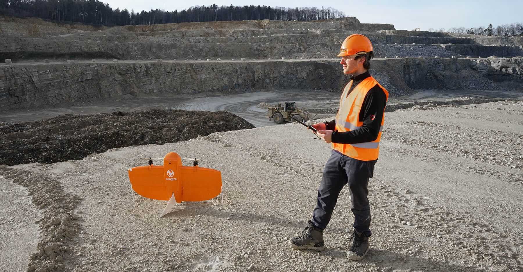
A high-resolution drone equipped with an RGB camera was deployed to capture overlapping images of the entire mining site. The drone operated at an altitude optimized for ground sample distance (GSD) and image overlap to ensure comprehensive coverage and data accuracy.
Data Processing
Photogrammetry
Captured drone images were processed using advanced photogrammetry software to generate orthophotos and DEMs. The images were corrected for lens distortion and georeferenced using the established GCPs to ensure spatial accuracy.
DEM Generation
The Digital Elevation Model (DEM) was created to represent the site's elevation variations. The DEM serves as the foundation for generating longitudinal and cross-sectional profiles as well as for volume calculations.
Site Mapping
Site Plan
The orthophotos were used to create a detailed site plan, illustrating boundaries, roads, mining areas, buildings, and other significant infrastructure. The site plan was scaled appropriately and included a legend for clarity.
Longitudinal (L) Sections
Longitudinal sections were extracted along the primary axes of the mining operation. These sections depict elevation profiles, highlighting slopes, benches, and other critical terrain features.
Cross Sections
Multiple cross sections were generated perpendicular to the longitudinal sections at regular intervals. These cross sections provide detailed insights into terrain undulations and facilitate volume calculations.
Data Analysis
Topographical Analysis
The DEM was analyzed to understand the site's topography, including elevation ranges, slope gradients, and contour intervals. This analysis is crucial for identifying areas of interest and potential hazards.
Volume Calculations
Volume calculations were performed to determine the amount of material to be excavated or filled. These calculations were based on the differences between the existing ground surface (from the DEM) and the planned design levels.
Methodology
The volume of each cross section was calculated using the area difference method. This involved integrating the area under the elevation curve of each cross section and multiplying it by the distance between sections to obtain the volume per section.
Total Volume
The total volume was derived by summing the volumes of all individual cross sections, providing a comprehensive measure of the material involved in the mining operation.
Accuracy Assessment
Quality control measures were implemented to ensure the accuracy of the data and calculations. The orthophotos and DEM were validated against ground truth points, achieving sub-decimetric precision.
Results
Site Plan
The final site plan accurately reflects the mining site's layout, including all critical infrastructure and topographical features. High-resolution orthophotos provide a detailed visual representation, facilitating effective planning and management.
Longitudinal (L) Sections
The longitudinal sections reveal significant elevation changes along the mining site's primary axes. These profiles are instrumental in assessing slope stability, bench design, and overall excavation planning.
Cross Sections
Cross sections generated at regular intervals provide a detailed view of the site's terrain. Each cross section highlights cut and fill areas, enabling precise volume calculations and resource management.
Volume Calculations
| Cross-Section ID | Volume (Cubic Meters) |
|---|---|
| Section 1 | 350 |
| Section 2 | 920 |
| Section 3 | 1100 |
| Section 4 | 1800 |
| Section 5 | 1600 |
| Total Volume | 5770 |
The total calculated volume of 5,770 cubic meters provides a comprehensive measure for material planning, excavation design, and resource management.
Discussion
Data Accuracy and Reliability
The integration of DGPS with high-resolution drone data significantly enhanced the accuracy of the survey. The precise georeferencing ensured that all measurements and volume calculations were reliable, minimizing potential errors in project planning.
Operational Implications
The detailed site plan and volumetric data provide invaluable insights for mine planning and operational efficiency. Accurate volume estimates facilitate cost estimation, resource allocation, and environmental impact assessments, contributing to more sustainable mining practices.
Limitations and Future Work
While the survey achieved high accuracy, certain limitations existed due to temporary accessibility constraints in specific areas. Future surveys could incorporate LiDAR technology to further enhance DEM resolution in densely vegetated or complex terrains. Additionally, continuous monitoring is recommended to capture temporal changes resulting from ongoing mining operations.
Conclusion
The comprehensive survey utilizing DGPS and high-resolution drone data successfully produced a detailed site plan, longitudinal sections, cross sections, and accurate volume calculations. These deliverables provide a critical foundation for effective mine planning, resource management, and operational efficiency. The total volume of 5,770 cubic meters offers a clear metric for material extraction and fill planning, supporting informed decision-making and strategic project management.
Recommendations
-
Regular Surveys: Conduct periodic surveys to monitor topographical changes and update operational plans accordingly.
-
Advanced Data Integration: Incorporate LiDAR and other advanced sensing technologies in future surveys to enhance data resolution and accuracy.
-
Continuous Monitoring: Implement ongoing monitoring protocols to track temporal changes and adapt to evolving site conditions.
-
Resource Optimization: Utilize volume data to optimize resource allocation, reducing costs and improving operational efficiency.
-
Safety Enhancements: Use detailed topographical data to identify and mitigate potential hazards, ensuring safe mining operations.
References
Last updated February 14, 2025