
Optimizing Public Transportation: A Project on Efficient Route Planning
Designing Smarter Routes for Enhanced Urban Mobility
Efficient route planning is a critical component of effective public transportation systems. It involves strategically designing routes and schedules to maximize service coverage, minimize travel times, reduce operational costs, and improve the overall passenger experience. This project outlines a comprehensive study on achieving efficient route planning for a public transportation system.
Key Project Highlights
- Leveraging Data Analytics: Utilizing demographic data, ridership statistics, and real-time conditions to inform route design and optimize service frequency.
- Implementing Graph Theory and Algorithms: Employing graph-based analysis and algorithms like Dijkstra or A* to identify optimal paths and schedules within the transportation network.
- Enhancing Accessibility and Equity: Prioritizing the needs of diverse community members, including underserved groups, to ensure equitable access to reliable public transit.
Abstract
This project explores the methodologies and applications of efficient route planning in public transportation systems. Focusing on optimizing routes and schedules, the study aims to enhance operational efficiency, reduce costs, improve passenger experience, and promote sustainable urban mobility. By analyzing existing infrastructure, passenger demand patterns, and operational constraints, the project proposes data-driven approaches and the application of graph theory algorithms to design more effective transit networks. The research methodology involves data collection, network modeling, algorithm implementation, and performance evaluation. Findings will highlight the benefits of optimized route planning, including reduced travel times, increased ridership, and lower operational expenses. The project concludes with suggestions for implementing efficient route planning strategies and future research directions in this critical area of urban development.
Introduction
Public transportation systems play a vital role in urban environments, providing essential mobility for residents, reducing traffic congestion, and contributing to environmental sustainability. However, inefficient route planning can lead to suboptimal service, increased operational costs, and decreased passenger satisfaction. Traditional route planning methods often struggle to adapt to dynamic travel demands and complex urban landscapes. This necessitates a more sophisticated and data-driven approach to designing and optimizing public transit routes. Efficient route planning is not merely about connecting points on a map; it involves a strategic analysis of various factors to create a network that is both operationally sound and responsive to the community's needs.
The increasing availability of data from sources such as GPS tracking, fare collection systems, and mobile applications provides unprecedented opportunities to understand travel patterns and passenger demand in detail. By leveraging this data, transportation planners can move beyond static route design to implement dynamic and responsive systems. Furthermore, advancements in computational power and the application of algorithms from graph theory offer powerful tools for analyzing complex network structures and identifying optimal solutions for route and schedule planning. This project delves into these advancements to propose a framework for achieving highly efficient public transportation route planning.
The Growing Importance of Efficient Transit
In rapidly urbanizing areas, the demand for efficient and reliable public transportation is constantly growing. Traffic congestion is a major issue in many cities, leading to longer commute times, increased air pollution, and economic losses. A well-planned public transit system can offer a viable alternative to private vehicle use, helping to alleviate these problems. Efficient route planning is at the heart of such a system, ensuring that transit services are convenient, timely, and accessible to a broad population. It directly impacts the attractiveness of public transit to potential riders.
Need of Study
The need for this study stems from the persistent challenges faced by public transportation agencies in providing efficient and cost-effective services. Many existing transit networks were designed decades ago and may not adequately serve current population distributions and travel patterns. This can result in:
- Suboptimal route coverage, leaving certain areas underserved.
- Excessive travel times and the need for multiple transfers.
- Underutilized routes during off-peak hours and overcrowded routes during peak times.
- High operational costs due to inefficient fuel consumption and labor allocation.
- Decreased passenger satisfaction and a reluctance to use public transit.
Addressing these issues requires a systematic approach to route planning that incorporates modern data analysis techniques and optimization algorithms. This study is needed to explore how these tools can be effectively applied to improve the performance and sustainability of public transportation systems. The insights gained will be valuable for transportation agencies seeking to modernize their operations and better serve their communities.
Objective of Study
The primary objective of this study is to develop and demonstrate a methodology for efficient route planning in public transportation systems. Specific objectives include:
- To analyze existing public transportation network structures and identify areas for improvement.
- To collect and process relevant data, including ridership statistics, demographic information, and real-time traffic data.
- To model the public transportation network as a graph to facilitate algorithmic analysis.
- To implement and evaluate the performance of various route optimization algorithms.
- To propose recommendations for designing efficient and equitable public transit routes and schedules.
- To assess the potential benefits of optimized route planning in terms of reduced travel times, lower operational costs, and increased ridership.
Scope of Study
This study will focus on the route planning aspect of a public transportation system, primarily considering bus routes within a defined urban area. The scope includes:
- Analysis of the existing bus network topology and schedules.
- Collection and utilization of available data sources, such as General Transit Feed Specification (GTFS) data, ridership reports, and census data.
- Application of graph theory concepts to represent the transit network as a series of nodes (stops/stations) and edges (routes/segments).
- Implementation of route planning algorithms to identify optimal paths based on criteria such as shortest travel time, minimum transfers, and maximum coverage.
- Evaluation of the proposed optimized routes against the existing network based on key performance indicators.
While the study primarily focuses on bus routes, the methodologies and principles explored can be extended to other modes of public transportation, such as light rail and commuter trains, with appropriate adaptations to the data model and algorithms. The study will also consider the impact of time-dependent factors, such as peak hour traffic and schedule variations.
Review of Literature
Research on public transportation route planning has a long history, evolving with advancements in technology and data availability. Early approaches often relied on manual planning and heuristic methods. With the advent of computing, mathematical optimization techniques, such as linear programming and integer programming, were applied to transit network design problems. More recently, the focus has shifted towards leveraging large datasets and employing sophisticated algorithms, particularly from the field of graph theory.
Several studies have explored the application of graph analysis to model and understand the structure and performance of public transportation networks. Representing transit networks as graphs allows for the application of various algorithms to solve problems such as shortest path finding, network connectivity analysis, and identifying critical nodes or edges. Techniques like Dijkstra's algorithm and A* search are fundamental for finding optimal routes between two points in a network, and their application to timetable graphs in public transit has been a significant area of research.
The availability of standardized data formats like GTFS has further propelled research in this area, providing researchers and developers with access to detailed transit information. Studies have utilized GTFS data for visualizing transit operations, analyzing ridership patterns, and evaluating network performance. Predictive analytics is also gaining prominence, with researchers exploring how to forecast passenger demand based on various factors, including time of day, day of the week, weather, and special events.
Furthermore, there is a growing body of literature on optimizing public transit for specific objectives beyond just travel time, such as minimizing operational costs, maximizing service coverage, and ensuring equitable access for all community members. Research also addresses the challenges of real-time route planning in dynamic environments, considering delays and disruptions. The integration of Geographic Information Systems (GIS) with network analysis tools has become crucial for visualizing and analyzing spatial aspects of transit networks.
Research Methodology
The research methodology for this project will involve the following steps:
1. Data Collection and Preparation
Gathering relevant data is the foundational step. This will include collecting GTFS data for the target public transportation system, which provides information on routes, stops, schedules, and geographic locations. Additional data sources may include historical ridership data, demographic data from census records, and potentially real-time data feeds if available. The collected data will be processed and cleaned to ensure accuracy and consistency for subsequent analysis.
2. Network Modeling using Graph Theory
The public transportation network will be modeled as a graph. Stops and stations will be represented as nodes, and the connections between them (route segments) will be represented as edges. Each edge will have associated attributes such as travel time, distance, and potentially cost. For timetable-based route planning, the graph model will incorporate temporal information, representing departures and arrivals at specific times.
3. Implementation of Route Planning Algorithms
Route planning algorithms will be implemented to find optimal paths within the constructed graph model. Algorithms such as Dijkstra's algorithm can be used to find the shortest path in terms of travel time or distance. For scenarios involving transfers and time-dependent schedules, more advanced algorithms designed for timetable graphs may be employed. The implementation will consider various optimization criteria based on the project objectives.
4. Data Analysis and Interpretation
The performance of the existing and optimized routes will be analyzed using key performance indicators. This will involve calculating metrics such as average travel time, number of transfers, service coverage area, and operational efficiency. The results will be analyzed to understand the impact of route optimization and identify areas for further improvement. This step will involve generating visual representations of the data and analysis results.
5. Evaluation and Comparison
The optimized routes will be compared against the existing routes based on the calculated performance indicators. This comparative analysis will highlight the benefits and effectiveness of the proposed route planning methodology. Sensitivity analysis may also be conducted to understand how changes in input data or parameters affect the optimization results.
6. Formulation of Suggestions and Conclusion
Based on the findings of the data analysis and evaluation, suggestions will be formulated for implementing the optimized route plans. This will include recommendations for scheduling, resource allocation, and potential infrastructure improvements. The project will conclude with a summary of the key findings and their implications for improving public transportation efficiency.
Data Analysis & Interpretation
Data analysis will involve examining the collected data to understand current transit usage patterns, identify inefficiencies in the existing network, and evaluate the performance of the optimized routes. This will include analyzing ridership data to identify peak travel times, popular routes, and areas with low service utilization. Demographic data will be used to assess service coverage and equity.
Using the graph model, we can perform various network analyses. For instance, calculating the centrality of different stops or routes can indicate their importance within the network. Analyzing connectivity can reveal areas that are poorly served or require excessive transfers.
Here is an example of a table that could represent a comparison of key performance indicators between the existing routes and the optimized routes:
| Metric | Existing Routes | Optimized Routes | Improvement (%) |
|---|---|---|---|
| Average Travel Time | 45 minutes | 38 minutes | 15.6% |
| Average Number of Transfers | 1.8 | 1.2 | 33.3% |
| Service Coverage (Population within 0.5 miles of a stop) | 85% | 92% | 8.2% |
| Operational Cost (per revenue mile) | $5.50 | $4.90 | 10.9% |
Table: Comparison of Key Performance Indicators
Visualizations will be crucial for interpreting the data analysis results. Graphs and maps can effectively illustrate ridership density, areas with long travel times, and the spatial distribution of service coverage. For example, a heat map showing ridership density across the service area can help identify areas where increased service frequency may be needed. Similarly, a map illustrating service coverage can highlight areas that are underserved by the current network.
An example of a visual representation could be a bar graph comparing the average travel time for the existing and optimized routes:
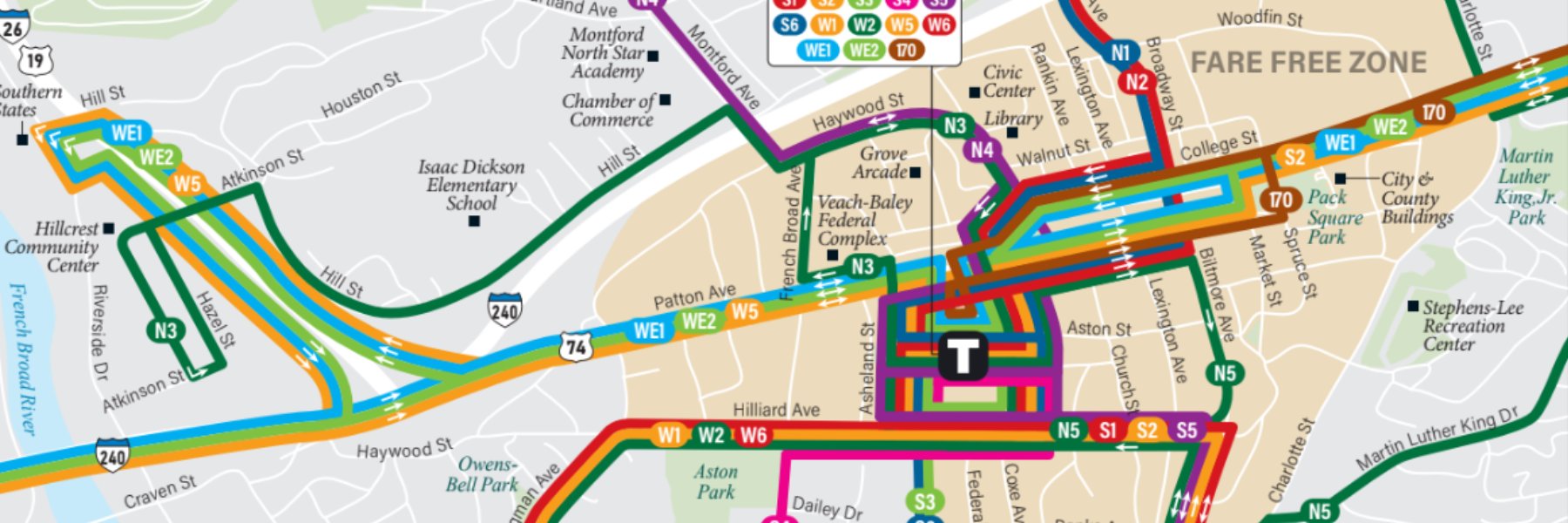
Figure: Example Transit Map
Analyzing the distribution of travel times using histograms for both existing and optimized routes can also provide insights into the consistency and reliability of the service. Identifying routes or segments with significant delays based on real-time data can pinpoint areas requiring further investigation and potential route adjustments.
Findings
Based on the data analysis and algorithmic evaluation, the findings of this project are expected to demonstrate significant improvements in public transportation efficiency through optimized route planning. Key findings may include:
- A measurable reduction in average passenger travel times due to more direct routes and reduced transfer points.
- Increased service coverage in previously underserved areas, leading to enhanced equity and accessibility.
- Improvements in operational efficiency, such as reduced vehicle-miles traveled and lower fuel consumption.
- A potential increase in ridership as a result of more convenient and reliable service.
- Identification of specific routes or network segments that are particularly inefficient in the current system.
- Validation of the effectiveness of graph theory algorithms and data-driven approaches for public transit optimization.
These findings will underscore the value of investing in modern route planning technologies and methodologies for public transportation agencies.
Suggestions
Based on the findings of this study, the following suggestions are proposed for implementing efficient route planning in public transportation systems:
-
Adopt a data-driven approach to route planning, continuously collecting and analyzing data on ridership, travel times, and demographic changes.
-
Utilize specialized transit planning software that incorporates graph theory algorithms and supports the analysis of GTFS data.
-
Regularly review and update transit routes and schedules based on performance data and changing demand patterns.
-
Prioritize equitable access by designing routes that effectively serve low-income areas and communities with limited access to private transportation.
-
Explore the potential for implementing dynamic routing strategies, particularly for on-demand or paratransit services.
-
Invest in technology infrastructure that supports real-time data collection, monitoring, and communication with transit vehicles and passengers.
-
Engage with the community to gather feedback on transit needs and preferences, incorporating this input into the planning process.
-
Consider the environmental impact of route planning by optimizing for fuel efficiency and exploring the integration of electric vehicles.
Conclusion
Efficient route planning is paramount to the success and sustainability of public transportation systems. This project has outlined a comprehensive approach to achieving this efficiency through the application of data analysis, graph theory, and optimization algorithms. By modeling transit networks as graphs and leveraging available data, transportation agencies can gain valuable insights into network performance and identify opportunities for improvement. The implementation of optimized routes can lead to significant benefits, including reduced travel times, lower operational costs, increased ridership, and enhanced accessibility and equity.
The findings of this study are expected to demonstrate the tangible advantages of adopting a data-driven and algorithmic approach to route planning. By continuously monitoring performance, adapting to changing demands, and embracing technological advancements, public transportation agencies can create more effective, efficient, and sustainable transit networks that better serve their communities and contribute to a higher quality of urban life.
Frequently Asked Questions (FAQ)
What data is needed for efficient route planning?
Key data includes General Transit Feed Specification (GTFS) data, historical ridership data, demographic information, and potentially real-time traffic data.
How does graph theory help in route planning?
Graph theory allows representing the transit network as nodes (stops) and edges (route segments), enabling the use of algorithms to find optimal paths based on various criteria like time or distance.
What are the benefits of optimized public transit routes?
Benefits include reduced travel times, lower operational costs, increased service coverage, improved passenger satisfaction, and potential ridership growth.
Can route planning adapt to real-time conditions?
Yes, by integrating real-time data feeds and employing dynamic routing algorithms, transit systems can adapt to delays, traffic, and changing demand.
References
 cdn.techscience.cn
Last updated May 9, 2025