
GIS Mapping of Groundwater Potential Zone Using Machine Learning Techniques
Innovative Approach for Sustainable Water Management in Vavuniya District, Sri Lanka
Key Highlights
- Integration of GIS and Machine Learning: Leveraging advanced spatial analysis with predictive modeling to map groundwater potential.
- Comprehensive Methodology: Detailed steps from data collection and preprocessing to model validation and policy recommendations.
- Sustainable Water Management: Providing actionable insights for effective groundwater resource planning in an arid region.
Introduction
In the arid and water-stressed Vavuniya District of Sri Lanka, groundwater constitutes a critical resource for both domestic use and agriculture. The rising demand for water due to population growth combined with the challenging climatic conditions has necessitated a thorough understanding and efficient management of groundwater resources. Newly emerging technologies in Geographic Information Systems (GIS) and Machine Learning (ML) offer transformative approaches to map, analyze, and predict groundwater potential zones. This research proposal synopsis outlines a comprehensive plan to integrate GIS and machine learning techniques to delineate groundwater potential zones precisely, thereby supporting sustainable water resource management.
Objectives
The primary aim of this research is to develop an innovative and data-driven framework to identify potential groundwater zones in Vavuniya District. The specific objectives of this study are:
- To identify key influencing factors: Geological, geomorphological, and hydrological parameters including slope, soil type, land use, rainfall, drainage density, and lineament density will be examined.
- To design a GIS-based framework: Developing thematic layers with spatial information and employing multi-criteria decision methods to integrate diverse datasets.
- To incorporate advanced machine learning models: Implementing algorithms such as Random Forest, Support Vector Regression, and Gradient Boosting Decision Trees to predict groundwater potential.
- To validate the predictive models: Using field observations and statistical metrics like Area Under the Curve (AUC) and Root Mean Square Error (RMSE) to assess model performance.
- To create detailed groundwater potential maps: Providing clear visual outputs for stakeholders to make informed decisions regarding groundwater extraction and recharge strategies.
Literature Review and Rationale
Recent studies have established the efficacy of combining GIS with machine learning for environmental and hydrological applications. GIS facilitates the integration of heterogeneous datasets such as satellite imagery, digital elevation models, and remote sensing data, which are essential in identifying factors that affect groundwater distribution. Machine learning techniques, by contrast, capitalize on vast amounts of historical and spatial data to reveal intricate patterns and relationships that classical statistical approaches might overlook.
The Vavuniya District experiences substantial water scarcity, making it imperative to pinpoint areas with high groundwater recharge potential for sustainable management. Precedents in similar studies have demonstrated that such integrated approaches not only enhance accuracy but also provide a replicable framework for other regions facing analogous challenges.
Methodology
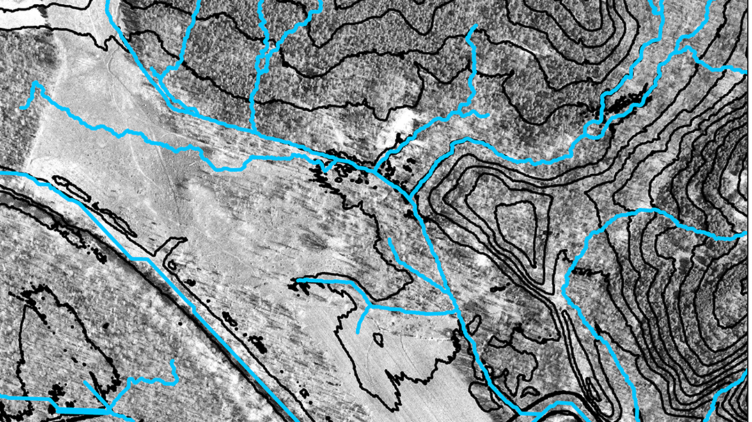
Data Collection and Preprocessing
To build an effective groundwater mapping model, the collection of high-quality spatial data is essential. The following datasets will be integrated:
- Topographical Data: Digital Elevation Models (DEMs) to extract slopes and other terrain characteristics.
- Geological Maps: Information about rock types, fault lines, and aquifer characteristics.
- Hydrological Data: Drainage networks, stream density, and watershed boundaries.
- Land Use/Land Cover Data: Satellite imagery to determine agricultural, urban, and natural land covers.
- Climatic Data: Rainfall distribution and seasonal variations obtained from meteorological records.
- Soil Information: Soil types and properties derived from soil surveys.
Table: Data Layers for Groundwater Mapping
| Data Layer | Description | Source |
|---|---|---|
| Digital Elevation Model (DEM) | Topographical details for slope analysis | Satellite (e.g., SRTM, ASTER) |
| Geological Data | Information on rock formations and aquifer characteristics | Local geological surveys |
| Hydrological Data | Stream networks and drainage density | Hydrological databases |
| Land Use/Land Cover | Classification of land areas based on usage | Satellite imagery |
| Climatic Data | Rainfall, temperature, and seasonal patterns | Meteorological stations |
| Soil Properties | Soil type and permeability | Soil surveys and digital databases |
Machine Learning Model Development
With the spatial datasets prepared, various machine learning algorithms will be employed to predict groundwater potential. The following steps will be adhered to during model development:
- Feature Selection: Assess the influence of various factors using correlation analysis and techniques such as Variance Inflation Factor (VIF) to avoid multicollinearity.
- Training and Testing: Divide the collected data into training (approximately 70%) and testing (30%) sets to calibrate and validate the predictive models.
- Algorithm Implementation: Use the following machine learning models:
- Random Forest (RF)
- Support Vector Regression (SVR)
- Gradient Boosting Decision Tree (GBDT)
- Hybrid Model Approach: Evaluate the performance of each model and explore the possibility of combining them to enhance accuracy.
- Performance Metrics: Utilize Area Under the Curve (AUC) and Root Mean Square Error (RMSE) for comprehensive model evaluation.
GIS Integration and Mapping
The outputs from the machine learning models will be integrated into a GIS framework. This integration involves:
- Multi-Criteria Decision Analysis: Using tools like the Analytical Hierarchy Process (AHP) to weigh different factors influencing groundwater potential.
- Spatial Overlay Analysis: Combining the machine learning predictions with thematic maps derived from GIS to create a final groundwater potential map.
- Map Classification: Delineating the study area into zones (high, medium, low) to clearly represent groundwater potential.
- Validation: Cross-referencing the generated maps with field observations and existing groundwater well data to ensure accuracy.
Expected Outcomes
The anticipated outcomes from this research include:
- Groundwater Potential Maps: Detailed spatial maps that clearly identify areas with varying levels of groundwater potential. These maps are expected to serve as vital tools for policymakers and water resource managers in Vavuniya District.
- Enhanced Understanding: A deeper understanding of the influence of various environmental and geological factors on groundwater distribution, which can be applied to other water-stressed regions.
- Model Evaluation: A comparative assessment of different machine learning methodologies, leading to recommendations on the most efficient and accurate modeling techniques for groundwater mapping.
- Policy Recommendations: Actionable guidelines for sustainable groundwater extraction, recharge planning, and water resource management based on machine learning insights.
Significance and Impact
This research is particularly significant given the increasing pressure on water resources in arid areas like the Vavuniya District. By integrating GIS and machine learning techniques, the study seeks to provide a cost-effective, accurate, and replicable methodology for identifying groundwater potential zones. This not only aids local government initiatives in water management and planning but also contributes to the global corpus of sustainable water resource management strategies.
The study results will empower decision-makers with robust data, facilitating improved water usage policies, preventing over-extraction, and guiding future infrastructure investments related to water supply. Additionally, by validating machine learning approaches in real-world contexts, the project is expected to foster further applications of artificial intelligence in environmental sciences.
Timeline and Resources
Proposed Timeline
The research is anticipated to span a period of approximately 12 months, with the following phases:
- Data Collection and Preprocessing: 3 months – Collection of spatial datasets from various sources, data cleaning, and preprocessing using GIS and statistical tools.
- Model Development and Training: 4 months – Implementation and calibration of machine learning models using training datasets and selection of the best-performing algorithms.
- GIS Integration and Mapping: 3 months – Incorporation of model outputs into the GIS environment, spatial analysis, and creation of groundwater potential maps.
- Validation and Reporting: 2 months – Field validation, performance evaluation, and preparation of a detailed report with policy recommendations.
Resources Required
Successful execution of this research will require:
- Software: Advanced GIS platforms (such as ArcGIS and QGIS), statistical software, and Python-based machine learning libraries (e.g., scikit-learn).
- Hardware: High-performance computing resources for processing large spatial datasets and running complex machine learning models.
- Personnel: A multidisciplinary team including GIS specialists, hydrologists, machine learning experts, and field surveyors.
- Funding: Financial support for data acquisition, software licenses, field surveys, and personnel cost.
Policy and Practical Implications
Groundwater over-extraction and mismanagement are prevalent issues in regions with limited water availability. The innovative GIS and machine learning approach presented in this research proposal offers several practical implications:
- Enhanced Decision-Making: The detailed groundwater potential maps will assist policymakers in planning water resource allocations and prioritizing areas for extraction and recharge interventions.
- Risk Mitigation: Identification of zones with low groundwater potential helps in mitigating risks associated with over-extraction, ensuring long-term water sustainability and preventing resource depletion.
- Scalability: The methodology designed here can be adapted and replicated in other regions facing similar challenges, thereby contributing to broader sustainable, data-driven water management practices.
- Community Impact: Improved water resource planning will have a direct beneficial impact on local communities, particularly in agriculture-dependent households and rural areas facing water scarcity.
Ethical Considerations
Care will be taken to ensure that all data collection, processing, and model evaluation activities comply with ethical guidelines and local regulations. Data privacy and the rights of local communities will be carefully considered. In addition, the research will include consultations with local stakeholders to ensure that the resulting groundwater maps and recommendations are applicable and beneficial to the community at large.
References
- Identification of Artificial Groundwater Recharge Zones - Agrieast
- GIS and Groundwater Potential Mapping - Acadpubl
- Status of Groundwater Potential Mapping Research - ResearchGate
- Assessment of Groundwater Quality in Vavuniya - IWA
- Delineating Potential Groundwater Zones - Taylor & Francis
Recommended Further Readings and Queries
Last updated March 5, 2025