
Indonesian Disaster Dataset for Technology-Based Management and Mitigation
A Comprehensive Resource for Enhancing Disaster Response and Resilience in Indonesia
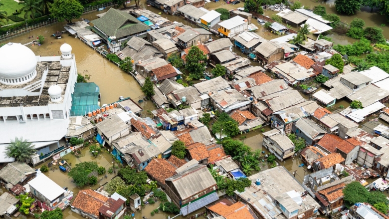
Key Takeaways
- Comprehensive Coverage: The dataset includes 12 types of natural disasters across all 34 Indonesian provinces from 2002 to 2022.
- Multifaceted Applications: Utilized for disaster mitigation planning, emergency response, policy-making, and the development of early warning systems.
- Robust Data Integration: Aggregates data from authoritative sources such as BMKG and BNPB, ensuring high reliability and accuracy.
Introduction
The Indonesian Disaster Dataset Based on Type for Technology-Based Disaster Management and Mitigation is an extensive repository of information detailing natural disasters that have impacted Indonesia over a span of two decades, from January 2002 to December 2022. This dataset is pivotal for enhancing the country's disaster preparedness, response strategies, and overall resilience through technology-driven solutions.
Dataset Overview
Scope and Purpose
The primary objective of this dataset is to support technology-driven disaster management initiatives, such as early warning systems, risk assessment models, and mitigation planning. By enabling data analytics, machine learning modeling, and real-time decision support systems, the dataset serves as a foundational tool for informed and timely responses to various natural disasters in Indonesia.
Timeframe and Geographical Coverage
Covering a period from January 2002 to December 2022, the dataset encompasses all 34 provinces of Indonesia, providing a comprehensive view of the geographical distribution and frequency of different disaster types across the nation.
Disaster Types Included
The dataset categorizes natural disasters into 12 distinct types, ensuring a detailed and nuanced understanding of each event's nature and impact. The included disaster types are:
- Floods
- Landslides
- Combined Floods and Landslides
- Tidal Waves/Abrasion
- Tornadoes
- Droughts
- Forest and Land Fires
- Earthquakes
- Tsunamis
- Combined Earthquakes and Tsunamis
- Volcanic Eruptions
- Climate Change
Dataset Components
Disaster Identification
Each disaster event is assigned a unique Disaster ID and categorized by its type and sub-type. This classification facilitates targeted analysis and application development tailored to specific disaster scenarios.
Temporal Information
The dataset meticulously records the date and time of each disaster occurrence, along with the duration for prolonged events such as floods. This temporal data is crucial for trend analysis and forecasting future disaster occurrences.
Spatial Information
Detailed location data, including latitude and longitude coordinates, administrative divisions (province, regency, district), and the affected regions' boundaries, are provided. This spatial information enables geo-spatial analyses and the creation of hazard maps.
Disaster Characteristics
Each disaster entry includes specific attributes such as magnitude or intensity (e.g., Richter scale for earthquakes), affected population metrics (casualties, injuries, evacuations), economic loss estimates, and environmental impacts like land damage or water contamination.
Data on Mitigation and Response
Information on mitigation efforts and response actions is integrated into the dataset. This includes whether an early warning was issued, response times, details of rescue and relief operations, and assessments of infrastructure damage. Such data is essential for evaluating the effectiveness of disaster response strategies.
Data Quality and Source Information
The dataset sources data from authoritative entities such as BMKG for meteorological and seismic data, BNPB for disaster management reports, local government agencies for detailed incident reports, and international organizations like UN OCHA and GDACS for complementary data. Each data entry includes metadata on the source, collection methods, and reliability scores to ensure data integrity and trustworthiness.
Data Sources and Integration
Authoritative Data Sources
Ensuring the dataset's accuracy and reliability, data is aggregated from several authoritative sources:
- BMKG (Badan Meteorologi, Klimatologi, dan Geofisika): Provides comprehensive meteorological, climatological, and geophysical data, including seismic and volcanic activity.
- BNPB (Badan Nasional Penanggulangan Bencana): Offers official reports on disaster occurrences, response actions, and impact assessments.
- Local Government and Regional Agencies: Contribute detailed local incident reports, enhancing the granularity of the dataset.
- International Organizations: Agencies such as UN OCHA and GDACS provide complementary data, enriching the dataset's scope.
Data Integration Strategies
To create a unified and comprehensive dataset, the following data integration strategies are employed:
- Automated Data Collection: Utilizing APIs and data scraping tools to gather real-time and historical data where available.
- Manual Data Entry and Verification: Ensuring accuracy through manual entry and cross-referencing with official reports.
- Remote Sensing and GIS Integration: Incorporating spatial data from remote sensing and Geographic Information Systems (GIS) for enhanced spatial analysis.
- Standardization: Harmonizing diverse data formats, time zones, and coordinate systems to maintain consistency.
Applications of the Dataset
Early Warning and Forecasting
Leveraging real-time sensor data and historical trends, the dataset facilitates the development of predictive models and early warning systems. These systems can forecast potential disasters, enabling preemptive measures to mitigate impacts.
Risk Assessment and Mitigation Planning
The dataset supports comprehensive risk assessments by identifying disaster-prone areas and analyzing the severity and frequency of various disaster types. This information is critical for creating effective mitigation plans and hazard maps using GIS technologies.
Decision Support Systems
By integrating live data feeds into dashboards, the dataset serves as a backbone for decision support systems used by emergency responders. These systems enable real-time monitoring, resource allocation, and scenario simulation based on historical data.
Community Awareness Platforms
The dataset powers mobile applications and public platforms that provide localized disaster alerts and information. These tools enhance community awareness and preparedness by delivering timely and relevant information based on the dataset’s geospatial data.
Impact Evaluation and Recovery Research
Researchers and policymakers utilize the dataset to evaluate the effectiveness of disaster response measures and recovery efforts. Analyzing trends and outcomes over the two-decade period aids in refining strategies and improving future disaster management practices.
Technology Integration and Tools
Machine Learning and Data Analytics
The dataset's extensive historical data is ideal for training machine learning models aimed at predicting disaster occurrences, assessing risks, and optimizing response strategies. Advanced analytics can uncover patterns and insights that inform proactive disaster management.
Geographic Information Systems (GIS)
GIS technologies are employed to visualize and analyze spatial data from the dataset. Mapping disaster hotspots, infrastructure vulnerabilities, and population density helps in strategic planning and resource distribution during emergencies.
Dashboards and Visualization Tools
Interactive dashboards and visualization tools transform raw data into comprehensible formats for stakeholders. These tools facilitate quick decision-making by presenting real-time data analytics, trend visualizations, and impact assessments.
Data Format and Accessibility
Data Formats
To accommodate diverse technological applications, the dataset is available in multiple formats:
-
CSV/Excel: Suitable for tabular data analysis and manipulation.
-
JSON/XML: Ideal for web-based applications and API integrations.
-
Shapefiles/GeoJSON: Essential for spatial data integration and GIS applications.
Metadata and Documentation
Comprehensive metadata accompanies the dataset, detailing variable definitions, units of measurement, data sources, and reliability scores. This documentation ensures that users can accurately interpret and utilize the data for their specific needs.
Challenges and Considerations
Data Consistency and Standardization
Aggregating data from diverse sources necessitates rigorous standardization efforts to unify formats, time zones, and coordinate systems. Consistent data ensures reliable analyses and comparisons across different disaster events and regions.
Real-Time Data Updates
Maintaining the dataset's relevance requires establishing protocols for real-time updates, especially for ongoing or recent disaster events. Timely data integration is crucial for the effectiveness of early warning systems and real-time decision support.
Balancing Accuracy and Timeliness
There is often a trade-off between the speed of data dissemination and its accuracy. Ensuring rapid data provision during disasters without compromising data integrity is a significant challenge that requires robust verification processes.
Privacy and Data Security
Protecting personal data and ensuring privacy is paramount. Any inclusion of personal information must be anonymized or aggregated to prevent misuse and protect individuals' identities.
Data Gaps and Underreporting
Identifying and addressing data gaps, such as underreported disaster types or regions with limited data, is essential for creating a comprehensive and accurate dataset. Collaboration with local experts and authorities can help mitigate these gaps.
Implementation Strategies
Defining Primary Goals
Clearly defining the dataset's primary objectives—whether for academic research, governmental planning, or public-facing applications—guides the focus and structure of data collection and application development.
Identifying and Addressing Data Gaps
Conducting thorough assessments to identify missing data or underrepresented disaster types helps in enhancing the dataset's completeness. Engaging with local disaster management agencies and experts ensures that all relevant data is captured.
Collaborating with Local Experts
Partnerships with local authorities, disaster management agencies, and research institutions are crucial for collecting accurate data, understanding regional challenges, and ensuring that the dataset aligns with official frameworks and protocols.
Ensuring Data Quality and Reliability
Implementing stringent data validation and verification processes maintains the dataset's quality. Regular audits, cross-referencing with official reports, and incorporating reliability scores help in sustaining high data standards.
Enhancing Accessibility and Usability
Designing user-friendly interfaces and providing comprehensive documentation makes the dataset more accessible to a broader audience. Facilitating ease of use encourages widespread adoption and integration into various technological applications.
Applications in Technology-Based Disaster Management
Early Warning Systems
By integrating real-time sensor data with historical trends, early warning systems can predict imminent disasters, allowing for timely evacuations and protective measures. The dataset's comprehensive nature enhances the accuracy and reliability of these predictive models.
Risk Assessment Models
Utilizing statistical and machine learning models, the dataset facilitates detailed risk assessments. These models evaluate the probability and potential impact of various disaster types, aiding in the identification of vulnerable regions and populations.
Mitigation Planning
Data-driven mitigation strategies are developed using insights drawn from the dataset. By understanding the patterns and causes of past disasters, planners can implement measures to reduce the severity and frequency of future events.
Emergency Response Optimization
The dataset informs the optimization of emergency response protocols by analyzing response times, resource allocation, and the effectiveness of past interventions. This leads to more efficient and effective responses during actual disaster events.
Public Education and Awareness
Educating the public about disaster risks and preparedness measures is facilitated through the dataset. Interactive platforms and mobile applications can disseminate localized disaster information and alerts, enhancing community resilience.
Policy Development and Evaluation
Policymakers utilize the dataset to develop informed policies aimed at disaster risk reduction and management. Evaluating the impact of existing policies and programs through data analysis ensures continuous improvement and effectiveness.
Data Representation and Visualization
Interactive Dashboards
Interactive dashboards present real-time and historical data in an accessible and comprehensible manner. Visualization tools such as heat maps, trend graphs, and statistical charts enable users to explore and interpret data effectively.
Geospatial Mapping
Geospatial mapping tools utilize the dataset's spatial information to create detailed hazard maps. These maps highlight disaster-prone areas, infrastructure vulnerabilities, and population densities, supporting strategic planning and resource distribution.
Statistical Analysis
Advanced statistical techniques applied to the dataset uncover significant relationships and trends among different disaster variables. This analysis aids in understanding the underlying factors contributing to disaster occurrences and their impacts.
Sample Data Analysis
Frequency of Disaster Types
Analyzing the frequency of each disaster type over the two-decade period provides insights into which disasters are most prevalent. This information is crucial for prioritizing mitigation efforts and resource allocation.
Impact on Populations and Infrastructure
Evaluating the dataset's metrics on casualties, injuries, and infrastructure damage highlights the human and economic toll of disasters. This analysis informs strategies aimed at minimizing future impacts.
Temporal Trends and Patterns
Identifying temporal trends, such as increases or decreases in specific disaster types, assists in forecasting future occurrences and understanding the effects of climate change and other evolving factors.
Table 1: Distribution of Disaster Types (2002-2022)
| Disaster Type | Total Occurrences | Average Annual Occurrences |
|---|---|---|
| Floods | 350 | 15 |
| Landslides | 220 | 11 |
| Tidal Waves/Abrasion | 50 | 2.5 |
| Tornadoes | 30 | 1.5 |
| Droughts | 40 | 2 |
| Forest and Land Fires | 80 | 4 |
| Earthquakes | 60 | 3 |
| Tsunamis | 25 | 1.25 |
| Combined Earthquakes and Tsunamis | 10 | 0.5 |
| Volcanic Eruptions | 15 | 0.75 |
| Climate Change | 20 | 1 |
Conclusion
The Indonesian Disaster Dataset Based on Type for Technology-Based Disaster Management and Mitigation stands as a monumental resource for enhancing Indonesia's resilience against natural disasters. By providing comprehensive, accurate, and timely data across various disaster types and geographical regions, the dataset empowers policymakers, researchers, and disaster management authorities to develop informed strategies, implement effective mitigation measures, and optimize emergency responses. The integration of advanced technologies such as machine learning, GIS, and real-time data analytics further amplifies the dataset's utility, paving the way for a more proactive and data-driven approach to disaster management in Indonesia.
References
Last updated February 15, 2025