
Discovering Fire-Safe Zones in Kinawe, Libona, Bukidnon
A Comprehensive Guide to Identifying and Establishing Safe Zones Amid Fire Hazards
Highlights
- Designated Structures: Identify community centers, schools, and municipal buildings as primary safe zones.
- Geographical Considerations: Evaluate topography, vegetation, and proximity to water sources as critical factors.
- Open Areas & Accessibility: Leverage open spaces, farmlands, and elevated regions to ensure unobstructed evacuation routes.
Overview of Fire Hazards in Kinawe, Libona, Bukidnon
In Kinawe, Libona, Bukidnon, the potential for fire hazards exists due to the area's agricultural landscape and natural vegetation. With wildfires becoming more frequent and severe due to climatic changes, it is essential to delineate safe zones that can serve as refuges in the event of a fire outbreak.
Fire hazards in the region are influenced by several factors, including the density of vegetation, agricultural practices, meteorological conditions, and the local infrastructure's preparedness. The region's topology, ranging from 340 meters to 661 meters above sea level with steep slopes in certain parts, necessitates a contextual planning approach for emergency evasion and safe sheltering.
Identified Safe Zones in Kinawe, Libona
1. Community Structures and Institutional Buildings
a. Community Centers and Barangay Halls
Community centers and barangay halls are crucial as they are often strategically located and equipped with basic facilities that can support emergency management. In the context of Kinawe, these buildings may serve as evacuation points or as command centers where residents can receive timely information during a fire hazard. Their construction is generally robust and may include features that resist heat and facilitate rapid evacuation.
b. Educational Institutions (e.g., Kinawe National High School)
Schools, such as the Kinawe National High School, often have comprehensive infrastructure including assembly areas, open grounds, and access to communication channels. These features make them ideal safe shelters during emergencies. Additionally, schools are frequently the focus of community-based disaster preparedness programs, ensuring that both students and local residents are familiar with evacuation protocols.
2. Open Public Areas and Farmlands
a. Open Spaces and Parks
Open areas such as parks or large communal spaces can provide immediate relief during evacuations by offering space where large groups of people can gather without the risk of being trapped by surrounding structures. These locations generally have minimal flammable materials and allow for easier access for emergency vehicles.
In an agricultural setting like Kinawe, the vast open farmlands can temporarily serve this function, though care must be taken regarding the presence of flammable crops and operational equipment.
b. Farmland Areas with Low Vegetation Density
Not all agricultural lands are equal in terms of fire risk. Areas with low vegetation density, or zones where agriculture is less intensive, might present lower fire risk. These regions tend to have fewer combustible materials and are less likely to support sustained fires, making them potential safe spots during an emergency.
3. Geographical and Natural Buffers
a. Elevated Areas
Elevation plays a critical role in determining safe zones during fire occurrences. Regions that are on higher ground, particularly those above the average elevation mark (around 500 meters), can act as natural barriers against fire spread. Such areas tend to experience better airflow, potentially slowing the progression of a fire, and are less likely to be densely populated with flammable materials. In Kinawe, identifying these elevated spots within safe corridors is essential, though the relatively flat topography in some areas might limit this option.
b. Proximity to Water Sources
Areas near rivers, streams, lakes, or other water bodies provide an inherent safety advantage. The natural presence of water not only acts as a firebreak but also enables quicker firefighting efforts. Regions where communities can easily access water are usually less prone to fire sustainability and can be advantageous for both manual and vehicular firefighting operations.
4. Roadways and Accessibility
a. Roads as Safe Corridors
Wide roadways, particularly those that are well-maintained and accessible, can serve as evacuation routes and even temporary safe zones. These routes not only facilitate the rapid movement of emergency services but also demarcate clear, unobstructed paths for evacuation. They are especially useful in densely populated areas, ensuring that residents can leave in an orderly fashion.
b. Connection to Emergency Services
Proximity to fire stations and emergency service centers enhances the safety of designated zones. Areas along major roads that provide direct access to such services should be prioritized since they ensure that help arrives promptly. Advanced planning and local emergency mapping should incorporate these zones to coordinate swift responses.
Structured Summary Table of Safe Zones
| Category | Potential Safe Zones | Key Considerations |
|---|---|---|
| Community Structures | Barangay Halls, Community Centers, Schools (e.g., Kinawe National High School) | Robust infrastructure, accessible communication channels, emergency management facilities |
| Public Open Areas | Parks, Open Fields, Farmlands with Low Vegetation | Wide spaces allowing safe assembly, minimal flammability, easy access for emergency vehicles |
| Geographical Buffers | Elevated Areas, Regions near Rivers/Streams | Higher elevation slows fire spread, proximity to water aids firefighting |
| Roadways and Accessibility | Main Roads, Street Corridors with Nearness to Emergency Services | Facilitate effective evacuation, provide clear pathways for emergency response |
Practical Implementation and Community Action
Community Awareness and Education
In addition to designating safe zones, active community education and regular drills are paramount. Residents of Kinawe need to be informed about the exact locations of these safe zones via community meetings, printed flyers, and online resources. Establishing a clear communication plan with local disaster risk reduction offices ensures that in the event of an emergency, everyone knows where to go.
Collaboration with Local Authorities
Local government units and emergency services must collaborate to maintain and update safe zone maps, particularly as environmental and infrastructural conditions evolve. Regular hazard assessments, using tools such as the Fire Hazard Severity Zone Viewer and other geographic information systems (GIS), assist in identifying risk areas. Integrating community feedback into emergency planning can also enhance the overall effectiveness of these safety zones.
Regular Updates and Drills
It is critical to periodically review and update the designated safe zones. Changes in local agriculture, construction activities, or climate patterns can impact the safety of previously secured areas. Conducting regular evacuation drills helps ensure that everyone is well-prepared and can proceed quickly to the safe zones when needed.
Incorporating Technology for Enhanced Safety
Geospatial Mapping and Monitoring
In today's digital age, the use of geospatial technology is invaluable. Platforms such as the Fire Hazard Severity Zone Viewer, GIS tools, and local mapping systems provide real-time data on hazard conditions and safe zone demarcations. These technologies help not only in verifying existing safe zones but also in identifying new areas that meet safety criteria based on topography, vegetation density, and infrastructure.
Emergency Communication Systems
Effective communication systems are vital during fire emergencies. Apps and alert systems can quickly inform residents of changes in hazard levels or provide updated instructions on safe zone locations. Local authorities are encouraged to integrate modern communication strategies with traditional media to ensure everyone is reached promptly during critical situations.
Integration with Disaster Risk Reduction Programs
Integrating local safe zones into broader disaster risk reduction (DRR) programs ensures that such initiatives are supported by a range of resources. These programs often include training sessions, resource allocation for firefighting, and infrastructure improvements which collectively enhance community resilience against fire hazards.
Detailed Considerations: Geography and Infrastructure
Topography and Elevation
Kinawe's topographical diversity, with elevations ranging from 340 meters to 661 meters, can influence fire behavior. Elevated points not only reduce the risk of fire propagation but also offer vantage points for monitoring fire development. These locations can be integrated into local evacuation plans to allow early detection and rapid response.
Vegetation and Agricultural Layout
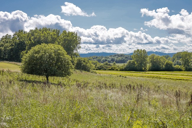
The region’s agricultural identity, dominated by cornfields and sunflower farms, requires careful management during fire emergencies. High-density vegetation areas are more prone to rapid fire spread, whereas areas with low density or sparse vegetation provide better safety margins. It is essential for local planners to map these variables, ensuring that designated safe zones remain secure from unexpected fire spread.
Infrastructure and Accessibility Challenges
While evaluating safe zones, one must consider existing infrastructure challenges such as limited road connectivity, water supply issues, and regional communications. Enhancing infrastructure, for example by widening roads near potential safe zones or improving signage, can greatly improve the safety and accessibility of these areas during emergencies. Local authorities and community stakeholders should work collaboratively to address these challenges.
Leveraging Local Knowledge and Data
Community Feedback
Input from residents who have a deep understanding of the local terrain and historical fire occurrences is invaluable. Community forums and surveys can help pinpoint potential safe areas that might not be immediately obvious from generalized mapping data. Such ground-truthing reinforces planning efforts and encourages collective responsibility in disaster preparedness.
Use of Historical Data and Modern GIS Tools
Combining historical fire event records with current GIS mapping can provide a dynamic model for fire hazard prediction. This integration aids local emergency services in updating safe zone maps to reflect the most current environmental conditions. Utilizing comprehensive datasets ensures that safe zones remain relevant and effective in the wake of evolving hazards.
References
- Fire Hazard Severity Zone Viewer - ArcGIS Experience
- Is Your Home In a Fire Hazard Severity Zone? - FEMA Hub
- Fire Hazard Severity Zones | OSFM
- Think Hazard - Bukidnon Wildfire Report
- HazardHunterPH - Local Hazard Assessments
Recommended Related Queries
 legistarweb-production.s3.amazonaws.com
Last updated March 24, 2025