
Understanding LiDAR Technology
An in-depth exploration of LiDAR's principles, mechanisms, and applications
Key Insights
- Principle of Operation: LiDAR uses laser pulses for distance measurements based on precise time-of-flight calculations.
- Data Integration: Incorporating GPS, IMU, and high-fidelity scanning enables the creation of detailed 3D environmental models.
- Wide Applications: From autonomous vehicles to topographic mapping, LiDAR’s versatility extends across various fields.
Fundamentals of LiDAR Operation
Basic Principle
LiDAR, which stands for Light Detection and Ranging, is a remote sensing technology that operates by emitting pulses of laser light towards the target area. The core functionality is based on the measurement of the time it takes for these laser pulses, when emitted, to hit an object and then reflect back to the sensor.
The fundamental formula that governs this process is derived from the speed of light. Mathematically, the distance is expressed as \[ \frac{\text{Speed of Light} \times \text{Time Elapsed}}{2} \] where the division by two accounts for the round trip as the light travels to the target and returns to the sensor. The speed of light is approximately \( \text{300,000 km/s} \) (or \( \text{299,792 km/s} \) in more precise terms).
Emission and Reflection Mechanism
The LiDAR system begins with the emission of rapid and focused pulses of laser light. These lasers are typically tuned to specific wavelengths, commonly within the range of 800 to 1064 nanometers for diode lasers, or around 1550 nanometers for fiber lasers. Once the light pulse travels toward the target area, it interacts with objects present, including terrain, vegetation, buildings, and other physical features.
Upon striking an object, a portion of the laser light is reflected back towards the sensor. The sensor’s ability to detect even faint signals is critical, especially in conditions where the reflective properties of surfaces vary due to texture, material, or angle of incidence.
Time-of-Flight Measurement
One of the most critical elements of LiDAR technology is the precise measurement of the time-of-flight. This measurement records the time interval between when the laser pulse is emitted and when its reflection is detected by the sensor. Given that light travels extremely quickly, the precise instrumentation and timing mechanisms are essential. High-speed electronics are therefore incorporated to measure these intervals, often in the range of nanoseconds.
The use of time-of-flight data enables the system to calculate the distance to each point that the laser strikes. Converting these time measurements into distance is done using the formula already mentioned: \[ \text{Distance} = \frac{\text{Speed of Light} \times \text{Time Elapsed}}{2}. \]
Data Collection and Processing
LiDAR systems are capable of emitting hundreds of thousands to millions of laser pulses per second. This results in the collection of vast amounts of data within a very short period. The raw data includes multiple individual distance measurements along with additional metadata such as the angular position of the laser beam and the time stamps associated with each pulse.
To convert these raw data points into a coherent representation, sophisticated data processing algorithms are utilized. These algorithms integrate the time-of-flight measurements with additional sensor inputs – most notably from the Global Positioning System (GPS) and an Inertial Measurement Unit (IMU). The GPS provides accurate geolocation for every measurement, ensuring that each data point is correctly positioned on the Earth’s surface. The IMU, which measures the orientation (roll, pitch, yaw) of the LiDAR sensor, further refines the spatial accuracy. This combination permits the construction of highly detailed three-dimensional models or maps.
Core Components and Technologies Involved
Key Hardware Components
Laser Scanner
The laser scanner is the heart of a LiDAR system. It is responsible for emitting and receiving laser pulses. Innovations in this area have led to different types of LiDAR scanners:
- Discrete Return LiDAR: Captures individual reflection peaks, recording one or several distinct returns per laser pulse.
- Full Waveform LiDAR: Records the entire energy distribution of the returning signal, allowing for a more detailed analysis of the target surface, albeit with more complex data processing requirements.
GPS and Inertial Measurement Unit (IMU)
To ensure spatial accuracy and consistency, LiDAR systems integrate with GPS and IMU systems:
- GPS: Provides precise location data, ensuring that every distance measurement can be accurately mapped to its real-world coordinates.
- IMU: Offers detailed orientation data (roll, pitch, yaw), which is crucial when the LiDAR unit is in motion, such as on an aircraft, drone, or moving vehicle.
How the Process Works in Detail
When analyzing the entire process from emission to mapping, the operation of LiDAR transforms into a multi-stage procedure:
Step 1: Emission
The LiDAR system begins by emitting a stream of laser pulses at very high frequencies. The choice of laser type and its operational wavelength is dictated by the intended application, environmental conditions, and desired resolution.
Step 2: Interaction and Reflection
As the emitted laser pulses encounter various surfaces, they reflect off these objects back toward the sensor. The reflective quality of different materials may vary, but the sensor is designed to detect even weak signals.
Step 3: Time-of-Flight Measurement
The sensor accurately measures the time taken for each laser pulse to return. Given the incredibly fast speed of light, the instrumentation used must provide measurements in nanoseconds or even pico-seconds. This time-of-flight forms the foundation for accurate distance calculation.
Step 4: Distance Calculation
Using the known speed of light and the measured time of flight, the system calculates the distance from the sensor to the object. The mathematical expression used is \[ \text{Distance} = \frac{\text{Speed of Light} \times \text{Time Elapsed}}{2}, \] ensuring that the calculated distances are precise.
Step 5: Mapping the Environment
Once all individual distance measurements are acquired, they are integrated with GPS and IMU data to accurately position them in three-dimensional space. This process creates a detailed point cloud—a collection of geospatial data points—that represents the environment.
Applications and Advanced Topics
Diverse Applications of LiDAR
LiDAR technology plays an essential role in a number of fields due to its ability to capture accurate spatial information. Here are some major applications:
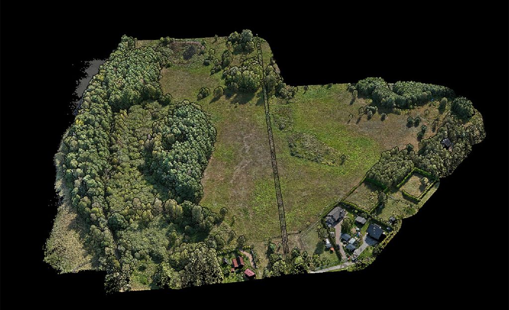
- Geographical Mapping: LiDAR is extensively used in topographical mapping to generate digital elevation models (DEM) and digital terrain models (DTM). The technology’s ability to capture precise ground elevation even under dense vegetation is particularly valued in geological surveys and urban planning.
- Autonomous Vehicles: In self-driving car systems, LiDAR sensors provide real-time 3D data to detect obstacles, identify road boundaries, and ensure smooth navigation, making them crucial for vehicular safety and autonomy.
- Forestry Management: Detailed mapping of forest canopies, tree heights, and vegetation structures are achieved through LiDAR, contributing significantly to environmental monitoring and resource management.
- Archaeology: LiDAR has been instrumental in uncovering ancient structures and terrains hidden beneath dense jungle canopies, providing archaeologists with unprecedented insights into lost cities and historical landscapes.
- Infrastructure and Construction: LiDAR helps in building high-resolution 3D models of construction sites, aiding in planning, design, and monitoring the progress of large-scale engineering projects.
Advanced LiDAR Technologies
There are nuanced variations in LiDAR systems tailored for specific needs:
- Full Waveform LiDAR: Instead of detecting just the peak of the reflected signal, full waveform LiDAR captures the entire energy distribution. This provides additional detail about the vertical structure of objects, such as tree canopies, buildings, or layered terrain.
- Discrete Return LiDAR: This system records one or more distinct return points per laser pulse. While less detailed than full waveform, it is highly effective for mapping ground surfaces and is simpler to process.
- Single-Photon LiDAR: Capable of detecting extremely faint signals, single-photon LiDAR is used for long-range and low-reflectivity targets. It is particularly useful when very subtle changes in terrain need to be mapped.
- Green Wavelength LiDAR: Operating in the green spectrum, this type is especially beneficial for underwater or shallow water mapping because water has better transmission properties for green wavelengths compared to infrared.
Integration with Data Processing and Analysis Tools
The power of LiDAR does not solely lie in data collection. Equally essential are the data processing techniques that transform raw measurements into actionable insights. Using advanced algorithms, the point cloud data can be filtered, analyzed, and converted into various outputs:
Digital Elevation Models (DEM)
By processing the collected point cloud data, a DEM is created, which represents the bare earth surface devoid of vegetation or structures. This model is invaluable for flood modeling, civil engineering projects, and ecological studies.
3D Modeling and Visualization
High-resolution three-dimensional models can be constructed from LiDAR data, which are useful for urban planning, virtual reality applications, and historical conservation. The 3D models not only display terrain elevations but also outline man-made structures, forming a comprehensive representation of the environment.
Comparative Table: LiDAR versus Other Sensing Technologies
| Aspect | LiDAR | Radar | Sonar |
|---|---|---|---|
| Wavelength | Laser light (visible/infrared) | Radio waves | Sound waves |
| Precision | High precision (meter to centimeter level) | Lower than LiDAR | Varies with medium |
| Applications | Mapping, autonomous vehicles, forestry, archaeology | Aviation, weather forecasting, long-range detection | Submarine navigation, underwater mapping |
| Time-of-flight Calculation | Yes, measured in nanoseconds | Yes, but at lower resolution | Yes, adjusted for sound speed |
Safety Considerations and Environmental Effects
Safety and Operational Guidelines
Although LiDAR employs laser light which can be intense, it is generally designed to adhere to safety regulations that prevent damage to human eyes and surroundings. The light power is carefully controlled to ensure that it is safe for both operators and the public.
Additionally, depending on the environment and operational altitude (for instance, when mounted on a drone or aircraft), LiDAR systems are regulated to minimize any environmental disturbances or potential hazards. The rapid pulse emissions make it possible to gather immense amounts of data while remaining unobtrusive.
Environmental Impacts
LiDAR is similarly advantageous in studying environmental changes over time. By frequently capturing high-resolution terrain data, it contributes to understanding natural phenomena such as erosion, deforestation, and coastal changes. The technology’s capability to operate under various lighting conditions—including nighttime—ensures a constant stream of reliable data crucial for both scientific research and emergency management.
References and Suggested Queries
References
- Lidar: Light Detection and Ranging - GISGeography
- What is LiDAR - Synopsys
- LiDAR Basics - NEON Science
- Understanding LiDAR - Ouster
- LiDAR Overview - Wikipedia
Recommended Related Queries
Last updated March 18, 2025