
Unveiling Placentia's Labyrinth: A Deep Dive into Its 800+ Streets
Discover the intricate network of avenues, lanes, and boulevards that define this Southern California city.
Welcome to an in-depth exploration of the streets that form the backbone of Placentia, California. Nestled in northern Orange County, this suburban city boasts a surprisingly extensive and well-organized network of roadways. From major thoroughfares to quiet residential cul-de-sacs, Placentia's streets tell a story of community, history, and careful urban planning.
Key Insights into Placentia's Streetscape
- Extensive Network: Placentia is home to over 800 individual streets, a testament to its development and residential spread.
- Systematic Naming & Numbering: The city employs a logical system for naming and numbering streets, with Bradford Avenue and Chapman Avenue serving as key reference points.
- Historical Significance: Many streets, parks, and buildings in Placentia are named after individuals who played significant roles in the city's history as mayors, council members, educators, and business leaders.
The Scope of Placentia's Roadways
Placentia's urban fabric is woven together by a considerable number of streets, precisely 803 according to available street map data. These roadways are distributed across the city's primary ZIP codes, 92870 and 92871, catering to a population of over 51,000 residents (as of the 2020 census). The street system supports a mix of residential neighborhoods, commercial zones, and public facilities, reflecting the city's character as a "pleasant place" – a translation of its name.
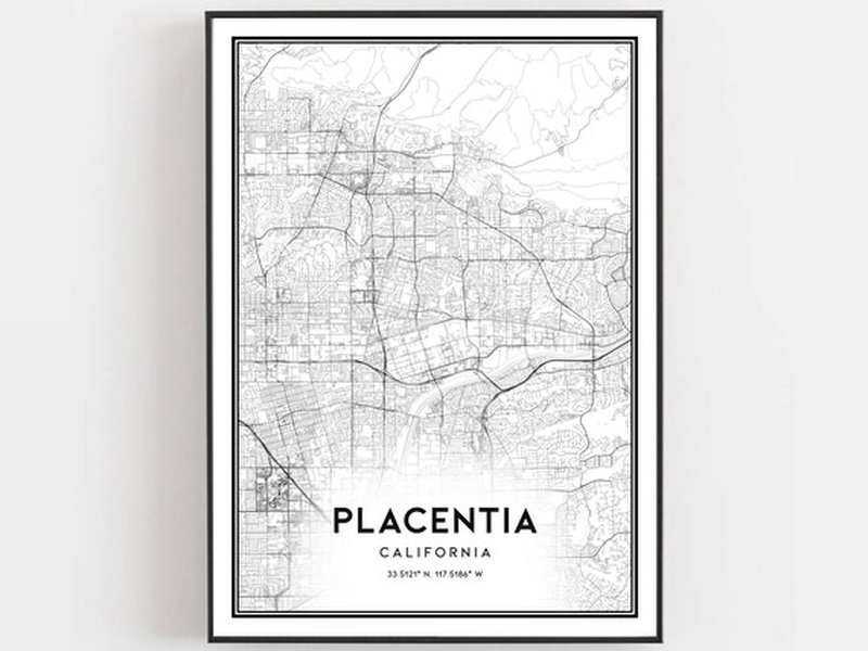
An artistic representation of Placentia's street network.
Understanding Street Naming and Numbering Conventions
The City of Placentia has established clear ordinances to govern its street nomenclature and building addressing, ensuring consistency and ease of navigation. These regulations are detailed in Title 14 of the City of Placentia's Code of Ordinances.
Naming Protocols
All existing and future streets and public highways within the city limits are officially named as recorded in county maps and tract profiles. A notable convention is the prefix "West" for any street or avenue situated west of Bradford Avenue or its prolongation. This systematic approach aids in distinguishing locations within the city.
Building Numbering System
The addressing system is anchored by two main arteries:
- Building numbers commence with "100" at the east and west lines of Bradford Avenue.
- Similarly, numbering starts at "100" at the north and south lines of Chapman Avenue.
Each block is typically allocated 100 numbers. A consistent pattern is followed for assigning numbers: even numbers are designated for buildings on the east and south sides of streets, while odd numbers are used for those on the west and north sides. Generally, one number is allotted for every 25 feet of street or highway frontage. If a hallway or tenant entrance fronts a street within this 25-foot space, an additional half number (e.g., 101 ½) may be assigned.
The city also encourages the use of reflective house numbers to assist emergency personnel in quickly locating addresses, particularly at night or during emergencies.
A Glimpse into Placentia's Street Names
While an exhaustive list of all 803 streets is extensive, here is a representative sample showcasing the variety of names found throughout Placentia. These names range from common thoroughfares to smaller residential ways:
| Street Name Category | Example Streets | Common Suffixes |
|---|---|---|
| Alphabetical (A-C) | Aberdeen Drive, Acacia Drive, Addy Avenue, Adella Lane, Aguirre Lane, Alcott Avenue, Aldrin Way, Allegheny Avenue, All America Way, Avenida de Carlotta, Bradford Avenue, Berea Way, Berryessa Way, Brookhaven Avenue, Chapman Avenue, Crowther Avenue, California Way, Crescent Drive | Drive, Avenue, Lane, Way, Circle |
| Major Thoroughfares | Orangethorpe Avenue, Yorba Linda Boulevard, Imperial Highway, Rose Drive, Kraemer Boulevard, Melrose Street, Santa Fe Avenue, Chapman Avenue, Bradford Avenue | Avenue, Boulevard, Highway, Road |
| Residential Streets | Delores Street, Diamond Street, El Dorado Street, Fairview Avenue, Golden Avenue, La Jolla Street, Linda Vista Avenue, McFadden Avenue, Petra Lane, Ruby Drive, Sequoia Drive | Street, Lane, Way, Court, Place |
| Referenced Avenues | Bradford Avenue, Chapman Avenue, North Placentia Avenue, Edinger Avenue, Lakeview Avenue, Serrano Avenue | Avenue |
This table provides a snapshot of the diversity in street nomenclature within Placentia, reflecting both its planned development and historical influences.
Visualizing Placentia's Street Characteristics
To better understand the attributes of Placentia's street network, the following chart provides an opinionated analysis of several key characteristics. This visualization helps to conceptualize how different aspects contribute to the city's overall urban environment. The scores are relative and for illustrative purposes, ranging from 1 (lower emphasis/density) to 10 (higher emphasis/density).
This chart illustrates Placentia's strengths in areas like residential focus and modern infrastructure, while also highlighting good network density and connectivity. The influence of historical naming is also a notable characteristic.
Street Infrastructure and Maintenance
The City of Placentia is proactive in maintaining its street infrastructure. This includes managing over 3,600 streetlights along public thoroughfares. The primary purpose of this extensive lighting system is to enhance safety, facilitate smooth traffic flow, support nighttime business operations, improve neighborhood aesthetics, and bolster public security. Southern California Edison (SCE) owns and maintains the majority of these (approximately 3,459), with the City of Placentia responsible for the remainder, including safety lights mounted above traffic signals. Residents can report issues with city-owned lights to the Public Works Department and SCE-owned lights directly to Edison.
Furthermore, Placentia designates specific streets or portions thereof as "through streets" and implements stop intersections as necessary. The public works director oversees the erection and maintenance of stop signs, adhering to the California Vehicle Code.
Understanding Placentia's Street System Organization
The following mindmap illustrates the key components and relationships within Placentia's street system, from official regulations to the tangible elements like street names and infrastructure.
This mindmap provides a hierarchical view of how Placentia's streets are defined, managed, and experienced by its residents and visitors.
Discover Placentia: A Pleasant Place
To get a better feel for the city of Placentia beyond just its street names, the following video offers a glimpse into what makes it "A Pleasant Place." It provides broader context about the community and environment that these streets serve.
A video showcasing Placentia, offering insights into the city's character.
This overview helps contextualize the importance of the street network in connecting the various facets of life in Placentia.
Frequently Asked Questions (FAQ)
How many streets are there in Placentia, CA?
What are the main ZIP codes for Placentia streets?
Are there any special naming rules for streets in Placentia?
How does the building numbering system work in Placentia?
Where can I find a complete list of all streets in Placentia?
Are any streets in Placentia named after historical figures?
Conclusion
The streets of Placentia, CA, form an intricate and well-managed network that is fundamental to the city's identity and functionality. With over 800 distinct roadways, governed by systematic naming and numbering conventions rooted in key thoroughfares like Bradford and Chapman Avenues, Placentia offers a structured yet diverse urban landscape. From its historical naming practices to its ongoing infrastructure maintenance, the city's street system reflects a commitment to order, safety, and community heritage. This network not only facilitates daily life for its residents but also tells a part of Placentia's story as a "pleasant place" to live and work.
Recommended Further Exploration
To delve deeper into topics related to Placentia, consider these queries:
- What is the history of urban development and planning in Placentia, CA?
- How can I access and use the City of Placentia's GIS Open Data Portal for street information?
- Which notable historical figures are commemorated in Placentia's street names?
- What are the current public works projects related to street maintenance and improvement in Placentia, CA?
References
Last updated May 21, 2025