
S-100 ECDIS Detailed Explanation
An in-depth analysis in McKenzie style reporting of maritime navigation evolution
Highlights
- Seamless Integration: S-100 transforms traditional 2D charts into dynamic 3D representations, integrating multiple data sets.
- Enhanced Safety: Advanced data layers including bathymetry, tidal information, and under-keel clearance lead to unprecedented navigational safety.
- Future-Ready Framework: With full extensibility and interoperability, S-100 ECDIS is set to support emergent technologies and meet evolving maritime standards.
Introduction to S-100 ECDIS
The evolution of maritime navigation has taken a significant leap forward with the advent of the S-100 Electronic Chart Display and Information System (ECDIS). Developed under the aegis of the International Hydrographic Organization (IHO), the S-100 framework establishes a universal hydrographic data model that marries traditional electronic charting with the dynamic demands of contemporary maritime navigation. Built to surpass the limitations of the older S-57 standard, S-100 provides the agility needed to support multiple data products, ranging from bathymetric surfaces to tidal levels and under-keel clearance measurements.
Executive Summary
The transformation from traditional S-57 Electronic Navigational Charts (ENCs) to S-100 compliant systems represents a paradigm shift in how hydrographic data is integrated and displayed. In essence, the S-100 framework embraces a data-centric approach that allows for the relatively seamless inclusion of multiple product specifications into one cohesive maritime navigation tool – the next-generation ECDIS. This report in McKenzie style provides an overview of the technological evolution, key components, operational functionalities, benefits, and challenges associated with S-100 ECDIS.
Technological Evolution
From S-57 to S-100: A Quantum Leap
The traditional S-57 standard, which has been the cornerstone for electronic maritime navigation for decades, is now being succeeded by the more robust and flexible S-100 framework. The primary motivation behind this transition is to accommodate a growing variety of data types which were not well-served by the older system. S-100 is designed to be highly extensible, allowing the incorporation of new data products as maritime technologies advance.
Notably, S-100 provides a universal set of model rules for expressing marine environmental phenomena, meaning that it is not confined to a single data type or a rigid format. This versatility means that S-100 can integrate data from sensors, satellite imagery, and other advanced mapping technologies, enabling a move from flat two-dimensional (2D) displays to significantly more engaging three-dimensional (3D) visualization.
Key Components of S-100 ECDIS
Core Elements and Data Layers
The S-100 ECDIS is characterized by its layered approach where different products converge to yield a comprehensive navigation tool. The following are the key components:
Universal Hydrographic Data Model
At its heart, S-100 provides a universal data model that standardizes how marine features are represented. This model defines guidelines for encoding and representing hydrographic data accurately, ensuring that any navigational system built around this framework adheres to global standards.
Product Specifications
S-100 supports multiple product specifications, allowing for diverse layers of information on a single ECDIS display:
- S-101: This standard is designed to replace the aged S-57 ENCs with a richer and more adaptable format, enabling enhanced representation of maritime information.
- S-102: Represents the bathymetric surface data which is crucial for determining seafloor topography and dynamic under-keel clearance.
- S-104: Provides water level and tide data, which are integral for adjusting depth measures on the fly, thereby improving navigational safety.
- S-111: Encapsulates data pertaining to surface currents, which greatly aids in route planning and fuel efficiency.
- S-129: Dedicated to under-keel clearance information allowing vessels to maintain optimal draft and avoid grounding risks.
Dual Operational Mode
During its transitional phase, S-100 ECDIS systems are designed to operate in a “dual fuel” mode. This means they can handle both traditional S-57 ENC data and the emerging S-101 and other S-100 product specifications. Such a mode ensures a smooth transition for mariners, as they can continue to rely on familiar data while gradually adopting the advanced functionalities of S-100.
Operational Mechanisms and Data Integration
Enhanced Interoperability
One of the most compelling aspects of the S-100 framework is its emphasis on interoperability. The universal data model ensures that diverse datasets – from bathymetric and tidal data to surface currents and beyond – seamlessly integrate into a single, cohesive ECDIS interface.
To ensure effective data exchange, S-100 supports several encoding formats, notably ISO8211, HDF5, and GML. This multi-format support not only enhances compatibility but also future-proofs the system against evolving technological standards. The comprehensive registries included within the framework define feature concepts, portrayal items, and product specifications, contributing to uniformity in data representation.
Machine Readability and Automation
The forward-thinking design of S-100 emphasizes machine readability for both data and metadata. This ensures that ECDIS can automate critical functions and dynamically adjust to real-time changes, such as tide variations or shifting currents. An inherent benefit of this automation is the facilitation of dynamic under-keel clearance calculations – a function that adjusts navigational decisions based on continuously updated data streams.
Data Visualization and 3D Representation
Enhanced Chart Display
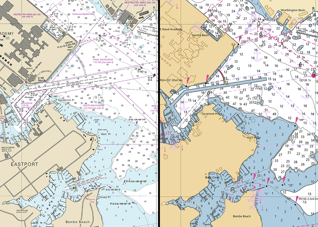
A transformative feature of S-100 ECDIS is its ability to elevate navigational charts from static, 2D representations to interactive, three-dimensional (3D) landscapes. This development is achieved by overlaying traditional chart data with supplementary layers such as bathymetry, water levels, and surface current information.
The integrated visualizations provide mariners with a more realistic depiction of the marine environment, thereby fostering improved situational awareness. This new paradigm in charting not only aids in more accurate navigation but also enhances safety by providing a deeper insight into potential underwater obstructions and seabed irregularities.
Implementation Timeline
Phased Rollout and Compatibility
The broad adoption of S-100 ECDIS is anticipated by 2026. During this transitional period, vessels equipped with the new systems will operate in dual mode. This backward compatibility ensures that existing navigational charts (S-57) remain usable alongside the emerging S-100-based products.
The phased rollout is intended to allow industry players time to update data production pipelines, recalibrate navigational systems, and secure regulatory approvals. As such, while the ultimate objective remains the complete transition to the S-100 format, the interim period will see a harmonious blend of legacy and new systems.
Enhanced Safety and Situational Awareness
Dynamic Under-Keel Clearance
Maritime safety is fundamentally enhanced through the S-100 framework, particularly due to its innovative approach to under-keel clearance. By integrating real-time bathymetric data with tide and water-level indicators, the system automates the calculation of the safe clearance margin beneath a vessel's hull. This automation reduces the risk of grounding and optimizes navigation, especially in shallow or congested waterways.
Layered Data for Better Decision-Making
The capacity to overlay multiple data layers on the navigational display means that decision-makers can access comprehensive insights in a single glance. For instance, by viewing tidal height data alongside detailed bathymetric information, captains can adjust sailing routes dynamically and predict potential hazards with far greater accuracy.
Advantages and Challenges of S-100 ECDIS
Benefits
The adoption of S-100 ECDIS brings forth numerous advantages:
- Improved Data Granularity: The rich detail available through S-100 enhances situational awareness and facilitates more informed navigational decisions.
- Interoperability: Its universal model allows for seamless integration of diverse data sets, ensuring compatibility with various systems and data sources.
- Regulatory Compliance: By adhering to global standards set forth by the IHO, the framework supports improved navigational safety requirements required by maritime authorities.
- Adaptability: The extensible nature of S-100 allows it to evolve alongside emerging technologies such as Maritime Autonomous Surface Ships (MASS), ensuring long-term relevance.
Challenges
Despite the numerous benefits, transitioning to S-100 ECDIS is not without its challenges:
- Data Migration: Adapting legacy systems and data from the S-57 standard to the new S-100 framework requires significant investment in time and resources.
- Training Requirements: Mariners and navigation officers must undergo additional training to operate dual-mode systems effectively and to familiarize themselves with advanced features.
- Regulatory Approval: Navigational authorities need to update regulatory frameworks to fully endorse and implement the new standard.
- System Integration: Ensuring the smooth interoperability between legacy data and new data types poses technical challenges during the transitional phase.
Operational Overview: Data Integration in S-100 ECDIS
Table: Key Data Products in S-100 Framework
| Data Product | Description | Primary Utility |
|---|---|---|
| S-101 | Next-generation Electronic Navigational Charts that supersede S-57 data | Provides comprehensive and dynamic route information |
| S-102 | Bathymetric Surface Data | Enhances under-keel clearance calculations and seabed topology visualization |
| S-104 | Water Level and Tide Data | Enables dynamic depth adjustments during tidal variations |
| S-111 | Surface Currents Data | Aids in route planning and fuel efficiency through current analysis |
| S-129 | Under-Keel Clearance Data | Supports safe navigation by preventing groundings |
Future Directions and Technological Advancements
Building a Future-Ready Navigation System
The S-100 framework is not merely an upgrade of existing navigation systems; it represents a vision for the future of maritime navigation. With its extensible design, S-100 provides the structural capacity to incorporate additional product specifications as technologies evolve. The maritime industry is already looking toward integration with autonomous navigation systems and real-time data analytics, both of which are supported by S-100’s robust framework.
The introduction of Maritime Autonomous Surface Ships (MASS) necessitates a navigation system that can process real-time sensor data and make dynamic adjustments in rapidly changing marine environments. S-100’s emphasis on machine readability and automated data integration is particularly positioned to meet these futuristic challenges, ensuring that vessels remain both safe and efficient in an era of autonomous operations.
Regulatory and Compliance Overview
Adapting to International Standards
The alignment of the S-100 framework with international maritime standards is a crucial element in its rapid adoption. Regulatory bodies across the globe are incentivizing upgrades to navigation systems that comply with these enhanced standards, facilitating a smoother transition away from legacy systems. This regulatory endorsement, in turn, improves the overall safety and reliability of maritime operations.
As part of the compliance process, regulatory authorities are revising guidelines and operational standards to integrate the benefits of dynamic data display, greater data granularity, and automated safety measures embedded within S-100 ECDIS. Such measures also open avenues for enhanced maritime communication and coordinated responses during emergencies.
Implementation Challenges and Strategic Solutions
Navigating Transitional Phases
The migration from S-57 to S-100 ECDIS systems poses substantial technical and operational challenges. One of the primary difficulties lies in data conversion and ensuring that the rich, multi-dimensional datasets of S-100 are harmonized with the legacy data. This includes ensuring that historical charts remain compatible during the dual-mode operational phase.
Moreover, extensive training and upgrades in system software and hardware are required. Strategic solutions involve phased implementation plans, comprehensive training modules, and robust support from industry regulators. Collaborative efforts among manufacturers, regulatory bodies, and maritime organizations are essential to overcome these transitional challenges, ensuring that the full benefits of S-100 are realized with minimal disruption to maritime operations.
Conclusion and Final Thoughts
In conclusion, the S-100 ECDIS framework stands as a revolutionary development in maritime navigation. By building on the foundation of S-57 and pushing the boundaries of digital hydrographic data, S-100 integrates diverse information streams into a single, cohesive navigational interface. The framework’s dual operational mode facilitates a smooth transition from legacy systems to state-of-the-art navigation, ensuring both backward compatibility and full utilization of advanced data layers.
Enhanced with dynamic under-keel clearance, multi-dimensional charting capabilities, and machine-readable data sets, the S-100 standard not only improves situational awareness but also sets a robust platform for future technological advancements. While the adoption process does present challenges – from data migration to regulatory adjustments – the significant enhancements in safety and efficiency strongly outweigh these transitional obstacles. As maritime operations become increasingly automated and data-driven, S-100 ECDIS is poised to become the backbone of next-generation navigational systems, supporting both human and autonomous maritime endeavors.
The evolution towards a more integrated and responsive navigation system signals a future of maritime operations that is safer and more efficient. The ongoing collaboration among industry stakeholders to streamline conversion efforts and update regulatory frameworks underscores the commitment to realizing this visionary standard. Ultimately, the S-100 framework embodies the combined advancements in technology and data integration—the cornerstone of modern, secure, and effective maritime navigation.
References
- An explanation of the S-100 data framework - Thetius
- The 101 on S-100: what YOU need to know about maritime’s big data transformation - NAVTOR
- S-100 Data Formats - Precision Marine Navigation
- S-100: A Quick Guide - Electronic Chart Centre
- S-100: Shaping the future of navigation - ADMIRALTY
Recommended Queries for Further Exploration
Last updated February 27, 2025