
Unveiling Earth's Emissions: How Satellites Are Revolutionizing Our View from Above
Discover the latest breakthroughs (2024-2025) in leveraging satellite technology to monitor and quantify global greenhouse gas emissions.
Key Insights: The Cutting Edge of Emission Monitoring
- Advanced Gas Detection: Recent studies highlight significant progress in satellite capabilities for monitoring key greenhouse gases like carbon dioxide (\(CO_2\)), methane (\(CH_4\)), and nitrous oxide (\(N_2O\)), with new methodologies improving accuracy for sources ranging from power plants to agricultural activities.
- Next-Generation Satellites: Upcoming missions like the EU's CO2M and China's TanSat-2, alongside recently launched MethaneSAT, promise enhanced spatial resolution, precision, and revisit times, aiming to address current limitations in capturing the full scope of emissions.
- Methodological Innovations: Researchers are increasingly employing sophisticated techniques, including direct estimation from satellite column data, advanced inversion models, and machine learning algorithms, to refine emission estimates and provide more actionable data for climate policy.
The Evolving Landscape of Satellite-Based Emission Estimation
The use of satellite data for estimating greenhouse gas and pollutant emissions has seen remarkable advancements, particularly in 2024 and 2025. Journal articles from this period reveal a concerted effort to improve the accuracy, coverage, and granularity of emission data, which is crucial for understanding climate change, verifying national emission inventories, and guiding mitigation strategies. Satellites offer a unique top-down perspective, complementing traditional ground-based, bottom-up inventories.
Monitoring Specific Greenhouse Gases: Recent Breakthroughs
Recent research underscores significant progress in detecting and quantifying various emissions critical to climate change.
Carbon Dioxide (\(CO_2\)) Monitoring
Efforts to monitor \(CO_2\) emissions, a primary driver of global warming, have intensified. Studies from 2023-2025 highlight new direct estimation methods for global anthropogenic \(CO_2\) emissions using satellite-retrieved \(CO_2\) column amounts (XCO2). For instance, one approach demonstrated strong agreement (R² = 0.929) with existing inventories like the Open-source Data Inventory for Anthropogenic CO2 (ODIAC), offering potential for higher frequency and broader coverage. Research published in *Atmospheric Chemistry and Physics* (2025) discussed the robustness of air-pollution-satellite-based \(CO_2\) emission inversion systems. However, challenges remain. A 2025 study analyzing Orbiting Carbon Observatory (OCO) satellite data found that current systems might underestimate \(CO_2\) emissions, particularly from smaller power plants, capturing only about 29% (±12%) of U.S. power plant emissions. This highlights the need for improved spatial resolution, precision, and monitoring frequency.
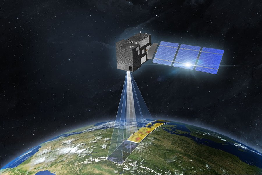
Artist's impression of the Copernicus Anthropogenic CO₂ Monitoring (CO2M) satellite, designed to measure atmospheric carbon dioxide.
Methane (\(CH_4\)) Detection and Quantification
Methane, a potent greenhouse gas, is another key focus. A 2025 systematic review in *ScienceDirect* covering 77 studies emphasized the pivotal role of satellites like TROPOMI and EMIT in detecting methane point sources globally, including emissions from fossil fuel exploitation, coal mines, and landfills. High-resolution satellite data, such as that from the EMIT mission (as detailed in a 2025 MDPI publication on coal mine emissions), allows for detailed plume analysis and more accurate quantification. Some analyses, like a 2025 Ember report, revealed that satellite data indicated significantly higher methane emissions from sources like Australian coal mines (40% higher) than previously reported in national inventories. The recently launched MethaneSAT (early 2024) is specifically designed to monitor methane emissions with high precision over wide areas.
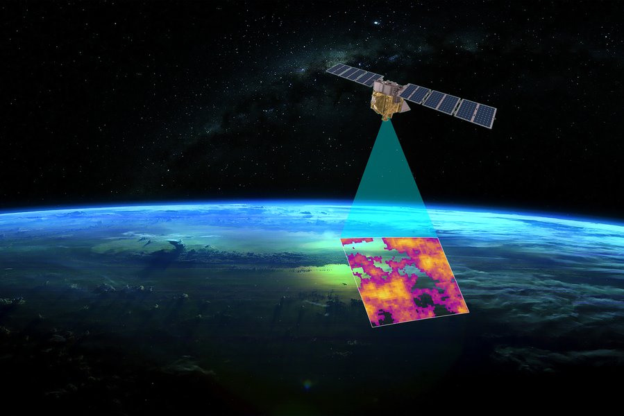
Data rendering from MethaneSAT, illustrating its capability to detect and map methane emissions.
Nitrous Oxide (\(N_2O\)) and Other Emissions
While \(CO_2\) and \(CH_4\) have received extensive attention, satellite monitoring of nitrous oxide (\(N_2O\)), another significant greenhouse gas, is also advancing. A 2024 study in *ACS Environmental Science & Technology* presented novel approaches for estimating \(N_2O\) concentrations and fluxes in complex estuarine environments using satellite remote sensing. Additionally, satellites are employed to estimate emissions from biomass burning. For example, studies have combined field and satellite data using geospatial techniques to estimate emission factors and biomass-carbon emissions due to deforestation and forest degradation.
Advancements in Satellite Technology and Methodologies
The increasing sophistication of satellite instruments and analytical techniques is driving progress in emission estimation.
Next-Generation Satellite Missions
A new era of satellite missions is set to significantly enhance our monitoring capabilities. The European Union's Copernicus Anthropogenic \(CO_2\) Monitoring Mission (CO2M), expected to launch from 2025 onwards, aims for 0.7 ppm precision and 4 km² spatial resolution. China's TanSat-2 is also anticipated to provide daily global coverage with high precision for industrial \(CO_2\) emissions. These missions, along with others like MethaneSAT, are designed to overcome some of the limitations of current satellites by offering improved accuracy, finer spatial and temporal resolution, and better coverage of various emission sources.
Innovations in Data Processing and Analysis
Methodological innovations are key to translating raw satellite data into meaningful emission estimates. Recent developments include:
- Direct Estimation Techniques: Moving beyond traditional top-down disaggregation, methods are being developed to directly estimate anthropogenic \(CO_2\) emissions from satellite column measurements.
- Advanced Inversion Models: Sophisticated atmospheric transport and inversion models (e.g., GEOS-Chem) are used to infer emissions from observed atmospheric concentrations. A 2025 article in *Atmospheric Chemistry and Physics* validated the robustness of such \(CO_2\) emission inversion systems.
- Machine Learning and AI: AI and machine learning are increasingly used to process vast amounts of satellite data, improve pattern recognition for plume detection, and produce high-fidelity emission maps, such as 1km resolution \(CO_2\) and \(CH_4\) maps over the Arabian Peninsula (Nature Scientific Reports, 2024).
- Integrated Approaches: The Finnish Meteorological Institute (FMI) announced new methodologies in May 2025 that combine satellite observations with atmospheric dispersion models to provide more accurate daily emission monitoring for cities and power stations.
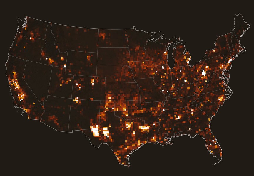
Average methane concentrations over the continental United States in 2019, as observed by the TROPOMI instrument on the Sentinel-5P satellite. Hotspots indicate higher concentrations.
Comparative Analysis of Satellite Capabilities
Satellite missions for emission monitoring vary in their technical specifications and primary objectives. The radar chart below offers a conceptual comparison between current-generation multi-gas sensors, upcoming next-generation missions primarily focused on \(CO_2\), and specialized missions targeting methane. The capabilities are rated on a relative scale, illustrating the anticipated improvements and specializations in the field. Higher values indicate better performance or capability in that specific aspect.
This chart visually represents how next-generation and specialized missions are expected to enhance specific aspects like precision for target gases or point source identification, while also improving overall spatial and temporal coverage compared to some current systems.
Mapping the Domain: Key Aspects of Satellite Emission Monitoring
The field of satellite-based emission estimation is multifaceted, involving various greenhouse gases, diverse emission sources, sophisticated methodologies, and continuous technological advancements. The mindmap below provides a structured overview of these interconnected components, illustrating the breadth and depth of this rapidly evolving area of research.
Biomass Carbon)"] id2["Emission Sources Monitored"] id2a["Industrial Facilities (Power Plants
Factories)"] id2b["Urban Areas & Cities"] id2c["Fossil Fuel Exploitation (Oil & Gas
Coal Mines)"] id2d["Agriculture (Rice Paddies
Livestock)"] id2e["Landfills"] id2f["Biomass Burning (Deforestation
Forest Fires)"] id3["Methodologies & Technologies"] id3a["Satellite Instruments (TROPOMI
OCO
EMIT
IASI)"] id3b["Direct Estimation (Column Amounts)"] id3c["Inversion Techniques &
Atmospheric Models"] id3d["Machine Learning & AI"] id3e["Geospatial Analysis"] id3f["Mass-Balance Modeling"] id4["Advancements & Future Prospects"] id4a["Next-Generation Satellites (CO2M
TanSat-2
MethaneSAT)"] id4b["Higher Spatial & Temporal Resolution"] id4c["Improved Accuracy & Precision"] id4d["Enhanced Algorithms & Data Fusion"] id5["Challenges & Limitations"] id5a["Data Accuracy & Uncertainty"] id5b["Spatial Resolution Constraints"] id5c["Temporal Coverage Gaps"] id5d["Atmospheric Interference (Clouds
Aerosols)"] id5e["Underestimation of Certain Sources"] id5f["Impact of GHGs on LEO
Satellite Capacity"]
This mindmap highlights the complexity and interdisciplinary nature of using satellite data for emissions estimation, from identifying specific gases and their sources to employing advanced analytical techniques and anticipating future technological leaps while addressing inherent challenges.
Challenges and the Path Forward
Despite significant progress, challenges in satellite-based emission estimation persist. These include limitations in spatial and temporal resolution, precision, the influence of atmospheric conditions (like clouds and aerosols), and difficulties in distinguishing between anthropogenic and natural emissions for some gases. Studies continue to report underestimation of emissions by current satellite systems for certain sources, emphasizing the need for ongoing refinement of both sensor technology and retrieval algorithms.
A notable emerging concern, highlighted in a 2025 *Nature Sustainability* article, is that increasing atmospheric \(CO_2\) levels are projected to alter upper atmospheric density. This could reduce the satellite carrying capacity of Low Earth Orbit (LEO) by 50-66% by 2100, potentially impacting the very tools we rely on for emissions monitoring. This underscores the feedback loops within the climate system and the urgency of emission reduction.
The future, however, looks promising with the advent of new satellite constellations and collaborative international efforts. Continuous improvement in data assimilation techniques, integration with ground-based measurements, and the application of AI are expected to enhance the reliability and utility of satellite-derived emission data, making it an indispensable tool in global climate action.
Featured Satellite Missions and Capabilities
The table below summarizes key satellite missions and sensors that are pivotal in the ongoing effort to monitor global emissions from space. It highlights their primary target gases, key features, and operational status, reflecting both established platforms and upcoming advancements discussed in recent literature.
| Mission/Sensor | Primary Target Gas(es) | Key Feature/Capability | Status/Launch Era |
|---|---|---|---|
| TROPOMI (Sentinel-5P) | \(CH_4\), \(CO\), \(NO_2\), \(SO_2\), Ozone | Daily global coverage, methane point source detection, air quality monitoring | Operational (Launched 2017) |
| OCO-2 / OCO-3 | \(CO_2\) | Precise \(CO_2\) column measurements, global mapping of \(CO_2\) concentrations | Operational (OCO-2: 2014, OCO-3 on ISS: 2019) |
| EMIT (ISS) | \(CH_4\), Mineral Dust | High-resolution methane point source mapping, mineral composition of arid lands | Operational (Launched 2022) |
| CO2M (Copernicus) | \(CO_2\), \(CH_4\) (secondary), \(NO_2\) | High precision \(CO_2\) for anthropogenic emissions, city to country scale | Planned (First launch 2025/2026) |
| TanSat-2 (China) | \(CO_2\) | Aimed at daily global coverage, monitoring industrial emissions | Planned/Upcoming |
| MethaneSAT | \(CH_4\) | Wide-area (200km swath) methane monitoring with high precision, quantification of regional emissions | Launched (March 2024), Operational |
| GHGSat | \(CH_4\), \(CO_2\) | High-resolution targeted monitoring of industrial facility emissions | Operational (Constellation) |
These missions, among others, represent a global effort to build a comprehensive Earth observation system capable of tracking emissions with increasing accuracy and detail, thereby supporting climate science and policy.
Visualizing Emission Tracking: Satellites and AI
Understanding how satellites and artificial intelligence (AI) work in tandem to monitor global carbon and methane emissions is crucial. The following video provides an accessible overview of this technology, explaining the challenges of current emission data and how space-based observations combined with AI can lead to more accurate and transparent tracking of greenhouse gases. It highlights the importance of independent verification of emissions reported by various entities.
This type of advanced monitoring system is becoming increasingly important as nations and corporations commit to emission reduction targets. Satellite data provides an objective means to assess progress and identify areas requiring more focused mitigation efforts, moving beyond self-reported figures which can sometimes be inaccurate or manipulated.
Frequently Asked Questions (FAQ)
How accurate are current satellite-based emission estimates?
Accuracy varies depending on the gas, the satellite sensor, the emission source type, and the methodology used. While significant advancements have been made, current systems can still have uncertainties. For example, studies in 2025 indicated that satellites might capture only a fraction (e.g., around 29% for U.S. power plant \(CO_2\)) of total emissions from certain sources. However, ongoing research and new missions aim to improve precision, with some CO₂ estimates achieving high correlation (e.g., R² > 0.9) with established inventories under specific conditions. Methane point source detection is becoming increasingly robust.
What are the main greenhouse gases monitored by satellites?
The primary greenhouse gases monitored by satellites include Carbon Dioxide (\(CO_2\)), Methane (\(CH_4\)), and Nitrous Oxide (\(N_2O\)). Additionally, satellites monitor other pollutants and trace gases that have an indirect impact on climate or are relevant to air quality, such as Carbon Monoxide (\(CO\)), Nitrogen Dioxide (\(NO_2\)), Sulfur Dioxide (\(SO_2\)), and aerosols.
What are the primary challenges in using satellite data for emissions estimation?
Key challenges include:
- Spatial and Temporal Resolution: Some satellites may not have fine enough resolution to pinpoint smaller emission sources or capture rapid changes.
- Atmospheric Interference: Clouds, aerosols, and varying surface reflectivity can affect data quality.
- Data Validation: Comparing satellite data with ground-based measurements is crucial but can be complex.
- Algorithm Development: Converting raw satellite radiance data into accurate emission estimates requires sophisticated algorithms and models.
- Distinguishing Sources: Separating anthropogenic emissions from natural background fluxes can be difficult for some gases.
- Underestimation: Current systems sometimes underestimate total emissions from diffuse or smaller sources.
How are new satellite missions expected to improve emission monitoring?
New and upcoming missions like CO2M, TanSat-2, and MethaneSAT are designed with enhanced capabilities:
- Higher Precision: Improved sensors will measure atmospheric gas concentrations more accurately.
- Better Spatial Resolution: Finer resolution will allow for better identification and quantification of individual emission sources, including smaller ones.
- Increased Revisit Frequency: More frequent observations will provide better tracking of emission variability over time.
- Advanced Instrumentation: New sensor technologies can provide more comprehensive data, sometimes for multiple gases simultaneously.
- Wider Swaths: Some missions, like MethaneSAT, are designed to cover larger areas more quickly while maintaining high sensitivity.
Can satellites distinguish between natural and anthropogenic emissions?
Distinguishing between natural and anthropogenic (human-caused) emissions can be challenging but is an active area of research. While satellites primarily measure total atmospheric concentrations, scientists use various techniques to attribute emissions to specific sources. These include:
- Location and Context: Emissions detected over industrial areas, cities, or specific facilities (like power plants or oil and gas fields) are often presumed to be anthropogenic.
- Co-emitted Gases: Anthropogenic sources often release a specific mix of gases. For example, \(CO_2\) from fossil fuel combustion is often accompanied by nitrogen oxides (\(NO_x\)). Observing these co-emitted species can help identify the source type.
- Temporal Patterns: Anthropogenic emissions may follow weekly or seasonal patterns related to human activity, different from natural cycles.
- Isotopic Analysis (Indirectly): While satellites don't directly measure isotopes extensively yet for this purpose, they can provide data that, when combined with models incorporating isotopic information, can help differentiate sources.
- Inversion Modeling: Atmospheric inversion models use prior knowledge of emission locations (inventories) and types, along with meteorological data, to help separate contributions from different source categories.
Recommended Queries
- How do machine learning algorithms improve satellite-based emission detection?
- What are the specific capabilities of the CO2M satellite mission for monitoring anthropogenic emissions?
- Compare the methods used by satellites to estimate CO2 versus methane emissions.
- What impact does atmospheric CO2 have on the operational lifespan of satellites in Low Earth Orbit?
References
Last updated May 7, 2025