
Unraveling the Deluge: A Deep Dive into Flood Dynamics, Management, and Prediction
Explore the causes, riverine impacts, mitigation strategies, and analytical methods behind one of nature's most formidable forces.
Flooding, an overflow of water onto normally dry land, is one of the most common and destructive natural hazards worldwide. Understanding its multifaceted nature—from its diverse origins to the sophisticated strategies employed for its management and prediction—is crucial for mitigating its impact on human lives, infrastructure, and the environment. This exploration delves into the causes of floods, their specific characteristics within fluvial (river) systems, comprehensive management approaches including structural and non-structural methods, the pivotal role of dams, and the statistical techniques used for flood frequency analysis.
Essential Insights: Key Takeaways
- Floods arise from a complex interplay of natural events like heavy rainfall and snowmelt, often amplified by human activities such as urbanization and deforestation.
- Effective flood management integrates both structural defenses (dams, levees) and non-structural measures (zoning, forecasting), moving towards holistic flood resilience.
- Flood Frequency Analysis (FFA) is a critical statistical tool that predicts the likelihood and magnitude of future floods, guiding infrastructure design and risk planning.
The Genesis of Floods: Identifying the Primary Causes
Floods can be triggered by a variety of factors, often acting in combination. These can be broadly categorized into meteorological, hydrological, and human-influenced causes.
Heavy rainfall from storm systems can overwhelm natural and artificial drainage, leading to widespread flooding.
Natural Triggers
Meteorological Factors
Heavy Rainfall: This is the most common cause. Intense or prolonged precipitation can saturate the ground and exceed the capacity of natural and artificial drainage systems, leading to surface runoff and overflowing water bodies. Tropical cyclones, hurricanes, and monsoons are often associated with extreme rainfall events.
Snowmelt: Rapid melting of snow and ice, particularly during spring or unseasonably warm periods, can release large volumes of water into rivers and streams, causing them to swell and flood adjacent areas.
Hydrological Factors
River Overflow: When the volume of water in a river or stream exceeds its channel's capacity, it spills over its banks onto the surrounding floodplain. This is a common feature of fluvial systems.
Storm Surges and Tsunamis: Coastal flooding can be caused by storm surges, where strong onshore winds and low atmospheric pressure associated with storms like hurricanes cause sea levels to rise significantly. Tsunamis, giant waves typically caused by seismic activity, can also lead to catastrophic coastal inundation.
High Tides: Exceptionally high tides, sometimes combined with storm surges (tidal flooding), can inundate low-lying coastal areas.
Human-Induced Factors
Land Use Changes
Urbanization: The replacement of natural ground cover with impervious surfaces like concrete and asphalt reduces water infiltration into the soil. This increases the volume and speed of surface runoff, overwhelming drainage systems and heightening flood risk in urban areas.
Deforestation: Trees and vegetation play a crucial role in absorbing rainwater and stabilizing soil. Deforestation reduces this capacity, leading to increased runoff and soil erosion, which can silt up rivers and reduce their carrying capacity.
Infrastructure Issues
Dam and Levee Failures: While designed for water management and flood control, the structural failure of dams or levees can result in the sudden and catastrophic release of large volumes of impounded water, causing severe downstream flooding.
Inadequate Drainage Systems: Poorly designed or maintained drainage infrastructure in urban and rural areas can be insufficient to handle excess water, leading to localized flooding.
Blockages in Waterways: Obstructions such as debris jams, ice dams, or sediment buildup can impede the natural flow of water in rivers, causing water levels to rise upstream and potentially lead to flooding.
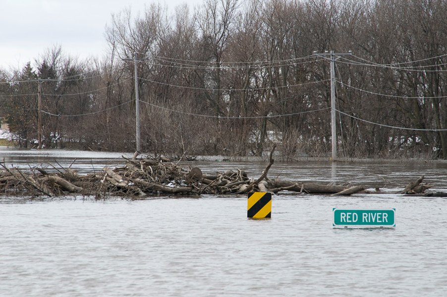
Flooding in Fluvial Systems: Rivers Unleashed
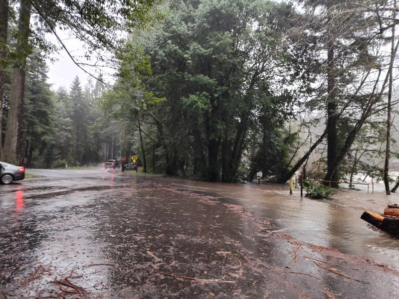
Fluvial floods, or river floods, occur when a river's flow exceeds its channel capacity, causing water to spill onto the adjacent floodplain. These are natural processes that shape river landscapes but can have devastating consequences when they interact with human settlements.
Fluvial flooding occurs when rivers like this one in Moorhead, MN, overtop their banks, inundating vast areas of floodplain.
Characteristics of Fluvial Floods
Exceedance of Channel Capacity
The primary mechanism is an increase in river discharge (volume of water flowing per unit time) beyond what the channel can contain. This is often due to prolonged heavy rainfall or rapid snowmelt within the river's catchment area (the area of land that drains into the river).
Floodplain Inundation
Floodplains are relatively flat areas adjacent to rivers, formed by historical flood deposits. During high flows, these areas naturally accommodate excess water. Human development on floodplains significantly increases vulnerability to damage.
Flash Floods in Fluvial Systems
While often associated with mountainous or urban areas with steep slopes and rapid runoff, flash floods can also occur in smaller river systems or tributaries. They are characterized by a very rapid rise in water levels, often with little warning, and can be extremely dangerous due to their speed and force.
Influence of Basin Characteristics
The nature of fluvial flooding is influenced by several factors related to the river basin:
- Size and Shape of the Basin: Larger basins generally experience slower-onset, longer-duration floods, while smaller, steeper basins are more prone to flash floods.
- Topography: Steep slopes promote rapid runoff, while flat terrain can lead to slower, more widespread inundation.
- Soil Type and Saturation: Impermeable soils or already saturated ground increase runoff.
- Vegetation Cover: Dense vegetation can intercept rainfall and slow runoff, reducing flood peaks.
- Channel Morphology: The shape, size, and roughness of the river channel affect its capacity and how quickly water moves through it. Sediment deposition can reduce channel capacity over time.
Backwater Effects
High water levels in a main river can impede the flow from its tributaries or cause water to back up in downstream sections of the main channel, leading to flooding in areas that might not otherwise be affected directly by the primary flood source.
Taming the Tides: Flood Management Strategies
Flood management encompasses a range of strategies and measures aimed at reducing or preventing the detrimental effects of floodwaters. The approach to flood management has evolved from a primary focus on "flood control" (attempting to completely prevent floods) to "flood risk management" (reducing the likelihood and impact of floods) and, more recently, to "flood resilience management," which emphasizes sustainable plans to cope with, adapt to, and recover from flood disasters.
This video explains various engineered structures designed to protect communities from flooding, highlighting their mechanisms and roles in flood management.
Flood management strategies are broadly categorized into structural and non-structural methods.
Structural Methods: Engineering Defenses
Structural methods involve the construction of physical barriers and infrastructure designed to control, divert, or contain floodwaters. These are often engineering-heavy solutions.
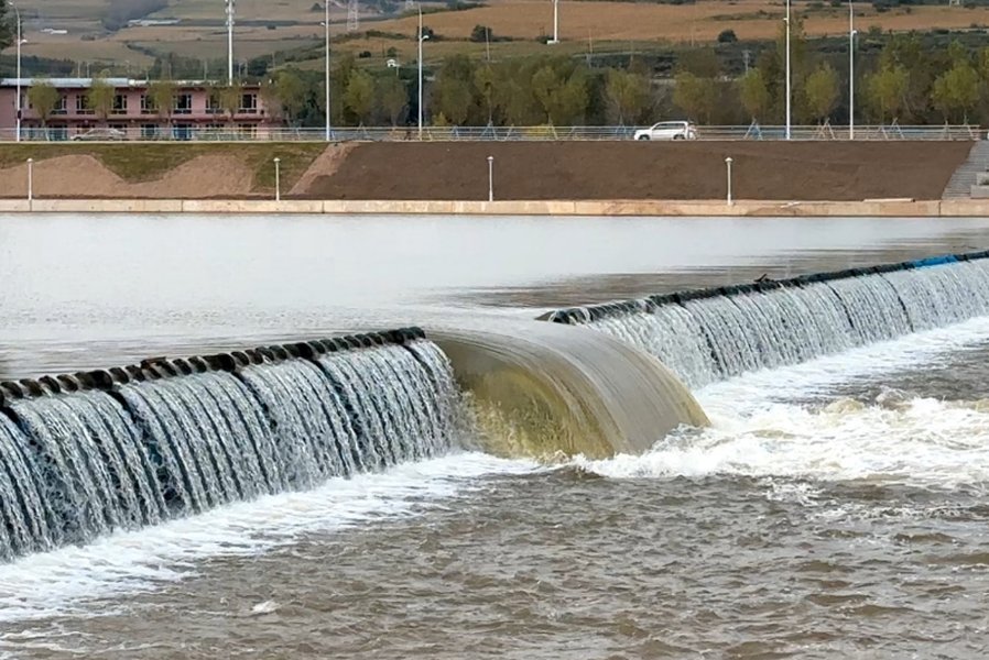
Flood bypasses, like this one, are engineered channels that divert excess river flow away from protected areas during high-water events.
Dams and Reservoirs
Dams are built across rivers to create reservoirs that can store excess water during periods of high inflow (e.g., heavy rainfall or snowmelt). This stored water can then be released gradually, regulating river levels downstream and reducing flood peaks. Many dams serve multiple purposes, including hydropower generation, water supply, and recreation, in addition to flood control.
Levees, Embankments, and Floodwalls
These are raised barriers constructed along riverbanks or coastlines.
- Levees (or Dikes): Earthen embankments built parallel to a river to prevent it from overflowing onto the adjacent floodplain.
- Floodwalls: Vertical barriers typically made of concrete or steel, often used in urban areas where space is limited.
- Embankments: General term for raised structures of earth or stone to contain or divert water.
Channel Modifications
These involve altering the river channel itself to improve its capacity to carry water or to speed up flow:
- Channelization: Straightening, deepening, or widening a river channel.
- Dredging: Removing sediment and debris from the riverbed to increase its depth and flow capacity.
- Lining Channels: Using concrete or other materials to smooth channel surfaces, reducing friction and increasing flow velocity.
Flood Relief Channels and Bypasses (Floodways)
These are artificial channels constructed to divert a portion of the floodwater away from vulnerable areas, rejoining the main river downstream or discharging into another water body or designated storage area (floodplain).
Overflow Areas or Flood Plains
Designated areas along rivers that are intentionally allowed to flood to store excess water, thereby protecting more developed or critical areas. These can sometimes be enhanced to improve their storage capacity.
Non-Structural Methods: Planning and Policy
Non-structural methods do not involve physical construction but focus on policies, planning, practices, and behavioral changes to reduce flood risk and vulnerability.
Floodplain Zoning and Land-Use Planning
This involves regulating development in flood-prone areas. Zoning ordinances can restrict certain types of construction (e.g., residential buildings) in high-risk zones or require new developments to meet flood-resistant design standards. This aims to minimize exposure to flood hazards.
Flood Forecasting and Early Warning Systems
These systems use meteorological data, hydrological models, and real-time monitoring of river levels and rainfall to predict the onset, magnitude, and extent of flooding. Timely warnings allow communities to prepare, evacuate, and take protective measures.
Real-time flood monitoring systems provide crucial data for early warnings and emergency response.
Flood Insurance
Financial mechanisms that provide compensation for flood-related damages. While it doesn't prevent flooding, insurance helps individuals and communities recover financially, spreading the cost of losses.
Public Awareness, Education, and Community Preparedness
Educating the public about flood risks, preparedness measures (e.g., emergency kits, evacuation routes), and how to respond during a flood event. Empowering communities to develop local flood action plans enhances resilience.
Green Infrastructure and Natural Water Retention Measures
These approaches work with natural processes to manage water:
- Wetlands Restoration and Creation: Wetlands act as natural sponges, absorbing and slowly releasing floodwaters.
- Reforestation and Afforestation: Planting trees increases water interception and infiltration, reducing runoff.
- Permeable Pavements and Green Roofs: In urban areas, these help reduce runoff by allowing water to soak into the ground or be absorbed by vegetation.
- Contour Ploughing and Terracing: Agricultural practices that slow down runoff on sloped land.
Relocation and Acquisition
In some high-risk areas, moving existing structures and communities away from floodplains may be the most sustainable long-term solution. This can involve government buy-out programs.
Comparing Flood Management Approaches
Both structural and non-structural methods have their advantages and disadvantages. Often, an integrated approach combining elements of both is most effective. The table below provides a comparative overview:
| Feature | Structural Methods | Non-Structural Methods |
|---|---|---|
| Definition | Physical constructions designed to control, divert, or contain floodwaters. | Policies, planning, practices, and behavioral changes to reduce flood risk and vulnerability. |
| Examples | Dams, levees, floodwalls, channelization, flood relief channels. | Floodplain zoning, early warning systems, flood insurance, public education, green infrastructure, relocation. |
| Primary Goal | Direct control of floodwaters, provision of physical protection to specific areas. | Reduction of exposure and vulnerability to flood risk, mitigation of impacts, adaptation. |
| Pros | Can provide a high level of protection to defined areas; often visible and reassuring to communities. | Generally more sustainable and environmentally friendly; can be more cost-effective in the long term; promotes adaptation and resilience. |
| Cons | High capital and maintenance costs; can have significant environmental impacts; may create a false sense of security leading to increased development in protected areas (levee effect); can transfer flood risk elsewhere; may fail under extreme events. | May require significant public cooperation and political will; benefits may be less immediate or visible; may not prevent all damage; effectiveness can depend on accurate forecasting and public response. |
| Timeframe | Impact is often realized shortly after construction, providing relatively immediate (though localized) protection. | Benefits accrue over the medium to long term and often require ongoing implementation and adaptation. |
The Dual Role of Dams in the Context of Floods
Dams are among the most significant structural measures for flood management, but their relationship with floods is complex. They can be crucial assets in mitigating flood risk, but they also introduce potential hazards if not properly designed, managed, or if they fail.
Flood control dams are designed to capture peak flows in their reservoirs and release water at a controlled rate to prevent downstream flooding.
Dams as Flood Control Mechanisms
Water Storage and Flow Regulation
The primary flood control function of a dam is to create a reservoir with dedicated flood storage capacity. During periods of high rainfall or snowmelt, excess river flow is captured and stored in this space. This reduces the peak discharge downstream, thereby lowering flood levels and mitigating potential damage.
Gradual Release of Stored Water
Once the flood peak has passed, the stored water is released from the reservoir in a controlled manner, at a rate that the downstream channel can safely accommodate. This helps to smooth out the hydrograph (the graph of river flow over time) and reduce the overall duration and severity of high-flow conditions.
Potential Negative Impacts and Risks Associated with Dams
Risk of Dam Failure
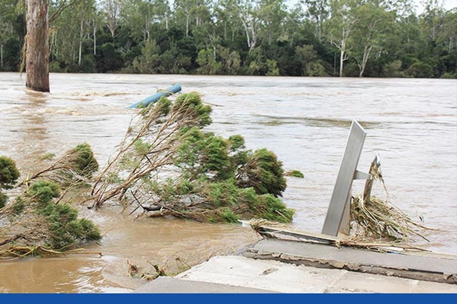
The most catastrophic flood-related risk associated with dams is their potential failure. This can occur due to various reasons, including structural flaws, overtopping during extreme flood events exceeding design capacity, earthquakes, or inadequate maintenance. A dam failure can release a massive volume of water very rapidly, causing devastating flash floods downstream with little to no warning.
Upstream Inundation
The creation of a reservoir permanently inundates the land upstream of the dam, which can lead to the loss of ecosystems, agricultural land, and displacement of communities.
Altered Flow Regimes and Ecological Impacts
Dams significantly alter the natural flow regime of a river, which can affect downstream ecosystems. Changes in water temperature, sediment transport (as sediment gets trapped in reservoirs), and flow patterns can impact fish migration, riparian habitats, and overall river health.
Operational Challenges
Effective flood control by dams requires careful operational management. This involves accurate forecasting of inflows, making timely decisions about water releases (balancing flood control needs with other uses like water supply or hydropower), and maintaining the structural integrity of the dam. Multipurpose dams can face conflicting demands, especially when trying to keep reservoir levels low for flood storage versus high for water supply or power generation.
Sedimentation
Reservoirs trap sediment carried by the river. Over time, this sedimentation can reduce the effective storage capacity of the reservoir, including its flood storage volume, thereby diminishing its flood control effectiveness unless managed through measures like dredging or sediment bypassing.
In summary, while well-designed and properly operated dams are invaluable tools for flood management, their construction and operation must be accompanied by rigorous safety standards, environmental assessments, and adaptive management strategies to minimize risks and negative impacts.
Comparative Effectiveness of Flood Management Strategies
Different flood management strategies offer varying degrees of effectiveness across several key criteria. The radar chart below provides an illustrative comparison based on factors like cost-effectiveness, environmental impact, speed of implementation, long-term sustainability, community acceptance, and technical complexity. The scores are on a scale of 1 to 10, where a higher score generally indicates a more favorable outcome or higher level for that criterion (e.g., higher cost-effectiveness, lower environmental impact is represented by a higher score for 'Environmental Friendliness'). Note that these are generalized assessments and actual effectiveness can vary greatly depending on specific local conditions and implementation.
This chart highlights that non-structural methods like floodplain zoning and early warning systems often score higher on environmental friendliness and long-term sustainability, while structural measures like dams may offer more tangible, albeit potentially environmentally impactful, protection. Green infrastructure aims to balance effectiveness with ecological benefits. The 'Technical Complexity (Lower is Better)' axis is inverted in scoring for clarity (e.g., a raw complexity of 9/10 becomes a score of 1/10 on the chart, meaning less desirable).
Predicting the Unpredictable: Methods of Flood Frequency Analysis
Flood Frequency Analysis (FFA) is a statistical technique used by hydrologists and engineers to estimate the probability of occurrence of floods of different magnitudes at a specific location on a river. It is a cornerstone of flood risk management, providing essential data for designing hydraulic structures (like bridges, culverts, dams, and levees), developing floodplain management plans, and setting flood insurance rates.
Core Concepts in FFA
Return Period (Recurrence Interval)
The return period of a flood of a given magnitude is the average time interval, in years, between occurrences of floods equal to or greater than that magnitude. For example, a "100-year flood" is a flood event that has a 1 in 100 (or 1%) chance of being equaled or exceeded in any given year. It does not mean that such a flood will occur exactly once every 100 years.
Annual Exceedance Probability (AEP)
AEP is the probability that a flood of a certain magnitude will be exceeded in any single year. It is the reciprocal of the return period (e.g., AEP for a 100-year flood = 1/100 = 0.01 or 1%).
Annual Peak Flow Data
FFA typically relies on historical records of the highest instantaneous discharge (peak flow) that occurred in a river each year. A sufficiently long and consistent record (generally at least 10 years, but ideally much longer) is crucial for reliable analysis.
Steps in Flood Frequency Analysis
-
Data Collection and Preparation
Gather systematic historical annual peak flow data from stream gauging stations. This data needs to be checked for consistency, completeness, and potential errors or influences (e.g., effects of upstream dam construction during the period of record).
-
Statistical Parameter Calculation
Calculate basic statistical parameters from the observed peak flow data, such as the mean, standard deviation, and coefficient of skewness. These parameters describe the central tendency, dispersion, and asymmetry of the data.
-
Fitting a Probability Distribution
The annual peak flows are assumed to follow a theoretical probability distribution. Common distributions used in FFA include:
- Log-Pearson Type III (LP3): Widely used in the United States, recommended by "Bulletin 17B" and its successors (e.g., Bulletin 17C) of the U.S. Interagency Advisory Committee on Water Data. It involves transforming the flow data to logarithms and then fitting a Pearson Type III distribution.
- Gumbel Distribution (Extreme Value Type I): Often used for modeling extreme events like floods and droughts.
- Generalized Extreme Value (GEV) Distribution: A flexible distribution that combines Gumbel, Fréchet, and Weibull distributions.
- Normal and Log-Normal Distributions: Simpler distributions, sometimes applicable if the data (or its logarithm) is symmetrically distributed.
- Weibull and Exponential Distributions.
-
Goodness-of-Fit Tests
Statistical tests (e.g., Chi-squared test, Kolmogorov-Smirnov test) are used to assess how well the chosen theoretical distribution represents the observed data. Graphical methods, like plotting observed data against the fitted distribution on probability paper, are also used.
-
Estimation of Flood Magnitudes for Specific Return Periods
Once a suitable distribution is fitted, it can be used to estimate the flood discharge corresponding to various return periods (e.g., 10-year, 50-year, 100-year, 500-year floods). This involves using the inverse of the cumulative distribution function.
Advanced Considerations and Techniques
Handling Outliers
Historical flood records may contain unusually high or low values (outliers) that can significantly influence the analysis. Techniques like the Grubbs-Beck test are used to identify and potentially adjust or accommodate these outliers.
Expected Moments Algorithm (EMA)
Used in methods like Bulletin 17C to incorporate historical flood information and regional skewness more robustly, improving estimates especially when data records are short or contain censored data.
Regionalization
For locations with little or no streamflow data (ungauged sites), flood frequencies can be estimated using regionalization techniques. This involves transferring information from nearby gauged sites with similar hydrological characteristics, often using regression equations that relate flood statistics to basin characteristics (e.g., drainage area, slope, land cover).
Applications of FFA
The results of FFA are vital for:
- Infrastructure Design: Designing bridges, culverts, dams, and levees to withstand floods of a specified return period.
- Floodplain Mapping: Delineating areas at risk of inundation for different flood severities, which informs zoning and land-use planning.
- Flood Risk Assessment: Quantifying the probability and potential consequences of flooding.
- Setting Insurance Rates: Establishing actuarially sound flood insurance premiums.
FFA provides a probabilistic framework for understanding and planning for future flood events, acknowledging the inherent uncertainties in predicting natural phenomena.
Visualizing the Interconnections: A Flood Knowledge Map
The following mindmap illustrates the key concepts related to floods, their causes, impacts on fluvial systems, various management strategies, the specific role of dams, and the analytical methods used to predict flood frequencies. This visual representation helps to understand how these different facets are interconnected in the broader context of flood science and management.
(Topography, Soil, Vegetation)"] id2e["Sediment Transport & Deposition"] id3["Flood Management Strategies"] id3a["Structural Methods"] id3a1["Dams & Reservoirs"] id3a2["Levees, Embankments & Floodwalls"] id3a3["Channel Modifications
(Dredging, Straightening)"] id3a4["Flood Relief Channels & Bypasses"] id3b["Non-Structural Methods"] id3b1["Floodplain Zoning & Land-Use Planning"] id3b2["Flood Forecasting & Early Warning Systems"] id3b3["Flood Insurance"] id3b4["Public Awareness & Education"] id3b5["Green Infrastructure
(Wetlands, Reforestation)"] id4["Dams and Floods"] id4a["Role in Flood Control
(Storage & Flow Regulation)"] id4b["Risks & Negative Impacts"] id4b1["Dam Failure Potential"] id4b2["Upstream Inundation"] id4b3["Ecological Alterations"] id4b4["Sedimentation Issues"] id5["Method of Flood Frequency Analysis (FFA)"] id5a["Core Concepts
(Return Period, AEP, Peak Flow Data)"] id5b["Statistical Process"] id5b1["Data Collection"] id5b2["Fitting Probability Distributions
(Log-Pearson III, Gumbel, GEV)"] id5b3["Estimation of Flood Magnitudes"] id5c["Applications in Planning & Design"]
This mindmap provides a hierarchical overview, branching out from the central theme of "Understanding Floods" into its various components. Each branch represents a key area discussed, with further sub-branches detailing specific aspects within that area, offering a quick yet comprehensive grasp of the topic's structure.
Frequently Asked Questions (FAQ)
Recommended Further Exploration
To deepen your understanding of flood-related topics, consider exploring these related queries:
- How does climate change affect the frequency and intensity of floods?
- What are the most innovative green infrastructure solutions for urban flood management?
- Explore case studies of successful integrated flood risk management projects.
- What role does community participation play in building flood resilience?
References
Last updated May 12, 2025