
Lost Your Way? Unveiling How UGVs Rediscover Their Path with VSLAM After Tracking Failure
Navigating the complexities of outdoor VSLAM relocalization for unmanned ground vehicles.
When an Unmanned Ground Vehicle (UGV) employing Visual Simultaneous Localization and Mapping (VSLAM) in an outdoor setting suddenly loses tracking, it's a critical moment. The vehicle effectively becomes "lost," unable to relate its current view to the map it has painstakingly built. Relocalization is the sophisticated process of re-establishing the UGV's position and orientation within the previously known coordinate system, referencing the existing map, landmarks, and prior poses. This capability is paramount for autonomous navigation, allowing the UGV to recover from unexpected disruptions and continue its mission.
Key Insights into VSLAM Relocalization
- Feature Renegotiation: At its core, relocalization involves matching current visual features against a database of landmarks and keyframes from the existing map to find a correspondence.
- Sensor Synergy: Integrating data from other sensors like GPS and Inertial Measurement Units (IMUs) significantly boosts relocalization robustness, especially in challenging outdoor conditions by providing supplementary positioning cues.
- Optimization is Crucial: Once a potential pose is found, pose graph optimization and bundle adjustment techniques refine the UGV's position, ensuring seamless reintegration with the previous map and trajectory.
Understanding the Challenge: When VSLAM Tracking Fails
Why Does Tracking Get Lost?
In dynamic outdoor environments, VSLAM systems can lose track for several reasons:
- Rapid Motion or Rotations: Sudden, fast movements can cause motion blur or insufficient visual overlap between consecutive camera frames.
- Poor Illumination or Drastic Changes: Extreme lighting conditions (e.g., glare, darkness) or rapid shifts in illumination (e.g., moving from shadow to bright sunlight) can degrade feature detection.
- Feature-Poor Scenes: Environments lacking distinct visual features (e.g., a plain wall, open sky, homogenous terrain) make it difficult for VSLAM to find stable landmarks.
- Occlusions: Temporary obstruction of the camera's view by objects.
- Dynamic Objects: Moving elements like other vehicles, pedestrians, or swaying vegetation can confuse feature trackers if not explicitly handled.
- Environmental Changes: Significant alterations in the scene compared to the existing map (e.g., seasonal changes, new constructions).
When tracking is lost, the VSLAM system can no longer update the UGV's pose relative to the map, effectively halting autonomous navigation until its position is re-established.
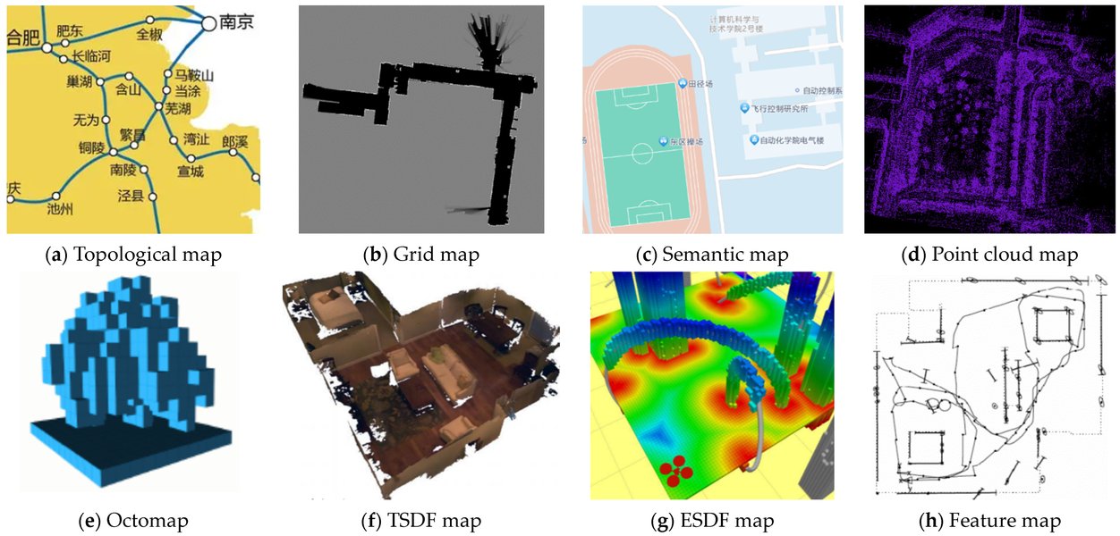
A typical Visual SLAM system architecture, highlighting components like tracking, mapping, loop closing, and relocalization.
Core Strategies for Relocalization
Recovering the UGV's pose involves several sophisticated techniques that work in concert:
1. Feature Matching and Place Recognition
Leveraging the Past to Understand the Present
This is the foundational step. When tracking is lost, the system attempts to find its bearings by comparing what it currently sees with what it has seen before.
- Keyframe-Based Matching: VSLAM systems typically store *keyframes* – information-rich frames from the past, complete with their associated 3D landmarks and camera poses. The current camera frame's visual features (e.g., ORB, SIFT, SURF descriptors) are extracted and matched against the descriptors stored in the keyframe database.
- Bag of Visual Words (BoVW): To accelerate the search for matching keyframes, especially in large maps, techniques like BoVW are employed. This method treats image features as "words" and creates a vocabulary. The current frame is queried against this vocabulary to quickly identify candidate keyframes representing similar locations, significantly narrowing down the search space.
- Landmark Matching: If a candidate keyframe is identified, the system attempts to match 2D features in the current frame with the 3D landmarks associated with that keyframe or region of the map.
2. Pose Estimation from Correspondences
Calculating "Where Am I?"
Once a sufficient number of robust 2D-to-3D feature correspondences are established between the current frame and the existing map, the UGV's pose (position and orientation) can be estimated.
- Perspective-n-Point (PnP) Algorithms: PnP solvers are commonly used to determine the 6-Degrees-of-Freedom (6DoF) pose of the camera given at least three 2D-3D point correspondences.
- RANSAC (Random Sample Consensus): To ensure robustness against incorrect matches (outliers), PnP is often used within a RANSAC framework. RANSAC iteratively samples minimal sets of correspondences, computes a pose hypothesis, and then verifies this hypothesis against all correspondences, selecting the pose supported by the largest number of inliers.
3. Object-Level Relocalization
Recognizing Familiar Objects for Orientation
More advanced systems can leverage semantic information. Instead of just relying on low-level features, they recognize and use objects (e.g., buildings, trees, signs) as anchors for relocalization.
- Object Detection and Association: The system detects objects in the current view and attempts to match them with 3D objects previously mapped. This can be more robust to appearance changes than feature-only methods.
- Object Graphs: Semantic relationships between objects can be represented as a graph. Matching the current scene's object graph to the map's object graph can provide a strong pose hypothesis. Systems like OA-SLAM and GOReloc utilize such approaches.
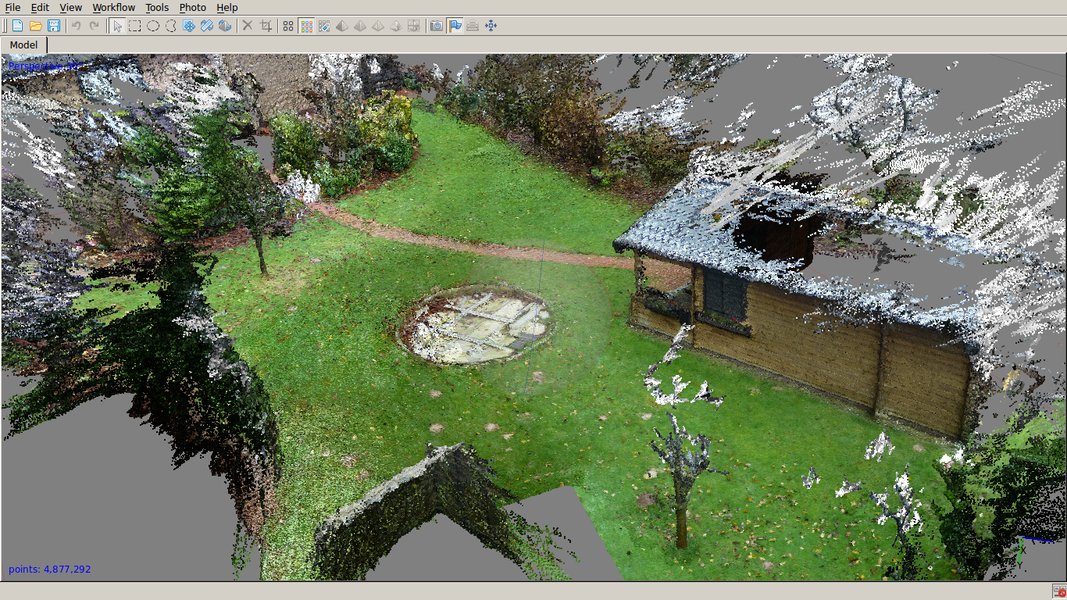
Example of a 3D map generated by SLAM in an outdoor environment, against which a UGV would relocalize.
4. Global Optimization and Map Consistency
Refining the Pose and Ensuring a Coherent Map
After an initial pose is recovered, it's refined to ensure consistency with the global map and minimize accumulated errors.
- Bundle Adjustment (BA): This is a powerful optimization technique that refines the 3D structure (positions of landmarks) and camera poses simultaneously by minimizing the reprojection error (the difference between observed feature locations and their predicted locations based on the current map and pose estimate). Local BA is often performed around the relocalized pose.
- Pose Graph Optimization: The entire history of camera poses and the spatial constraints between them (derived from visual odometry and loop closures/relocalizations) can be represented as a pose graph. When relocalization occurs (similar to a loop closure), a new constraint is added to this graph. Optimizing the graph adjusts all poses to be globally consistent, correcting drift and improving overall map accuracy.
Enhancements for Robust Outdoor Relocalization
Outdoor environments present unique challenges. Several strategies enhance the reliability of relocalization for UGVs:
Sensor Fusion: The Power of Multiple Perspectives
Relying solely on vision can be fragile. Fusing data from other sensors dramatically improves robustness:
- GPS (Global Positioning System): Where available, GPS provides an absolute global position estimate. This can significantly narrow down the search area within the map for visual relocalization, providing a strong prior for the UGV's location. Even intermittent GPS fixes can be highly beneficial.
- IMU (Inertial Measurement Unit): IMUs measure acceleration and angular velocity. Integrating IMU data (Visual-Inertial SLAM or VINS) provides high-frequency motion estimates, helps bridge short periods of visual tracking loss, and constrains pose estimation, making relocalization faster and more accurate.
- Wheel Odometry: For UGVs, wheel encoders provide estimates of the vehicle's movement. While prone to drift, odometry offers another source of motion information that can aid in predicting the UGV's pose and assist relocalization.
- LiDAR: Though the query specifies VSLAM, some systems might fuse LiDAR data for more robust geometric mapping and localization, complementing visual information.
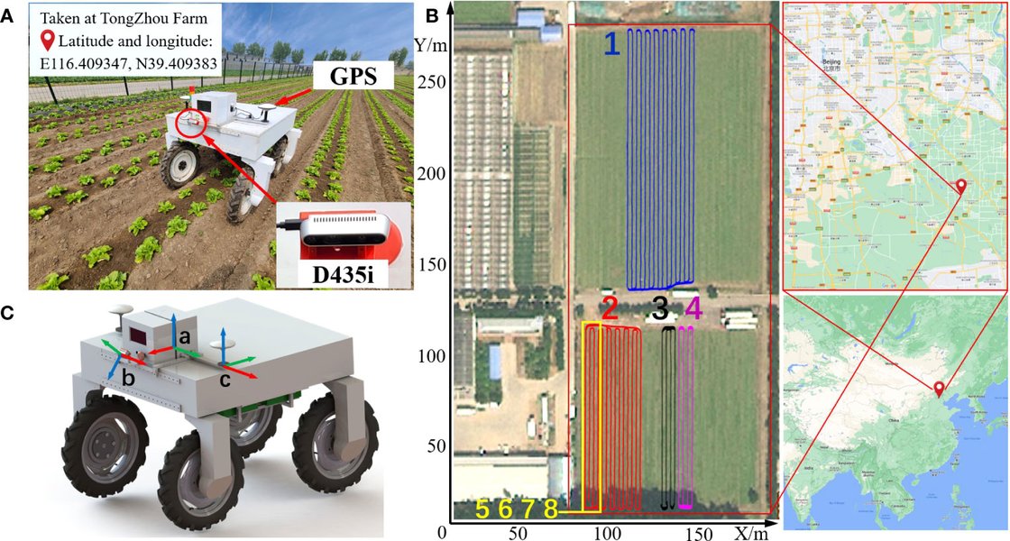
An example of an unmanned ground vehicle, typically equipped with multiple sensors for navigation tasks like VSLAM in agricultural environments.
Handling Dynamic Elements
Outdoor scenes are rarely static. Systems like DOE-SLAM (Dynamic Object Enhanced Visual SLAM) use deep learning-based semantic segmentation to identify and filter out dynamic objects (e.g., cars, pedestrians) from the feature matching and pose estimation process. This prevents moving objects from corrupting the localization. In some cases, the motion of these dynamic objects can even be used to help estimate the camera's pose if static background features are scarce.
Addressing Scale Ambiguity (Monocular VSLAM)
Monocular VSLAM (using a single camera) inherently cannot determine the absolute scale of the environment from vision alone; the map is built up to an arbitrary scale. When relocalizing, it's crucial to recover the pose consistent with the original map's scale. This is typically handled by ensuring 3D landmarks have consistent scale information or by using other sensors (like IMU or known object sizes) to resolve scale.
Multi-Session and Multi-Condition Mapping
Outdoor environments change significantly with time of day, weather, and seasons. Creating and maintaining multiple map sessions captured under different conditions can improve relocalization success. When tracking is lost, the system can attempt to relocalize against the map that best matches the current environmental conditions.
Visualizing Relocalization Strategies
The following chart provides a qualitative comparison of different aspects influencing VSLAM relocalization strategies. The scores (on a scale where higher is generally better or more prominent) are indicative and help illustrate the trade-offs and characteristics of each component.
This radar chart illustrates how different relocalization approaches perform across various criteria. For instance, GPS-Aided Relocalization scores high on outdoor scalability and accuracy but might be less effective if GPS signals are weak. Keyframe/Feature Matching is fundamental but can be affected by drastic lighting or viewpoint changes. Object-Level Relocalization shows promise in handling dynamic environments and viewpoint changes due to its semantic understanding.
The Relocalization Workflow: A Step-by-Step Guide
While specific implementations vary, the general process for relocalizing a UGV after tracking loss follows these steps:
- Detect Loss of Tracking: The VSLAM system continuously monitors tracking quality (e.g., number of tracked features, reprojection error). If quality drops below a threshold, it declares tracking lost and initiates relocalization.
- Activate Relocalization Module: The system switches from normal tracking mode to a dedicated relocalization mode.
- Feature Extraction from Current Frame: Robust visual features are extracted from the latest camera image.
- Candidate Keyframe/Map Region Retrieval:
- Using techniques like Bag-of-Words, the system queries its map database (or keyframe database) to find previously mapped locations that appear visually similar to the current view.
- If GPS or other global positioning aids are available, they can constrain this search to a specific geographic area of the map.
- Geometric Verification and Pose Estimation:
- For each candidate match, the system attempts to find 2D-3D correspondences between features in the current frame and 3D landmarks in the map.
- A PnP algorithm within a RANSAC loop is used to compute a robust 6DoF pose hypothesis.
- Pose Validation and Refinement:
- The estimated pose is validated. This might involve checking if enough inliers support the pose or if the reprojection error is sufficiently low.
- If a valid pose is found, it's often further refined using local bundle adjustment, optimizing the pose and nearby map points.
- Re-initialize Tracking: Once a reliable pose within the previous coordinate system is recovered, the VSLAM system re-initializes its tracking module using this new pose. The UGV can now continue localizing itself against the existing map.
- Map Update/Optimization (Optional but Recommended): The successful relocalization event (akin to a loop closure) can be used to trigger global pose graph optimization, further improving the consistency and accuracy of the entire map and trajectory.
Mindmap of VSLAM Relocalization
This mindmap provides a visual overview of the key concepts and processes involved in VSLAM relocalization for an outdoor UGV.
The mindmap illustrates how tracking loss triggers the relocalization sequence. Core processes like feature extraction, candidate retrieval, and pose estimation are central. Various techniques, including feature-based and object-level methods, are employed, often enhanced by sensor fusion and dynamic object handling strategies, especially critical for outdoor UGVs. The ultimate goal is to recover the UGV's pose and resume navigation within the established map.
Comparative Overview of Relocalization Approaches
Different relocalization strategies have distinct characteristics. The table below summarizes some common approaches used in VSLAM:
| Relocalization Technique | Description | Key Strengths | Common Challenges |
|---|---|---|---|
| Keyframe-Based Matching (e.g., ORB-SLAM style) | Matches current frame features against a database of stored keyframes using descriptors (e.g., ORB) and BoVW for efficient lookup. Pose recovered via PnP. | Widely used, relatively efficient, good for general scenes. | Sensitive to severe viewpoint/illumination changes, performance depends on keyframe density and quality. |
| Direct Methods | Minimize photometric error between current frame and synthesized views from the map, without explicit feature extraction. | Can work in texture-less areas where features are sparse, potentially more accurate. | Smaller convergence basin (requires good initial guess), sensitive to illumination changes, computationally intensive. |
| Object-Level Relocalization (e.g., OA-SLAM, GOReloc) | Utilizes detected and recognized semantic objects (e.g., signs, buildings) and their 3D positions in the map for pose estimation. | More robust to appearance changes than low-level features, provides semantic understanding. | Requires robust object detection and a map with semantic object information, higher computational overhead for detection. |
| GPS-Aided VSLAM | Fuses GPS data with visual information. GPS provides a coarse global position estimate, narrowing the search space for visual relocalization. | Greatly improves robustness in outdoor environments, provides global consistency, helps resolve scale. | Dependent on GPS signal availability and accuracy; GPS can be noisy or unavailable in urban canyons or indoors. |
| Visual-Inertial SLAM (VINS) Relocalization | Tightly couples visual data with IMU measurements. IMU helps predict motion and constrains pose, aiding relocalization during visual degradation. | Robust to fast motions and temporary visual tracking loss, accurate short-term motion estimation. | IMU drift over time, requires careful sensor calibration. |
| Multi-Session Mapping | Maintains multiple maps for different conditions (e.g., day/night, summer/winter). Relocalizes against the most appropriate map. | Improved robustness to long-term environmental changes. | Increased storage and management complexity for multiple maps. |
This table highlights that there's no one-size-fits-all solution. The choice of relocalization strategy often depends on the specific application, available sensors, computational resources, and the nature of the operating environment. Hybrid approaches combining several techniques are common in state-of-the-art systems.
Visualizing VSLAM in Action
Understanding the broader context of VSLAM, including aspects relevant to relocalization, can be aided by seeing systems in operation. The following video discusses key concepts in SLAM, which are foundational to how a UGV would map its environment and later relocalize within it.
This video, titled "Relocalization, Global Optimization and Map Merging for Monocular Visual Odometry / SLAM," delves into crucial components of VSLAM systems, particularly focusing on monocular (single camera) setups. It discusses relocalization as a method to recover the camera's pose after tracking failure, global optimization to maintain map consistency, and map merging techniques, all of which are highly relevant for robust UGV navigation in complex, potentially large-scale outdoor environments. Understanding these elements provides insight into how a VSLAM system can not only build a map but also reliably find its place within that map again after disruptions.
Frequently Asked Questions (FAQ)
What is the primary challenge in outdoor VSLAM relocalization?
The primary challenges include dynamic environments (moving objects, changing foliage), varying illumination conditions (sunlight, shadows, day/night transitions), large-scale areas leading to perceptual aliasing (different places looking similar), and seasonal changes that alter the appearance of landmarks. Ensuring robustness against these factors is key.
How quickly can a UGV relocalize?
Relocalization time can vary significantly based on the VSLAM algorithm, map size, computational resources, and the distinctiveness of the environment. Modern systems aim for relocalization within a few seconds, but it can take longer in very large or ambiguous environments. Efficient search strategies (like Bag-of-Words) and good hardware acceleration help reduce this time.
Can relocalization fail? What happens then?
Yes, relocalization can fail if the current scene is too different from any part of the stored map, or if there aren't enough distinctive features. If relocalization continuously fails, the system might need to:
1. Re-initialize mapping from scratch (losing the previous map context).
2. Enter a "safe mode" and await manual intervention.
3. Employ an exploration strategy to actively seek out familiar areas.
Robust systems often have fallback strategies or may attempt relocalization against different map sessions if available.
Does relocalization affect the existing map?
Successful relocalization, especially if treated as a loop closure, can positively affect the existing map. It provides a strong geometric constraint that can be used in pose graph optimization or bundle adjustment to correct accumulated drift and improve the overall consistency and accuracy of the map.
Recommended Further Exploration
To delve deeper into related topics, consider exploring these queries:
- How does sensor fusion improve VSLAM robustness in UGVs?
- What are the latest advancements in handling dynamic objects in Visual SLAM?
- Compare different feature descriptors like ORB, SIFT, and SURF for VSLAM applications.
- Explain the role of pose graph optimization in long-term SLAM.
References
Last updated May 16, 2025