
Yorkshire's Population Unpacked: How Many People Call "God's Own County" Home in 2025?
Delving into the numbers, growth trends, and regional variations across this vast and diverse English region.
Highlights: Yorkshire's Population Snapshot (2025)
- Overall Estimate: The wider Yorkshire and the Humber region is projected to have a population of approximately 5.62 million people in 2025.
- Major Population Hubs: Significant populations are concentrated in urban areas, particularly within West Yorkshire, home to major cities like Leeds (metro area ~2.3 million), Sheffield (~570,000), and Bradford (~530,000).
- Growth and Variation: The region has experienced recent population growth (around 1.1% annually), exceeding the previous decade's average, but significant variations exist between the densely populated urban south and the sparser rural north.
Unveiling Yorkshire's Population Landscape (2025)
The Big Picture: Yorkshire and the Humber
When discussing the population of Yorkshire, data often refers to the official government region of "Yorkshire and the Humber." Based on forecasts extrapolating from mid-2022 Office for National Statistics (ONS) data, the estimated population for Yorkshire and the Humber in 2025 is 5,623,321. This figure underscores Yorkshire's status as one of England's most populous regions.
This 2025 estimate reflects continued growth. The population stood at 5,541,262 in mid-2022, indicating a growth rate of approximately 1.1% between mid-2021 and mid-2022. This recent rate marks an acceleration compared to the average annual growth of 0.4% observed over the preceding ten years (mid-2012 to mid-2022). Projections suggest this upward trend may continue, potentially pushing the region's population towards 5.8 million by 2041.
Yorkshire and the Humber covers a substantial geographic area of 15,405 square kilometres. Based on the mid-2022 population figures, this results in an average population density of around 360 people per square kilometre. However, this average masks significant internal variations, from bustling cities to vast rural expanses.
A Closer Look: Population Across Yorkshire's Regions
Yorkshire is not a single administrative entity but comprises several distinct areas, each with its own demographic profile. Here's a breakdown of population estimates for key sub-regions in 2025:
West Yorkshire: The Urban Powerhouse
West Yorkshire is the most urbanized and densely populated part of the historic county. Population estimates for 2025 vary slightly depending on the definition:
- The West Yorkshire urban agglomeration/metro area is estimated to have a population of around 1,956,000 in 2025, showing a growth rate of about 0.72% from the previous year.
- The West Yorkshire local authority area, which covers a broader definition, has a higher population, cited as approximately 2,350,000 in recent figures.
This area includes major cities like Leeds, Bradford, Wakefield, Huddersfield, and Halifax. Its high population contributes to a significant density, reported as 3,001 people per square mile (approximately 1,159 people per square kilometre). The region has seen substantial long-term growth, adding hundreds of thousands to its population since the 1980s, driven by its industrial heritage and modern service economy. Data also indicates slightly more females than males reside in West Yorkshire.
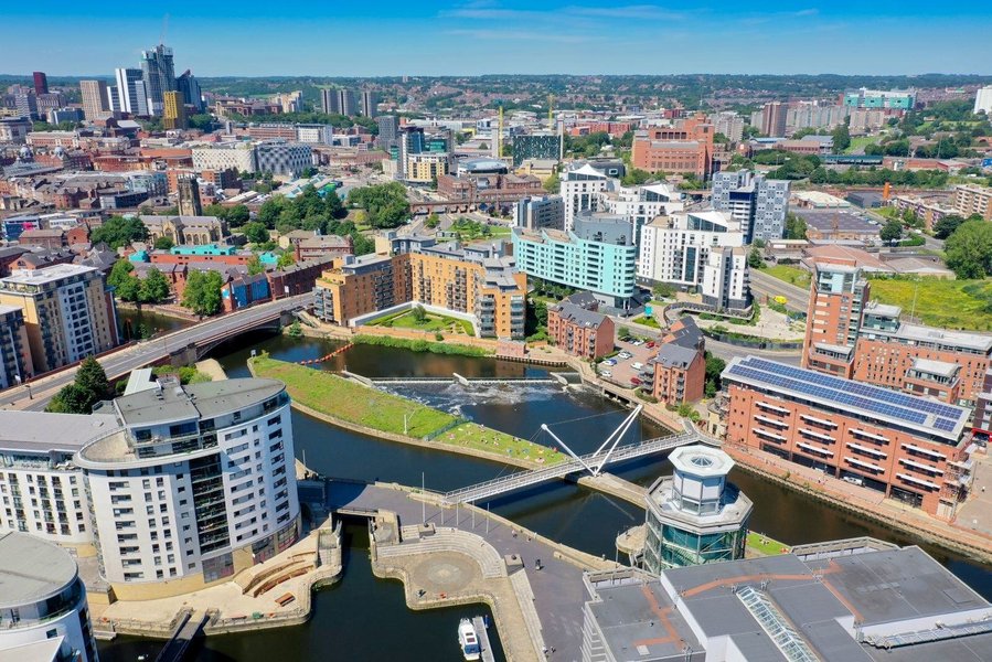
Suburban and town landscapes typical of West Yorkshire.
North Yorkshire: Space and Scenery
In stark contrast to West Yorkshire, North Yorkshire is characterized by its vast rural areas, including two national parks (the Yorkshire Dales and the North York Moors). Its population is significantly lower and more dispersed.
- The forecasted population for North Yorkshire in 2025 is 629,021. This aligns with recent growth trends, showing an increase from the mid-2022 figure of 623,501.
- Another recent update placed the population slightly lower at 618,800, potentially reflecting different methodologies or timeframes.
The growth rate in North Yorkshire between mid-2021 and mid-2022 was 0.8%, higher than its previous ten-year average but lower than the regional average. Covering an expansive 8,038 square kilometres, North Yorkshire has a very low population density of just 78 people per square kilometre (based on mid-2022 figures). Similar to West Yorkshire, demographic data suggests a slightly higher number of females than males.
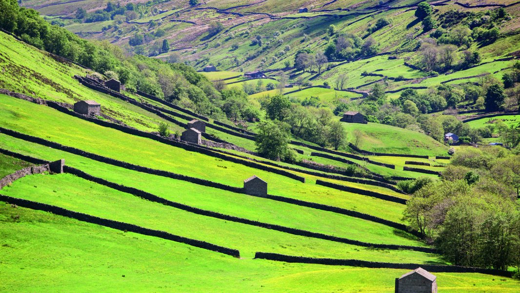
The expansive, sparsely populated landscape of the Yorkshire Dales in North Yorkshire.
East Riding of Yorkshire: Coastal and Countryside
The East Riding of Yorkshire local authority area (which excludes the city of Hull, a separate unitary authority) combines coastal areas with rural hinterlands. Its estimated population as of early 2025 is 343,100. The region has experienced steady long-term growth, increasing by over 71,000 people since 1981. Its population density is around 359 people per square mile (approximately 139 people per square kilometre), placing it between the high density of West Yorkshire and the low density of North Yorkshire. Again, females slightly outnumber males in this area.
City Spotlight: York
The historic city of York, a unitary authority geographically within the boundaries of North Yorkshire, has an estimated population of 220,568 for 2025. This represents continued growth from its 2011 census population of 198,051. York is a relatively densely populated city, with its 2011 density recorded at nearly 1,800 people per square mile within its boundaries. Demographics from 2011 showed more females than males and the largest age group being 35-54 years old.
Visualizing Population Dynamics
Comparing Yorkshire's Regions: A Radar Chart Perspective
This chart provides a visual comparison of key demographic characteristics across West Yorkshire, North Yorkshire, East Riding of Yorkshire, and the City of York. The scores (scaled 1-10, higher indicates 'more' or 'higher intensity') are relative and based on the data discussed, offering a quick understanding of the distinct profiles within the broader Yorkshire region:
- Population Score: Reflects the relative size of the 2025 estimated population.
- Density Score: Based on people per square kilometre, indicating how crowded the area is.
- Growth Score: Represents recent population growth trends (higher score indicates faster recent growth).
- Urbanization Score: A subjective rating of how urbanized the area is (based on presence of cities, density etc.).
- Area Score: Reflects the relative geographic size of the region.
As the chart illustrates, West Yorkshire dominates in population, density, and urbanization but covers a smaller area than North Yorkshire. North Yorkshire stands out for its vast area and low density but shows comparable recent growth scores. East Riding presents a more balanced profile, while York shows characteristics of a dense, urbanized city within a very small geographic footprint.
Mapping the Connections: Yorkshire's Demographic Landscape
This mindmap shows the hierarchical relationship between the overall Yorkshire region (represented by Yorkshire & The Humber), its major sub-regions, key cities, and core demographic features discussed.
(Yorkshire & The Humber Region ~5.62M)"] id1["Key Characteristics"] id1a["Total Population ~5.62M"] id1b["Recent Growth ~1.1%"] id1c["Avg. Density ~360/km²"] id1d["Urban/Rural Mix"] id1e["More Females than Males (in many areas)"] id2["Major Sub-Regions"] id2a["West Yorkshire (~1.96M - 2.35M)"] id2a1["High Density (~1159/km²)"] id2a2["Highly Urbanized"] id2a3["Major Cities: Leeds, Bradford, Sheffield*"] (*Sheffield is South Yorkshire, but often grouped culturally/economically) id2b["North Yorkshire (~629k)"] id2b1["Low Density (~78/km²)"] id2b2["Largely Rural"] id2b3["Includes York (City)"] id2c["East Riding of Yorkshire (~343k)"] id2c1["Medium Density (~139/km²)"] id2c2["Mix of Coast/Country"] id2c3["Excludes Hull (Unitary Authority)"] id2d["South Yorkshire (Not detailed in main text, includes Sheffield, Doncaster)"] id3["Major Cities (Estimates)"] id3a["Leeds (Metro ~2.3M)"] id3b["Sheffield (~570k)"] id3c["Bradford (~530k)"] id3d["York (~220k)"] id3e["Hull (Not detailed, significant pop.)"]
Population Insights and Trends
Key Demographic Characteristics
Beyond the headline numbers, Yorkshire's population exhibits several notable features:
- Gender Distribution: Several sources consistently report slightly more females than males residing in West Yorkshire, North Yorkshire, East Riding of Yorkshire, and York (as per 2011 data).
- Age Structure: While detailed 2025 age breakdowns require specific census updates, historical data (like York's 2011 census showing the 35-54 age group as largest) and regional trends suggest a diverse age profile typical of developed regions, with significant working-age populations alongside growing numbers of older residents.
- Life Expectancy: While specific 2025 Yorkshire figures aren't provided, life expectancy in the region generally aligns with England's averages (around 81 years at birth overall, slightly higher for females).
- Urban vs. Rural Disparities: The stark contrast in population density and urbanization levels between areas like West Yorkshire and North Yorkshire significantly influences lifestyle, economic activity, and service provision across the county.
Major Urban Centers at a Glance
Yorkshire hosts some of the UK's largest cities outside of London. Here are the approximate populations for its most significant urban centers based on recent estimates:
| City | Estimated Population | Notes |
|---|---|---|
| Leeds | ~1.8 Million (Wider Urban Area) / ~2.3 Million (Metro Area) | Largest city in Yorkshire, major economic hub. |
| Sheffield | ~570,000 | Located in South Yorkshire, major city with industrial heritage. |
| Bradford | ~530,000 | Located in West Yorkshire, known for its cultural diversity. UK City of Culture 2025. |
| York | ~220,000 | Historic city, major tourist destination. |
Note: Population figures for cities can vary based on definitions (city proper, urban area, metropolitan area). These figures provide a general scale based on available data.
Exploring Leeds: Yorkshire's Largest City
As the most populous city in Yorkshire, Leeds plays a crucial role in the region's demographic and economic landscape. Its wider urban area population nears 1.8 million, expanding to 2.3 million for the broader Leeds metropolitan area. This video offers a glimpse into the vibrant city centre, reflecting the scale and activity of Yorkshire's primary urban hub.
Frequently Asked Questions (FAQ)
What geographical area does "Yorkshire" cover in these population figures? ▼
Most large-scale population statistics use the official government region of "Yorkshire and the Humber." This includes the traditional counties of West Yorkshire, South Yorkshire, North Yorkshire (excluding some northernmost parts now in Tees Valley), the East Riding of Yorkshire, and parts of northern Lincolnshire. This response also breaks down figures for specific sub-regions like West Yorkshire, North Yorkshire, East Riding, and the city of York, which align more closely with historical and administrative parts of Yorkshire.
Is Yorkshire's population growing or shrinking? ▼
Yorkshire's population is currently growing. The Yorkshire and the Humber region experienced a growth rate of approximately 1.1% between mid-2021 and mid-2022, which is higher than the average annual growth rate of 0.4% over the previous ten years. Forecasts predict continued growth into 2025 and beyond.
Which part of Yorkshire has the highest population? ▼
West Yorkshire is the most populous part of Yorkshire, containing major cities like Leeds and Bradford. Its population is estimated to be around 1.96 million (metro area) to 2.35 million (local authority area) in 2025. This contrasts sharply with North Yorkshire, which is geographically the largest but has a much smaller population (around 629,000).
How does Yorkshire's population compare to other UK regions or countries? ▼
With an estimated population of around 5.6 million in 2025, the Yorkshire and the Humber region is one of the most populous regions in England. Its population is larger than that of Scotland (approx. 5.4 million) and Wales (approx. 3.1 million), highlighting its significant demographic weight within the UK.
Recommended Further Exploration
- What are the demographic trends in Leeds vs Sheffield?
- How has migration affected Yorkshire's population growth?
- What is the population forecast for Yorkshire in 2030?
- Compare population density in Yorkshire Dales vs Peak District.
References
Last updated May 4, 2025